


Summary
Peterview is a town located in the Exploits Valley area of central Newfoundland and Labrador, Canada, where Peters River empties into the Bay of Exploits, just south of Botwood, off Route 350.
Peterview, Newfoundland & Labrador
Peters Arm | |
|---|---|
Town | |
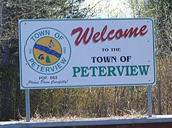 Peterview's welcome sign on the only road into the community. | |
 Seal | |
 Peterview, Newfoundland & Labrador Location of Peterview in Newfoundland | |
| Coordinates: 49°8′55″N 55°21′02″W / 49.14861°N 55.35056°W | |
| Country | |
| Province | |
| Census division | 6 |
| Incorporated | 1962 |
| Government | |
| Area | |
| • Total | 6.72 km2 (2.59 sq mi) |
| Elevation | 12 m (39 ft) |
| Population (2021) | |
| • Total | 723 |
| • Density | 123.2/km2 (319/sq mi) |
| Time zone | UTC-3:30 (Newfoundland Time) |
| • Summer (DST) | UTC-2:30 (Newfoundland Daylight) |
| Postal code span | |
| Area code | 709 |
| Highways | |
| Website | http://www.peterview.ca/ |
Originally named Peters Arm, the community was incorporated as the Town of Peterview in 1962. The mayor is Jim Samson and the deputy mayor is Pleman Brown. According to the 2001 Statistics Canada census, Peterview has a population of 807 with 266[1] private dwellings.
Peterview has connections to Demasduit, also known as Mary March, a figure in Newfoundland history and one of the last Beothuks, as John Peyton, one of her captors, built the first house in the area.[2]
Demographics edit
In the 2021 Census of Population conducted by Statistics Canada, Peterview had a population of 723 living in 279 of its 288 total private dwellings, a change of -12.7% from its 2016 population of 828. With a land area of 6.34 km2 (2.45 sq mi), it had a population density of 114.0/km2 (295.4/sq mi) in 2021.[3]
See also edit
References edit
- ^ Population and dwelling counts
- ^ "Let's cleanse the landscape of the name of a Beothuk killer | CBC News".
- ^ "Population and dwelling counts: Canada, provinces and territories, census divisions and census subdivisions (municipalities), Newfoundland and Labrador". Statistics Canada. February 9, 2022. Retrieved March 15, 2022.
49°07′00″N 55°21′00″W / 49.11667°N 55.35000°W