


Summary
Petrolina is a municipality located in the southernmost point of the state of Pernambuco, in Northeast Brazil, in the valley of the São Francisco River. The population was 354,317 in 2020, and the total area is 4,756.8 km2,[3] making it the largest municipality in the state by area. The municipality is closely integrated with Juazeiro, Bahia, located on the opposite bank of the São Francisco.
Petrolina | |
|---|---|
| Municipality of Petrolina | |
 Flag  Seal | |
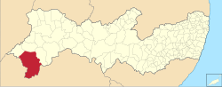 Location in Pernambuco | |
| Coordinates: 9°22′57″S 40°30′08″W / 9.38250°S 40.50222°W | |
| Country | |
| Region | Northeast |
| State | |
| Founded | 1870 |
| Government | |
| • Mayor | Simão Durando |
| Area | |
| • Total | 4,756.8 km2 (1,836.6 sq mi) |
| Elevation | 376 m (1,234 ft) |
| Population (2020)[1] | |
| • Total | 354,317 |
| • Density | 76.5/km2 (198/sq mi) |
| Demonym | petrolinense |
| Time zone | UTC−3 (BRT) |
| Postal code | 56300-001 to 56354-999 |
| Area code | +55 87 |
| HDI (2010) | 0.697 – medium[2] |
| Website | petrolina |


Etymology edit
Formerly called Passagem de Juazeiro (lit. 'Passage of Juazeiro'), there is no single story explaining the origin of the name Petrolina. One theory is that the name was in tribute of Brazilian emperor Pedro I and his consort Leopoldina, while another asserts that Petrolina was named for a 'beautiful rock' (Portuguese: Pedra linda) found on the banks of the São Francisco.[4]
History edit
The growth of Petrolina and its twin city Juazeiro in the late 20th century is the result of the construction of the Sobradinho Dam and the abundant availability of water for irrigation in these otherwise semi-arid soils. The region is perhaps the only one in the interior of the Northeast that has gained population through in-migration. While the population in the states of Pernambuco and Bahia as a whole increased by 50.1% between 1970 and 1990, it more than doubled in Petrolina-Juazeiro.[citation needed]
For many years the economy of the Valley of the São Francisco was based on extensive cattle ranching and subsistence farming.
Starting in the 1960s with the development policies implemented by the government, the valley soon became the beneficiary of important investments for economic development, translated into the construction of highways, increasing electrical energy, improvement in sanitation systems etc.
Investments made in the agricultural sector with the implantation of the irrigated sections of Bebedouro and Senador Nilo Coelho, in turn brought in the installation of factories connected to the regional agriculture base, especially producers of tomato paste, juices, textiles etc.
Agriculture has grown by leaps and bounds with irrigated farming being the main source of income and jobs in Petrolina. The Petrolina-Juazeiro nucleus has turned into a producer of a wide range of irrigated high-value crops, including table grapes and mangos that are sold fresh by cargo aircraft to Europe and the United States, and other crops for the domestic market, including bananas, coconuts, guavas, passion fruit, melons, industrial tomatoes, watermelons and onions, among others. Due to irrigation, growers in Petrolina-Juazeiro produce 90% of the country's exports of mangos and 30% of table grapes, displacing the states of São Paulo and Rio Grande do Sul as the most important exporters of these products.
Geography edit

Petrolina is situated on the left (northern) bank of the São Francisco River, in the interior semi-arid Sertão subregion, at an elevation of 376 m. On the other side of the river sits Juazeiro, in state of Bahia, and together the cities form an integrated metropolitan area. The two cities, making up an urban area of almost 700,000 people, are connected by the President Dutra Bridge. The Sobradinho Dam is located 26 km up river, and creates the Sobradinho Reservoir, the 34th largest reservoir by volume in the world.[5]
The municipality was designated a priority area for conservation and sustainable use when the Caatinga Ecological Corridor was created in 2006.[6]
Distances to other Brazilian cities edit
- Salvador 512 kilometres (318 mi)
- Recife (state capital) 714.4 kilometres (443.9 mi)[7]
- Brasília1,550 kilometres (960 mi)
- Belo Horizonte 1,663 kilometres (1,033 mi)
- Rio de Janeiro 1,927 kilometres (1,197 mi)
- São Paulo 2,246 kilometres (1,396 mi)
Climate edit
Petrolina's climate is very hot and dry, being classified as hot semi-arid (Köppen climate classification BSh). Petrolina is located in the semi-arid Sertão belt of the Northeastern Region of Brazil that has a distinctively erratic and seasonal rainfall. The rainy season begins in November and ends in April. After that, the climate is still dry until October, and in many years there is very little rain even during the rainy season.
| Climate data for Petrolina (1991–2020) | |||||||||||||
|---|---|---|---|---|---|---|---|---|---|---|---|---|---|
| Month | Jan | Feb | Mar | Apr | May | Jun | Jul | Aug | Sep | Oct | Nov | Dec | Year |
| Mean daily maximum °C (°F) | 33.5 (92.3) |
33.2 (91.8) |
33.1 (91.6) |
32.6 (90.7) |
31.6 (88.9) |
30.3 (86.5) |
29.8 (85.6) |
30.8 (87.4) |
32.8 (91.0) |
34.2 (93.6) |
34.3 (93.7) |
34.0 (93.2) |
32.5 (90.5) |
| Daily mean °C (°F) | 28.2 (82.8) |
28.1 (82.6) |
28.0 (82.4) |
27.6 (81.7) |
26.6 (79.9) |
25.2 (77.4) |
24.6 (76.3) |
25.2 (77.4) |
26.9 (80.4) |
28.5 (83.3) |
28.8 (83.8) |
28.6 (83.5) |
27.2 (81.0) |
| Mean daily minimum °C (°F) | 23.6 (74.5) |
23.6 (74.5) |
23.8 (74.8) |
23.4 (74.1) |
22.5 (72.5) |
21.1 (70.0) |
20.2 (68.4) |
20.3 (68.5) |
21.3 (70.3) |
22.7 (72.9) |
23.4 (74.1) |
23.7 (74.7) |
22.5 (72.5) |
| Average precipitation mm (inches) | 83.5 (3.29) |
78.1 (3.07) |
83.6 (3.29) |
45.8 (1.80) |
11.0 (0.43) |
5.7 (0.22) |
4.5 (0.18) |
1.7 (0.07) |
2.3 (0.09) |
9.2 (0.36) |
46.5 (1.83) |
47.1 (1.85) |
419.0 (16.50) |
| Average precipitation days (≥ 1.0 mm) | 5.5 | 5.7 | 6.2 | 3.6 | 1.9 | 1.5 | 0.9 | 0.5 | 0.4 | 0.9 | 3.1 | 4.0 | 34.2 |
| Average relative humidity (%) | 56.8 | 58.4 | 59.9 | 59.9 | 59.9 | 60.9 | 59.1 | 54.5 | 49.5 | 46.7 | 49.9 | 54.2 | 55.8 |
| Average dew point °C (°F) | 19.2 (66.6) |
19.7 (67.5) |
20.0 (68.0) |
19.7 (67.5) |
18.9 (66.0) |
17.8 (64.0) |
16.8 (62.2) |
16.3 (61.3) |
16.5 (61.7) |
17.0 (62.6) |
18.1 (64.6) |
18.9 (66.0) |
18.2 (64.8) |
| Mean monthly sunshine hours | 252.7 | 226.8 | 245.5 | 243.5 | 234.6 | 226.0 | 248.8 | 273.0 | 279.6 | 290.6 | 263.7 | 264.0 | 3,048.8 |
| Source: NOAA[8] | |||||||||||||
Demographics edit
Population edit
| Year | Pop. | ±% |
|---|---|---|
| 1970 | 61,252 | — |
| 1980 | 104,297 | +70.3% |
| 1991 | 175,406 | +68.2% |
| 2000 | 218,538 | +24.6% |
| 2010 | 293,962 | +34.5% |
| 2020 (estimated) | 354,317 | +20.5% |
| Source: Brazilian Institute of Geography and Statistics[9] | ||
As of the last census conducted in 2010, the population was 293,962, of which 219,215 lived in an urban area, with the remaining 74,747 lived in rural areas.[7] As of 2020, the estimated population is 354,317.
Of the population in 2010, 83,360 inhabitants (28.36%) were under the age of 15, 196,957 people were aged between 15 and 64 years (67.00%), 13,645 people were over 65 years of age (4.64%). Life expectancy in the municipality was 73 years and the total fertility rate was 2.2 children per woman. The Human Development Index (HDI) of Petrolina was 0.697, classified as "medium" by the United Nations Development Program (UNDP), sixth highest among the municipalities of the state and the highest in the interior of Pernambuco.[10]
Petrolina and Juazeiro, in Bahia, are part of a metropolitan area called a "Region of Integrated Development" (Brazilian Portuguese: Região Administrativa Integrada de Desenvolvimento), with a population of 686,410 in 2010.[11]
Poverty and inequality edit
The poverty line in Brazil is defined in federal government programs as R$140 per month.[12] In 2010, 20.9% of the population lived with an income below the poverty line. Despite a large reduction in this proportion since the year 2000, there were still approximately 60,123 people living in poverty. 79.2% of the population was above the poverty line, 12.5% were between the poverty line and "indigence line" of extreme poverty, defined as monthly income under R$70, and 8.3% were below the indigence line.[13] The Gini coefficient was 0.6253 in 2010.[7]
Religion edit

The vast majority of Petrolina is Christian, and in particular, Catholic.
According to the 2010 population census, the 73.09% of Petrolina's population identified as Catholic, while 0.69% practiced Spiritism. Evangelicals represent 15.89%, combining all denominations.[14]
About 7.92% declared no religion, including atheists and agnostics. Those who claimed not to have a specific religion or to feel multiple belonging were equivalent to 0.24%.[14]
All other religions were fairly rare: followers of religions of African origin, such as Umbanda and Candomblé, accounted for 0.01% and 0.06% respectively, while 0.01% of the population identified as Buddhist, while no one identified as Muslim or Hindu. Practitioners of esoteric traditions accounted for 0.01% of the population, while only 12 people declared themselves adepts of spiritualism.[14]
The Sacred Heart Cathedral in Petrolina was dedicated in 1929,[15] and is the seat of the Roman Catholic Diocese of Petrolina, in the ecclesiastical province of Olinda and Recife.
Politics and government edit
The municipality is headed by a mayor (Brazilian Portuguese: Prefeito/Prefeita), overseen by a city council (Câmara Municipal) that passes laws. The current mayor is Miguel Coelho of the Brazilian Socialist Party, first elected in 2016, and re-elected in 2020.[16]
Economy edit

The main economic activities in Petrolina are irrigated agriculture and its related industries. Main crops in tons[17] (2007)
There is also a substantial number of animals as of 2007, as follows:
- Goats - 99,500
- Sheep - 57,200
- Cattle- 29,200
- Pigs - 16,200
- Donkeys - 10,400
- Mules - 2,100
- Horses - 1,750
Economic indicators edit
| Population | GDP (in thousands of Brazilian Reais (R$)).[18] | GDP per capita (R$) | Percent of Pernambuco GDP |
|---|---|---|---|
| 294,081 | 2,375,492 | 8,601 | 3.37% |
Economy by Sector 2006
| Primary sector | Secondary sector | Service sector |
|---|---|---|
| 22.79% | 14.05% | 63.16% |
Infrastructure edit
Education edit
As of 2014, there were 185 elementary schools, and 56 high schools.[7] Petrolina hosts campuses of the Federal University of Vale do São Francisco and the University of Pernambuco, as well as private universities.
Health edit
Health indicators are as follows:[19][7]
| HDI (2010) | Hospitals (2015) | Hospital beds (2015) | Infant mortality rate per 1000 live births (2017) |
|---|---|---|---|
| 0.697 | 6 | 323 | 15.3 |
Transport edit
Petrolina is on national highway BR-407, connecting Feira de Santana, near Salvador, and Picos located in the state of Piauí. Juazeiro, across the São Francisco River, is served by the Ferrovia Centro-Atlântica rail line, which is used only for freight. Petrolina Airport serves mainly regional flights (with flights to Recife, São Paulo, and Salvador) and international cargo flights of fresh fruit.[citation needed]
References edit
- ^ IBGE 2020
- ^ "Archived copy" (PDF). United Nations Development Programme (UNDP). Archived from the original (PDF) on 8 July 2014. Retrieved 13 March 2022.
{{cite web}}: CS1 maint: archived copy as title (link) - ^ "Ambientebrasil - portal ambiental". Archived from the original on 2007-09-27. Retrieved 2006-12-22.
- ^ "História" (in Brazilian Portuguese). Municipal Prefecture of Petrolina. Retrieved 2021-04-22.
- ^ Chao, B. F.; Wu, Y. H.; Li, Y. S. (2008-04-11). "Impact of Artificial Reservoir Water Impoundment on Global Sea Level". Science. 320 (5873): 212–214. Bibcode:2008Sci...320..212C. doi:10.1126/science.1154580. ISSN 0036-8075. PMID 18339903. S2CID 43767440.
- ^ Mattos, Marluza (2006), Ministério cria Corredor Ecológico da Caatinga (in Portuguese), Ministério do Meio Ambiente, retrieved 2016-11-01
- ^ a b c d e "Perfil Municipal: Petrolina" (PDF). Assembleia Legislativa do Estado de Pernambuco. July 2016. Retrieved 2021-04-22.
- ^ "World Meteorological Organization Climate Normals for 1991-2020 — Petrolina". National Oceanic and Atmospheric Administration. Retrieved January 31, 2024.
- ^ Instituto Brasileiro de Geografia e Estatística. "População estimada » comparação entre os municípios: Pernambuco". Archived from the original on 26 September 2014. Retrieved 2014-09-25.
- ^ "Perfil do Município de Petrolina, PE". Atlas do Desenvolvimento Humano no Brasil. Archived from the original on 2014-09-26. Retrieved 2014-09-25.
- ^ "Population Census | IBGE". IBGE. Table 3.1. Retrieved 2021-04-24.
- ^ Tronco, Giordano Benites; Ramos, Marília Patta; Tronco, Giordano Benites; Ramos, Marília Patta (March 2017). "Poverty lines in the Brasil Sem Miséria Plan: a review and proposed alternatives in poverty measurement according to the methodology of Sonia Rocha". Revista de Administração Pública. 51 (2): 294–311. doi:10.1590/0034-7612162786. hdl:10183/159712. ISSN 0034-7612.
- ^ "Perfil municipal de Petrolina". Portal ODM. Archived from the original on 2014-10-01. Retrieved 2014-10-01.
- ^ a b c "Tabela 2094: População residente por cor ou raça e religião". sidra.ibge.gov.br. Retrieved 2021-04-22.
- ^ http://www.gcatholic.org/churches/brazil/2662.htm GCatholic, with Google satellite map
- ^ "Prefeito reeleito de Petrolina, Miguel Coelho toma posse para 2º mandato". G1 (in Brazilian Portuguese). Retrieved 2021-04-24.
- ^ PE State site - City by city profile
- ^ Petrolina 2007 GDP IBGE page 32 Archived 2016-03-04 at the Wayback Machine
- ^ "Petrolina (PE) | Cities and States | IBGE". www.ibge.gov.br. Retrieved 2021-04-24.