
KNOWPIA
WELCOME TO KNOWPIA

Piikani 147 
Summary
Piikani 147, formerly Peigan 147, is an Indian reserve of the Piikani Nation in Alberta.[3] It is located 61 km (38 mi) west of the City of Lethbridge. It has a land area of 426.992 km2 (164.863 sq mi),[1] making it the fourth-largest Indian reserve in Canada, and lies at an elevation of 1,046 m (3,432 ft). The Canada 2011 Census reported a population of 1,217 inhabitants. It is bordered by the Municipal District of Willow Creek No. 26 on its north and east, and by the Municipal District of Pincher Creek No. 9 on its west and south. The nearest outside communities are Fort Macleod and Pincher Creek.
Piikani 147 | |
|---|---|
| Piikani Indian Reserve No. 147 | |
 Flag | |
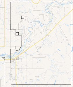 Boundaries of Piikani 147 | |
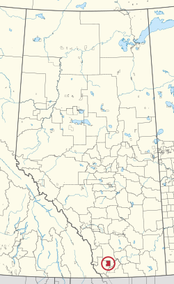 Location in Alberta | |
| First Nation | Piikani |
| Treaty | 7 |
| Country | Canada |
| Province | Alberta |
| Community | Brocket |
| Area | |
| • Total | 42,699.2 ha (105,512.0 acres) |
| Population (2016)[2] | |
| • Total | 1,544 |
| • Density | 3.6/km2 (9.4/sq mi) |
External links edit
- Map of Piikani 147 at Statcan
References edit
- ^ a b Reserve, settlement or village details for Piikani Nation Reserve at Indigenous and Northern Affairs Canada. Retrieved 19 July 2021.
- ^ "Census Profile, 2016 Census". Statistics Canada. February 8, 2017. Retrieved 2019-08-10.
- ^ First Nation details for the Piikani Nation First Nations at Indigenous and Northern Affairs Canada. Retrieved 19 July 2021.
49°35′N 113°40′W / 49.583°N 113.667°W