
KNOWPIA
WELCOME TO KNOWPIA

Pixie Mountain 
Summary
Pixie Mountain is a mountain in the North Carolina High Country, in the community of Linville. Its elevation reaches 4,058 feet (1,237 m). The mountain is adjacent to the Linville River.
| Pixie Mountain | |
|---|---|
 Grandfather Mountain (left) and Pixie Mountain (right) | |
| Highest point | |
| Elevation | 4,058 ft (1,237 m)[1] |
| Coordinates | 36°03′42″N 81°52′36″W / 36.06167°N 81.87667°W[1] |
| Geography | |
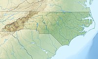 Pixie Mountain Location in North Carolina | |
| Location | Avery County, North Carolina, U.S. |
| Parent range | Blue Ridge Mountains |
| Topo map | USGS Newland |
The Linville Bypass (NC 181) goes around Pixie Mountain on its western side; while the majority of the Linville community is on its East and North.
References edit
- ^ a b "Pixie Mountain". Geographic Names Information System. United States Geological Survey, United States Department of the Interior. Retrieved 2009-12-29.