


Summary
Plogonnec (French pronunciation: [plɔɡɔnɛk]; Breton: Plogoneg) is a commune and small town in the Finistère department of Brittany in north-western France. It is about 13 km (8 mi) north west of Quimper and 10 km (6 mi) east of Douarnenez. The town is twinned with Llandysul in Wales.
Plogonnec
Plogoneg | |
|---|---|
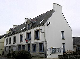 Town hall or Mairie | |
 Coat of arms | |
Location of Plogonnec .mw-parser-output .locmap .od{position:absolute}.mw-parser-output .locmap .id{position:absolute;line-height:0}.mw-parser-output .locmap .l0{font-size:0;position:absolute}.mw-parser-output .locmap .pv{line-height:110%;position:absolute;text-align:center}.mw-parser-output .locmap .pl{line-height:110%;position:absolute;top:-0.75em;text-align:right}.mw-parser-output .locmap .pr{line-height:110%;position:absolute;top:-0.75em;text-align:left}.mw-parser-output .locmap .pv>div{display:inline;padding:1px}.mw-parser-output .locmap .pl>div{display:inline;padding:1px;float:right}.mw-parser-output .locmap .pr>div{display:inline;padding:1px;float:left}html.skin-theme-clientpref-night .mw-parser-output .od,html.skin-theme-clientpref-night .mw-parser-output .od .pv>div,html.skin-theme-clientpref-night .mw-parser-output .od .pl>div,html.skin-theme-clientpref-night .mw-parser-output .od .pr>div{background:#000;color:#fff}html.skin-theme-clientpref-night .mw-parser-output .locmap{filter:grayscale(0.6)}@media(prefers-color-scheme:dark){html.skin-theme-clientpref-os .mw-parser-output .locmap{filter:grayscale(0.6)}html.skin-theme-clientpref-os .mw-parser-output .od,html.skin-theme-clientpref-os .mw-parser-output .od .pv>div,html.skin-theme-clientpref-os .mw-parser-output .od .pl>div,html.skin-theme-clientpref-os .mw-parser-output .od .pr>div{background:#000;color:#fff}}  Plogonnec  Plogonnec | |
| Coordinates: 48°04′43″N 4°11′35″W / 48.0786°N 4.1931°W | |
| Country | France |
| Region | Brittany |
| Department | Finistère |
| Arrondissement | Quimper |
| Canton | Quimper-1 |
| Intercommunality | Quimper Bretagne Occidentale |
| Government | |
| • Mayor (2020–2026) | Didier Leroy[1] |
| Area 1 | 54.14 km2 (20.90 sq mi) |
| Population (2021)[2] | 3,210 |
| • Density | 59/km2 (150/sq mi) |
| Time zone | UTC+01:00 (CET) |
| • Summer (DST) | UTC+02:00 (CEST) |
| INSEE/Postal code | 29169 /29180 |
| Elevation | 12–286 m (39–938 ft) |
| 1 French Land Register data, which excludes lakes, ponds, glaciers > 1 km2 (0.386 sq mi or 247 acres) and river estuaries. | |
Geography edit


The town is situated in a hilly area about 10 km (6 mi) inland from the fishing port of Douarnenez. Quimper is about 15 km (9 mi) to the south east and the N165 Brest to Nantes trunk road lies between Plogonnec and Quimper. The lowest part of the commune is the River Névet, the town is at an altitude of 130 m (427 ft) and the commune rises in the north to an altitude of 286 m (938 ft) on the slopes of the Montagne de Locronan. Panoramic views to the coast are available from the Montagne du Prieuré. The total area of the commune is around 3,200 ha (7,900 acres). Much of the land is agricultural but there are several protected areas of woodland. To the west is the extensive Bois du Nevet which offers opportunities for hiking.[3]
History edit
The Seigneures of Névet headed a clan and were one of the oldest and most influential families in the Cornouaille. Their lands included both the west and east parts of the commune but the central part was under the control of the Princes of the House of Rohan under the direct authority of the Bishops of Cornouaille.[3] At the end of the sixteenth century, the French Wars of Religion devastated the parish which was also affected by the Revolt of the Bonnets Rouges in 1675.
Notable buildings edit
Besides the Church of Saint-Thurien de Plogonnec there are a number of chapels dating from the 16th and 17th centuries. Particularly notable is the Chapel of Saint Théleau the evangelist which is known for its intricate sculptures and is classed as an ancient monument.[4] There are also secular historic buildings in the town including mansions, wash houses, mills and farmhouses. Facilities include primary schools, kindergartens, shops, bars and restaurants.[3]
Twinning edit
Plogonnec is twinned with Llandysul in West Wales, a small town in a similar rural area.[5] The purpose of the twinning is to promote cultural and commercial ties between the two. Members of the communities have exchanged hospitality and have united for various events in both Brittany and Wales.[5]
Population edit
The population of Plogonnec has varied over the last two centuries between around 2000 inhabitants to its present level of just over 3000, with the highest level of 3365 in 1911.[6] Inhabitants of Plogonnec are called in French Plogonnecois(es) or Plogonistes.[7]
|
| ||||||||||||||||||||||||||||||||||||||||||||||||||||||||||||||||||||||||||||||||||||||||||||||||||||||||||||||||||
| Source: EHESS[6] and INSEE (1968-2017)[8] | |||||||||||||||||||||||||||||||||||||||||||||||||||||||||||||||||||||||||||||||||||||||||||||||||||||||||||||||||||
See also edit
References edit
- This article incorporates material from the French Wikipedia
- ^ "Répertoire national des élus: les maires". data.gouv.fr, Plateforme ouverte des données publiques françaises (in French). 9 August 2021.
- ^ "Populations légales 2021". The National Institute of Statistics and Economic Studies. 28 December 2023.
- ^ a b c "Bienvenue à Plogonnec" (in French). Mairie de Plogonnec. Retrieved 17 January 2013.
- ^ Base Mérimée: Chapelle, sacristie et calvaire de Saint-Thélau, Ministère français de la Culture. (in French)
- ^ a b "The genesis of the twinning". Twinning Societies of Llandysul a’r Fro-Plogoneg. Retrieved 17 January 2013.
- ^ a b Des villages de Cassini aux communes d'aujourd'hui: Commune data sheet Plogonnec, EHESS (in French).
- ^ habitants.fr, Retrieved 17 August 2020.
- ^ Population en historique depuis 1968, INSEE
External links edit
- Official website (in French)
- Base Mérimée: Search for heritage in the commune, Ministère français de la Culture. (in French)