


Summary
Podgorny (Russian: Подго́рный) is an urban locality (an urban-type settlement) under the administrative jurisdiction of the closed town of Zheleznogorsk in Krasnoyarsk Krai, Russia. Population: 6,760 (2010 Russian census);[1] 6,164 (2002 Census);[5] It is located 30 km northeast of Krasnoyarsk and 5 km east of Sosnovoborsk on the right bank of the Yenisei River. The territory of the village is 7 square meters. km. Podgorny is a part of Krasnoyarsk metro area.
Podgorny
Подгорный | |
|---|---|
 Подгорный общий вид.jpg | |
Location of Podgorny .mw-parser-output .locmap .od{position:absolute}.mw-parser-output .locmap .id{position:absolute;line-height:0}.mw-parser-output .locmap .l0{font-size:0;position:absolute}.mw-parser-output .locmap .pv{line-height:110%;position:absolute;text-align:center}.mw-parser-output .locmap .pl{line-height:110%;position:absolute;top:-0.75em;text-align:right}.mw-parser-output .locmap .pr{line-height:110%;position:absolute;top:-0.75em;text-align:left}.mw-parser-output .locmap .pv>div{display:inline;padding:1px}.mw-parser-output .locmap .pl>div{display:inline;padding:1px;float:right}.mw-parser-output .locmap .pr>div{display:inline;padding:1px;float:left}html.skin-theme-clientpref-night .mw-parser-output .od,html.skin-theme-clientpref-night .mw-parser-output .od .pv>div,html.skin-theme-clientpref-night .mw-parser-output .od .pl>div,html.skin-theme-clientpref-night .mw-parser-output .od .pr>div{background:#000;color:#fff}html.skin-theme-clientpref-night .mw-parser-output .locmap{filter:grayscale(0.6)}@media(prefers-color-scheme:dark){html.skin-theme-clientpref-os .mw-parser-output .locmap{filter:grayscale(0.6)}html.skin-theme-clientpref-os .mw-parser-output .od,html.skin-theme-clientpref-os .mw-parser-output .od .pv>div,html.skin-theme-clientpref-os .mw-parser-output .od .pl>div,html.skin-theme-clientpref-os .mw-parser-output .od .pr>div{background:#000;color:#fff}}  Podgorny Location of Podgorny 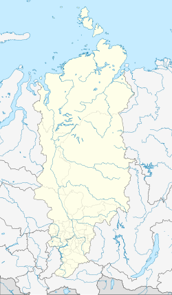 Podgorny Podgorny (Krasnoyarsk Krai) | |
| Coordinates: 56°7′19″N 93°25′39″E / 56.12194°N 93.42750°E | |
| Country | Russia |
| Federal subject | Krasnoyarsk Krai |
| Founded | 1953 |
| Population | |
| • Total | 6,760 |
| • Estimate (2018)[2] | 6,506 (−3.8%) |
| Time zone | UTC+7 (MSK+4 |
| Postal code(s)[4] | 662991 |
| OKTMO ID | 04735000056 |

History edit
In the spring of 1953, the construction of a special facility began by military personnel (the so-called "aviators"). A road from the highway was laid 5 km from Krasnoyarsk-26 near the villages of Novy Put and Belorussovka. On the site of the fourth district, it was supposed to build a hangar storage for aerial bombs and shells in the mountain; mailbox 70 was the customer for the construction.
In 1954, the construction of residential quarters of the village began. In January 1955, the area was surrounded by barbed wire. The 4th industrial region was a quarantine, transit base for the military builders of Krasnoyarsk-26. In 1956, Komsomol members who arrived on vouchers settled in the barracks.
In 1958, the construction of a special chemical plant facility began, which will be included in the defense complex of the mining and chemical plant and Krasmash. The main object of construction was a stand for testing rocket engines. Military builders and Komsomol members built new infrastructure in the taiga: roads, energy, warehouses for rocket fuel components, treatment facilities, an air separation complex to produce nitrogen, oxygen, argon, and many other facilities. Construction lasted 3 years.
On December 31, 1961, the main production was put into operation. From 1961 to 1990, the plant carried out defense orders. In 1968, a dam was built on the Tartat River, the Tartat Reservoir was formed, a favorite vacation spot for the villagers. In 1979, an ice sports palace was built. Since 1980, the Fakel recreation center has been operating as a pioneer and sports camp. In 1984, the construction of a swimming pool and a gym was completed.
In 1988, the production of blocks for refrigerators was placed at the plant. In 1990, as part of a planned conversion, facilities for the disposal of SLBMs and instrument compartments were placed. Since 1998, work has been underway on the construction of catalytic hydrogenation of rocket fuel under a contract with the United States. In 2001, the chemical plant was reformed, several organizations were created on its basis. On July 1, 2008, restrictions on entry into the town were lifted. The regime zone remained only around the chemical plant.
Population edit
| Year | Pop. | ±% |
|---|---|---|
| 2002 | 6,164 | — |
| 2009 | 6,161 | −0.0% |
| 2010 | 6,760 | +9.7% |
| 2012 | 6,743 | −0.3% |
| 2013 | 6,676 | −1.0% |
| 2014 | 6,587 | −1.3% |
| 2015 | 6,558 | −0.4% |
| 2016 | 6,536 | −0.3% |
| 2017 | 6,541 | +0.1% |
| 2018 | 6,506 | −0.5% |
| 2020 | 6,376 | −2.0% |
| 2021 | 6,371 | −0.1% |
The age composition is dominated by middle-aged and older people. The average age of the residents of the village is 47 years. Younger people tend to move to Krasnoyarsk.
The village has a general education school, an art school, 3 kindergartens, the Fakel sports complex, the Start cultural center, a chain of stores, and the Church of the Resurrection of Christ.
The city-forming enterprise is a chemical plant, workshops of the State Enterprise "Krasnoyarsk Machine-Building Plant". More than 30% of the population works there.
Climate edit
The climate is continental. Steady snow cover from November to March. Average January temperature: -21.6 °C, July: +21.5 °C. Summer lasts from the end of May to the last week of August. Demi-season: spring, autumn lasting 1.5–2 months. Snow cover is stable, above 20 cm. Maximum level in March: 55 cm. Most precipitation in the form of rain falls from late July to October
Flora and fauna edit
The predominant vegetation is coniferous trees: larch, pine, spruce; hardwoods: birch, aspen, bird cherry, sorbus, wild rose; acclimatized: maple, poplus, wild apple. Birds: crows, sparrows, tits, different types of woodpeckers, kites, pigeons, nuthatches. Fauna: mixed representatives of the taiga fauna of central Siberia and the south of the Krasnoyarsk Territory: brown bear, hare, roe deer, wolves, foxes, squirrels, chipmunks, ferrets, moles, ground squirrels, voles.
References edit
- ^ a b Russian Federal State Statistics Service (2011). Всероссийская перепись населения 2010 года. Том 1 [2010 All-Russian Population Census, vol. 1]. Всероссийская перепись населения 2010 года [2010 All-Russia Population Census] (in Russian). Federal State Statistics Service.
- ^ "26. Численность постоянного населения Российской Федерации по муниципальным образованиям на 1 января 2018 года". Federal State Statistics Service. Retrieved 23 January 2019.
- ^ "Об исчислении времени". Официальный интернет-портал правовой информации (in Russian). 3 June 2011. Retrieved 19 January 2019.
- ^ Почта России. Информационно-вычислительный центр ОАСУ РПО. (Russian Post). Поиск объектов почтовой связи (Postal Objects Search) (in Russian)
- ^ Federal State Statistics Service (21 May 2004). Численность населения России, субъектов Российской Федерации в составе федеральных округов, районов, городских поселений, сельских населённых пунктов – районных центров и сельских населённых пунктов с населением 3 тысячи и более человек [Population of Russia, Its Federal Districts, Federal Subjects, Districts, Urban Localities, Rural Localities—Administrative Centers, and Rural Localities with Population of Over 3,000] (XLS). Всероссийская перепись населения 2002 года [All-Russia Population Census of 2002] (in Russian).