
KNOWPIA
WELCOME TO KNOWPIA

Poilly-lez-Gien 
Summary
Poilly-lez-Gien (French pronunciation: [pwaji lɛ ʒjɛ̃], literally Poilly near Gien) is a commune in the Loiret department, located in north-central France.
Poilly-lez-Gien | |
|---|---|
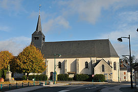 The church in Poilly-lez-Gien | |
Location of Poilly-lez-Gien .mw-parser-output .locmap .od{position:absolute}.mw-parser-output .locmap .id{position:absolute;line-height:0}.mw-parser-output .locmap .l0{font-size:0;position:absolute}.mw-parser-output .locmap .pv{line-height:110%;position:absolute;text-align:center}.mw-parser-output .locmap .pl{line-height:110%;position:absolute;top:-0.75em;text-align:right}.mw-parser-output .locmap .pr{line-height:110%;position:absolute;top:-0.75em;text-align:left}.mw-parser-output .locmap .pv>div{display:inline;padding:1px}.mw-parser-output .locmap .pl>div{display:inline;padding:1px;float:right}.mw-parser-output .locmap .pr>div{display:inline;padding:1px;float:left}html.skin-theme-clientpref-night .mw-parser-output .od,html.skin-theme-clientpref-night .mw-parser-output .od .pv>div,html.skin-theme-clientpref-night .mw-parser-output .od .pl>div,html.skin-theme-clientpref-night .mw-parser-output .od .pr>div{background:#000;color:#fff}html.skin-theme-clientpref-night .mw-parser-output .locmap{filter:grayscale(0.6)}@media(prefers-color-scheme:dark){html.skin-theme-clientpref-os .mw-parser-output .locmap{filter:grayscale(0.6)}html.skin-theme-clientpref-os .mw-parser-output .od,html.skin-theme-clientpref-os .mw-parser-output .od .pv>div,html.skin-theme-clientpref-os .mw-parser-output .od .pl>div,html.skin-theme-clientpref-os .mw-parser-output .od .pr>div{background:#000;color:#fff}}  Poilly-lez-Gien  Poilly-lez-Gien | |
| Coordinates: 47°40′43″N 2°36′00″E / 47.6786°N 2.6°E | |
| Country | France |
| Region | Centre-Val de Loire |
| Department | Loiret |
| Arrondissement | Montargis |
| Canton | Sully-sur-Loire |
| Intercommunality | CC Giennoises |
| Government | |
| • Mayor (2020–2026) | Alain Chaborel[1] |
| Area 1 | 33.29 km2 (12.85 sq mi) |
| Population (2021)[2] | 2,441 |
| • Density | 73/km2 (190/sq mi) |
| Demonym | Polisson |
| Time zone | UTC+01:00 (CET) |
| • Summer (DST) | UTC+02:00 (CEST) |
| INSEE/Postal code | 45254 /45500 |
| Elevation | 117–182 m (384–597 ft) |
| 1 French Land Register data, which excludes lakes, ponds, glaciers > 1 km2 (0.386 sq mi or 247 acres) and river estuaries. | |
Population edit
| Year | Pop. | ±% p.a. |
|---|---|---|
| 1968 | 1,550 | — |
| 1975 | 1,849 | +2.55% |
| 1982 | 2,104 | +1.86% |
| 1990 | 2,281 | +1.01% |
| 1999 | 2,189 | −0.46% |
| 2007 | 2,279 | +0.50% |
| 2012 | 2,377 | +0.85% |
| 2017 | 2,406 | +0.24% |
| Source: INSEE[3] | ||
See also edit
References edit
- ^ "Répertoire national des élus: les maires" (in French). data.gouv.fr, Plateforme ouverte des données publiques françaises. 13 September 2022.
- ^ "Populations légales 2021". The National Institute of Statistics and Economic Studies. 28 December 2023.
- ^ Population en historique depuis 1968, INSEE
Wikimedia Commons has media related to Poilly-lez-Gien.