


Summary
Pomona is an unincorporated community and census-designated place (CDP)[10] located within Galloway Township, in Atlantic County, in the U.S. state of New Jersey.[11][12][13] As of the 2010 United States Census, the CDP's population was 7,124.[14][15] The area is served as United States Postal Service ZIP Code 08240.[6]
Pomona, New Jersey | |
|---|---|
 Neighboring communities | |
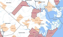
 Left: Map highlighting Pomona within Atlantic County: Right: location of Atlantic County in New Jersey. | |
| Coordinates: 39°28′07″N 74°33′00″W / 39.468722°N 74.550112°W[1][2] | |
| Country | |
| State | |
| County | Atlantic |
| Township | Galloway |
| Area | |
| • Total | 2.79 sq mi (7.21 km2) |
| • Land | 2.79 sq mi (7.21 km2) |
| • Water | 0.00 sq mi (0.00 km2) 0.00% |
| Elevation | 56 ft (17 m) |
| Population | |
| • Total | 7,416 |
| • Density | 2,662.8/sq mi (1,028.1/km2) |
| Time zone | UTC−05:00 (Eastern (EST)) |
| • Summer (DST) | UTC−04:00 (EDT) |
| ZIP Code | 08240[6] |
| Area code | 609 |
| FIPS code | 34-60030[1][7][8] |
| GNIS feature ID | 02389693[1][9] |


Locally, the name "Pomona" is loosely used also to refer to areas adjacent to Pomona proper, including adjoining portions of Hamilton Township and Egg Harbor Township in the vicinity of the Atlantic City International Airport.[citation needed]
Pomona was often described as the home to Stockton University,[citation needed] since the mailing address for the college was a post-office box located in the Pomona Post Office.[16] In 2011, the university changed its mailing address to its main campus (using the street Vera King Farris Drive, Galloway Township, New Jersey).[17]
Geography edit
According to the U.S. Census Bureau, the Pomona CDP had a total area of 2.797 square miles (7.244 km2), all of which was land.[1][2]
Demographics edit
| Census | Pop. | Note | %± |
|---|---|---|---|
| 1990 | 2,624 | — | |
| 2000 | 4,019 | 53.2% | |
| 2010 | 7,124 | 77.3% | |
| 2020 | 7,416 | 4.1% | |
| Population sources 1990-2010[13] 2000[18] 2010[14] 2020[5] | |||
2010 census edit
The 2010 United States census counted 7,124 people, 2,107 households, and 1,601 families in the CDP. The population density was 2,547.0 per square mile (983.4/km2). There were 2,202 housing units at an average density of 787.3 per square mile (304.0/km2). The racial makeup was 57.99% (4,131) White, 10.64% (758) Black or African American, 0.44% (31) Native American, 22.11% (1,575) Asian, 0.00% (0) Pacific Islander, 5.22% (372) from other races, and 3.61% (257) from two or more races. Hispanic or Latino of any race were 13.22% (942) of the population.[14]
Of the 2,107 households, 43.4% had children under the age of 18; 58.4% were married couples living together; 12.0% had a female householder with no husband present and 24.0% were non-families. Of all households, 19.7% were made up of individuals and 12.2% had someone living alone who was 65 years of age or older. The average household size was 3.19 and the average family size was 3.68.[14]
26.6% of the population were under the age of 18, 8.9% from 18 to 24, 25.7% from 25 to 44, 24.5% from 45 to 64, and 14.3% who were 65 years of age or older. The median age was 37.4 years. For every 100 females, the population had 86.6 males. For every 100 females ages 18 and older there were 82.3 males.[14]
2000 Census edit
At the 2000 census,[7] there were 4,019 people, 1,297 households and 1,002 families living in the CDP. The population density was 554.2/km2 (1,437.4/mi2). There were 1,357 housing units at an average density of 187.1/km2 (485.3/mi2). The racial makeup of the CDP was 74.15% White, 8.04% African American, 0.35% Native American, 11.99% Asian, 0.02% Pacific Islander, 3.56% from other races, and 1.89% from two or more races. Hispanic or Latino of any race were 7.49% of the population.[18]
There were 1,297 households, of which 45.7% had children under the age of 18 living with them, 61.0% were married couples living together, 10.9% had a female householder with no husband present, and 22.7% were non-families. 18.0% of all households were made up of individuals, and 8.8% had someone living alone who was 65 years of age or older. The average household size was 3.05 and the average family size was 3.47.[18]
30.4% of the population were under the age of 18, 7.3% from 18 to 24, 34.9% from 25 to 44, 18.9% from 45 to 64, and 8.5% who were 65 years of age or older. The median age was 34 years. For every 100 females, there were 95.4 males. For every 100 females age 18 and over, there were 88.4 males.[18]
The median household income was $52,796, and the median family income was $56,846. Males had a median income of $35,554 versus $29,453 for females. The per capita income for the CDP was $18,182. About 2.3% of families and 4.6% of the population were below the poverty line, including 3.3% of those under age 18 and 15.9% of those age 65 or over.[18]
Education edit
Galloway Township Public Schools operates schools for grades K-8 while the Greater Egg Harbor Regional High School District operates area high schools.
Galloway Township residents, including those of Pomona, are zoned to Absegami High School.[19]
Assumption Regional Catholic School, under the Roman Catholic Diocese of Camden, was previously in Pomona,[20] but in September 2007 moved to another campus elsewhere in the township.[21]
Notable people edit
- Anne Grunow (born c. 1959), senior research scientist at Ohio State University in the Byrd Polar Research Center.[22]
- Samuel Ojserkis (born 1990), rower who competed in the men's eight event at the 2016 Summer Olympics.[23]
References edit
- ^ a b c d Gazetteer of New Jersey Places, United States Census Bureau. Accessed July 21, 2016.
- ^ a b US Gazetteer files: 2010, 2000, and 1990, United States Census Bureau. Accessed September 4, 2014.
- ^ "ArcGIS REST Services Directory". United States Census Bureau. Retrieved October 11, 2022.
- ^ U.S. Geological Survey Geographic Names Information System: Pomona Census Designated Place, Geographic Names Information System. Accessed June 16, 2013.
- ^ a b QuickFacts Pomona CDP, New Jersey, United States Census Bureau. Accessed July 21, 2023.
- ^ a b Look Up a ZIP Code for Pomona, NJ, United States Postal Service. Accessed June 16, 2013.
- ^ a b U.S. Census website, United States Census Bureau. Accessed September 4, 2014.
- ^ Geographic codes for New Jersey, Missouri Census Data Center. Accessed June 9, 2023.
- ^ US Board on Geographic Names, United States Geological Survey. Accessed September 4, 2014.
- ^ State of New Jersey Census Designated Places - BVP20 - Data as of January 1, 2020, United States Census Bureau. Accessed December 1, 2022.
- ^ GCT-PH1 - Population, Housing Units, Area, and Density: 2010 - County -- County Subdivision and Place from the 2010 Census Summary File 1 for Atlantic County, New Jersey Archived 2020-02-12 at archive.today, United States Census Bureau. Accessed June 16, 2013.
- ^ 2006-2010 American Community Survey Geography for New Jersey, United States Census Bureau. Accessed June 16, 2013.
- ^ a b New Jersey: 2010 - Population and Housing Unit Counts - 2010 Census of Population and Housing (CPH-2-32), United States Census Bureau, p. III-3, August 2012. Accessed June 16, 2013.
- ^ a b c d e DP-1 - Profile of General Population and Housing Characteristics: 2010 Demographic Profile Data for Pomona CDP, New Jersey Archived 2020-02-12 at archive.today, United States Census Bureau. Accessed June 16, 2013.
- ^ Locality Search, State of New Jersey. Accessed April 19, 2015.
- ^ "Home". Stockton College. January 27, 2011. Archived from the original on January 27, 2011. Retrieved July 28, 2021.
P.O. Box 195 Pomona, NJ 08240
- ^ "Home". Stockton College. January 27, 2011. Archived from the original on September 29, 2011. Retrieved July 28, 2021.
101 Vera King Farris Drive Galloway, NJ 08205-9441
- ^ a b c d e DP-1 - Profile of General Demographic Characteristics: 2000 from the Census 2000 Summary File 1 (SF 1) 100-Percent Data for Pomona CDP, New Jersey Archived 2020-02-12 at archive.today, United States Census Bureau. Accessed June 15, 2013.
- ^ Policy 5120 Assignment of Pupils, Greater Egg Harbor Regional High School District. Accessed May 26, 2020. "Pupils shall attend the school located in the attendance area of their residence. [...] 2. Pupils who reside in Galloway Township shall attend Absegami High School. [...]"
- ^ "Home". Assumption Regional School. April 28, 2004. Archived from the original on April 28, 2004. Retrieved April 1, 2021.
276 West White Horse Pike Pomona, New Jersey
{{cite web}}: CS1 maint: unfit URL (link)
Compare to: "Home". Assumption Regional School. November 1, 2008. Archived from the original on November 1, 2008. Retrieved April 1, 2021.146 South Pitney Road Galloway, New Jersey 08205
- redirected from assumptionregionalschool.org - ^ "Bishop to announce school planning decisions Nov. 29". Diocese of Camden. Retrieved March 31, 2021.
- ^ Brunetti, Michelle. "Galloway Township native has Antarctic peak named for her", The Press of Atlantic City, December 23, 2017. Accessed November 24, 2018. "Anne Grunow, who recently had an Antarctic peak named after her, wasn’t terribly interested in science while a student at Absegami High School in the 1970s. 'I was dead set against doing anything with math or science. I loved history,' said the senior research scientist at Ohio State University and member of Absegami’s Class of 1977.... She always loved being outdoors, having grown up on a potato farm in the Pomona section of Galloway Township."
- ^ Sam Ojserkis, United States Olympic Committee. Accessed August 11, 2016. "Birthplace: Pomona, N.J.; Hometown: Linwood, N.J.; High School: Mainland Regional High School (Linwood, N.J.) '08"