
KNOWPIA
WELCOME TO KNOWPIA

Pompignac 
Summary
Pompignac (French pronunciation: [pɔ̃piɲak]; Occitan: Pompinhac) is a commune in the Gironde department in the Nouvelle-Aquitaine region in Southwestern France.
Pompignac
Pompinhac (Occitan) | |
|---|---|
 Pompignac Town Hall | |
 Coat of arms | |
Location of Pompignac .mw-parser-output .locmap .od{position:absolute}.mw-parser-output .locmap .id{position:absolute;line-height:0}.mw-parser-output .locmap .l0{font-size:0;position:absolute}.mw-parser-output .locmap .pv{line-height:110%;position:absolute;text-align:center}.mw-parser-output .locmap .pl{line-height:110%;position:absolute;top:-0.75em;text-align:right}.mw-parser-output .locmap .pr{line-height:110%;position:absolute;top:-0.75em;text-align:left}.mw-parser-output .locmap .pv>div{display:inline;padding:1px}.mw-parser-output .locmap .pl>div{display:inline;padding:1px;float:right}.mw-parser-output .locmap .pr>div{display:inline;padding:1px;float:left}html.skin-theme-clientpref-night .mw-parser-output .od,html.skin-theme-clientpref-night .mw-parser-output .od .pv>div,html.skin-theme-clientpref-night .mw-parser-output .od .pl>div,html.skin-theme-clientpref-night .mw-parser-output .od .pr>div{background:#000;color:#fff}html.skin-theme-clientpref-night .mw-parser-output .locmap{filter:grayscale(0.6)}@media(prefers-color-scheme:dark){html.skin-theme-clientpref-os .mw-parser-output .locmap{filter:grayscale(0.6)}html.skin-theme-clientpref-os .mw-parser-output .od,html.skin-theme-clientpref-os .mw-parser-output .od .pv>div,html.skin-theme-clientpref-os .mw-parser-output .od .pl>div,html.skin-theme-clientpref-os .mw-parser-output .od .pr>div{background:#000;color:#fff}}  Pompignac  Pompignac | |
| Coordinates: 44°51′07″N 0°26′09″W / 44.8519°N 0.4358°W | |
| Country | France |
| Region | Nouvelle-Aquitaine |
| Department | Gironde |
| Arrondissement | Bordeaux |
| Canton | Créon |
| Intercommunality | Coteaux Bordelais |
| Government | |
| • Mayor (2020–2026) | Céline Deligny-Estovert[1] |
| Area 1 | 11.62 km2 (4.49 sq mi) |
| Population (2021)[2] | 3,393 |
| • Density | 290/km2 (760/sq mi) |
| Time zone | UTC+01:00 (CET) |
| • Summer (DST) | UTC+02:00 (CEST) |
| INSEE/Postal code | 33330 /33370 |
| Elevation | 17–89 m (56–292 ft) (avg. 75 m or 246 ft) |
| Website | pompignac.fr |
| 1 French Land Register data, which excludes lakes, ponds, glaciers > 1 km2 (0.386 sq mi or 247 acres) and river estuaries. | |
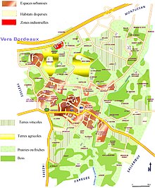
Geography edit
Demographics edit
| Year | Pop. | ±% p.a. |
|---|---|---|
| 1968 | 749 | — |
| 1975 | 1,222 | +7.24% |
| 1982 | 1,640 | +4.29% |
| 1990 | 2,355 | +4.63% |
| 1999 | 2,529 | +0.80% |
| 2009 | 2,590 | +0.24% |
| 2014 | 2,853 | +1.95% |
| 2020 | 3,301 | +2.46% |
| Source: INSEE[3] | ||
Notable people edit
- Wim Crusio, behavioral neurogeneticist[citation needed]
See also edit
References edit
- ^ "Répertoire national des élus: les maires". data.gouv.fr, Plateforme ouverte des données publiques françaises (in French). 9 August 2021.
- ^ "Populations légales 2021". The National Institute of Statistics and Economic Studies. 28 December 2023.
- ^ Population en historique depuis 1968, INSEE
Wikimedia Commons has media related to Pompignac.