
KNOWPIA
WELCOME TO KNOWPIA

Pont-sur-Madon 
Summary
Pont-sur-Madon (French pronunciation: [pɔ̃ syʁ madɔ̃] ⓘ) is a commune in the Vosges department in Grand Est in northeastern France.
Pont-sur-Madon | |
|---|---|
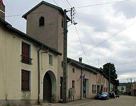 The town hall in Pont-sur-Madon | |
Location of Pont-sur-Madon .mw-parser-output .locmap .od{position:absolute}.mw-parser-output .locmap .id{position:absolute;line-height:0}.mw-parser-output .locmap .l0{font-size:0;position:absolute}.mw-parser-output .locmap .pv{line-height:110%;position:absolute;text-align:center}.mw-parser-output .locmap .pl{line-height:110%;position:absolute;top:-0.75em;text-align:right}.mw-parser-output .locmap .pr{line-height:110%;position:absolute;top:-0.75em;text-align:left}.mw-parser-output .locmap .pv>div{display:inline;padding:1px}.mw-parser-output .locmap .pl>div{display:inline;padding:1px;float:right}.mw-parser-output .locmap .pr>div{display:inline;padding:1px;float:left}html.skin-theme-clientpref-night .mw-parser-output .od,html.skin-theme-clientpref-night .mw-parser-output .od .pv>div,html.skin-theme-clientpref-night .mw-parser-output .od .pl>div,html.skin-theme-clientpref-night .mw-parser-output .od .pr>div{background:#000;color:#fff}html.skin-theme-clientpref-night .mw-parser-output .locmap{filter:grayscale(0.6)}@media(prefers-color-scheme:dark){html.skin-theme-clientpref-os .mw-parser-output .locmap{filter:grayscale(0.6)}html.skin-theme-clientpref-os .mw-parser-output .od,html.skin-theme-clientpref-os .mw-parser-output .od .pv>div,html.skin-theme-clientpref-os .mw-parser-output .od .pl>div,html.skin-theme-clientpref-os .mw-parser-output .od .pr>div{background:#000;color:#fff}}  Pont-sur-Madon  Pont-sur-Madon | |
| Coordinates: 48°22′14″N 6°09′14″E / 48.3706°N 6.1539°E | |
| Country | France |
| Region | Grand Est |
| Department | Vosges |
| Arrondissement | Épinal |
| Canton | Charmes |
| Intercommunality | CC Mirecourt Dompaire |
| Government | |
| • Mayor (2020–2026) | David Prévot-Pierre[1] |
| Area 1 | 3.42 km2 (1.32 sq mi) |
| Population (2021)[2] | 185 |
| • Density | 54/km2 (140/sq mi) |
| Time zone | UTC+01:00 (CET) |
| • Summer (DST) | UTC+02:00 (CEST) |
| INSEE/Postal code | 88354 /88500 |
| Elevation | 250–357 m (820–1,171 ft) (avg. 340 m or 1,120 ft) |
| 1 French Land Register data, which excludes lakes, ponds, glaciers > 1 km2 (0.386 sq mi or 247 acres) and river estuaries. | |
Inhabitants are called Madipontains.
Geography edit
The river Madon flows through the commune, and the bridge included in the name Pont-sur-Madon (Bridge over the Madon) is still in place.
See also edit
References edit
- ^ "Répertoire national des élus: les maires". data.gouv.fr, Plateforme ouverte des données publiques françaises (in French). 2 December 2020.
- ^ "Populations légales 2021". The National Institute of Statistics and Economic Studies. 28 December 2023.
Wikimedia Commons has media related to Pont-sur-Madon.