
KNOWPIA
WELCOME TO KNOWPIA

Powderhorn, Minneapolis 
Summary
Powderhorn is a defined community in Minneapolis, that consists of eight neighborhoods. The greater Powderhorn community is named after Powderhorn Park.
Powderhorn | |
|---|---|
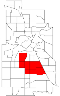 Location of Powderhorn within the U.S. city of Minneapolis | |
| Country | United States |
| State | Minnesota |
| County | Hennepin |
| City | Minneapolis |
| Founded | 1849 |
| City Council Wards | 8, 9, 10, 12 |
| Neighborhoods | |
| Government | |
| • Council Member, Ward 8 | Andrea Jenkins |
| • Council Member, Ward 9 | Jason Chavez |
| • Council Member, Ward 10 | Aisha Chughtai |
| • Council Member, Ward 12 | Aurin Chowdhury |
| Area | |
| • Total | 4.559 sq mi (11.81 km2) |
| Population (2020)[2] | |
| • Total | 55,913 |
| • Density | 12,000/sq mi (4,700/km2) |
| Time zone | UTC-6 (CST) |
| • Summer (DST) | UTC-5 (CDT) |
| ZIP code | 55404, 55405, 55406, 55407, 55408, 55409 |
| Area code | 612 |
| Census | Pop. | Note | %± |
|---|---|---|---|
| 1980 | 51,519 | — | |
| 1990 | 51,954 | 0.8% | |
| 2000 | 57,299 | 10.3% | |
| 2010 | 54,743 | −4.5% | |
| 2020 | 55,913 | 2.1% |
The community contains a large portion of City Council Ward 9, represented by Jason Chavez and parts of Wards 8, 10, and 12, represented by Andrea Jenkins, Aisha Chughtai, and Aurin Chowdhury, respectively.
Neighborhoods in the Powderhorn community edit
While most of Powderhorn is east of Interstate 35W and south of Lake Street, both the Lyndale and Whittier neighborhoods are west of I-35W, while Whittier is also north of Lake Street.
See also edit
- 38th Street (Minneapolis)44°56′21″N 93°15′47″W / 44.9393°N 93.2631°W[3]
- George Floyd Square
References edit
- ^ "Powderhorn neighborhood in Minneapolis, Minnesota (MN), 55404, 55406, 55407, 55408, 55409 detailed profile". City-Data. 2011. Retrieved 2013-11-12.
- ^ "Powderhorn community data". Minnesota Compass. Retrieved 2023-04-02.
- ^ Powderhorn, Minneapolis, MN. Google Earth. Retrieved 2011-03-09.
External links edit
- Minneapolis Neighborhood Profile - Bryant
- Bryant Neighborhood Organization
- Minneapolis Neighborhood Profile - Lyndale
- Lyndale Neighborhood Association