


Summary
Pratt is a town in Kanawha County, West Virginia, United States, along the Kanawha River. The population was 482 at the 2020 census.[2]
Pratt, West Virginia | |
|---|---|
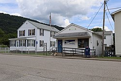 Post office in 2021 | |
|
Logo | |
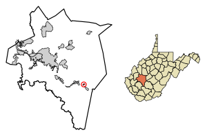 Location of Pratt in Kanawha County, West Virginia. | |
| Coordinates: 38°12′26″N 81°23′14″W / 38.20722°N 81.38722°W | |
| Country | United States |
| State | West Virginia |
| County | Kanawha |
| Area | |
| • Total | 0.29 sq mi (0.76 km2) |
| • Land | 0.29 sq mi (0.74 km2) |
| • Water | 0.01 sq mi (0.01 km2) |
| Elevation | 633 ft (193 m) |
| Population | |
| • Total | 482 |
| • Estimate (2021)[2] | 471 |
| • Density | 1,944.06/sq mi (749.59/km2) |
| Time zone | UTC-5 (Eastern (EST)) |
| • Summer (DST) | UTC-4 (EDT) |
| ZIP code | 25162 |
| Area code | 304 |
| FIPS code | 54-65356[3] |
| GNIS feature ID | 1555404[4] |
| Website | townofpratt |
History edit
The Pratt Historic District is listed on the National Register of Historic Places.[5]
Until its incorporation in 1905, the town was known as Clifton. It was renamed Pratt after the owner of the Charles Pratt Coal Company, Charles Pratt.[6] Many of the structures built by that company, including the miners' clubhouse for and various company houses are still standing.[7]
Geography edit
Pratt is located at 38°12′26″N 81°23′14″W / 38.20722°N 81.38722°W (38.207149, -81.387354).[8]
According to the United States Census Bureau, the town has a total area of 0.30 square miles (0.78 km2), of which 0.29 square miles (0.75 km2) is land and 0.01 square miles (0.03 km2) is water.[9]
Demographics edit

| Census | Pop. | Note | %± |
|---|---|---|---|
| 1910 | 306 | — | |
| 1920 | 315 | 2.9% | |
| 1930 | 325 | 3.2% | |
| 1940 | 417 | 28.3% | |
| 1950 | 457 | 9.6% | |
| 1960 | 602 | 31.7% | |
| 1970 | 671 | 11.5% | |
| 1980 | 821 | 22.4% | |
| 1990 | 640 | −22.0% | |
| 2000 | 551 | −13.9% | |
| 2010 | 602 | 9.3% | |
| 2019 (est.) | 556 | [10] | −7.6% |
| U.S. Decennial Census[11] | |||
2010 census edit
As of the census[12] of 2010, there were 602 people, 248 households, and 167 families living in the town. The population density was 2,075.9 inhabitants per square mile (801.5/km2). There were 280 housing units at an average density of 965.5 per square mile (372.8/km2). The racial makeup of the town was 96.5% White, 2.5% African American, 0.2% Native American, 0.2% Asian, and 0.7% from two or more races. Hispanic or Latino of any race were 1.2% of the population.
There were 248 households, of which 27.0% had children under the age of 18 living with them, 52.4% were married couples living together, 11.7% had a female householder with no husband present, 3.2% had a male householder with no wife present, and 32.7% were non-families. 29.4% of all households were made up of individuals, and 14.1% had someone living alone who was 65 years of age or older. The average household size was 2.43 and the average family size was 2.95.
The median age in the town was 41.3 years. 21.8% of residents were under the age of 18; 7.9% were between the ages of 18 and 24; 23.9% were from 25 to 44; 27.6% were from 45 to 64; and 18.6% were 65 years of age or older. The gender makeup of the town was 48.3% male and 51.7% female.
2000 census edit
As of the census[3] of 2000, there were 551 people, 239 households, and 163 families living in the town. The population density was 1,911.8 inhabitants per square mile (733.6/km2). There were 251 housing units at an average density of 870.9 per square mile (334.2/km2). The racial makeup of the town was 98.00% White, 0.54% African American, 0.18% Asian, 0.18% from other races, and 1.09% from two or more races. Hispanic or Latino of any race were 0.36% of the population.
There were 239 households, out of which 23.8% had children under the age of 18 living with them, 54.4% were married couples living together, 10.0% had a female householder with no husband present, and 31.4% were non-families. 28.5% of all households were made up of individuals, and 16.3% had someone living alone who was 65 years of age or older. The average household size was 2.31 and the average family size was 2.79.
In the town, the population was spread out, with 19.1% under the age of 18, 7.1% from 18 to 24, 27.0% from 25 to 44, 25.2% from 45 to 64, and 21.6% who were 65 years of age or older. The median age was 43 years. For every 100 females, there were 88.7 males. For every 100 females age 18 and over, there were 82.0 males.
The median income for a household in the town was $37,500, and the median income for a family was $42,115. Males had a median income of $31,500 versus $25,208 for females. The per capita income for the town was $18,773. About 5.4% of families and 9.4% of the population were below the poverty line, including 17.1% of those under age 18 and 5.2% of those age 65 or over.
References edit
- ^ "2019 U.S. Gazetteer Files". United States Census Bureau. Retrieved August 7, 2020.
- ^ a b c "City and Town Population Totals: 2020-2021". Census.gov. US Census Bureau. Retrieved July 3, 2022.
- ^ a b "U.S. Census website". United States Census Bureau. Retrieved January 31, 2008.
- ^ "US Board on Geographic Names". United States Geological Survey. October 25, 2007. Retrieved January 31, 2008.
- ^ "National Register Information System". National Register of Historic Places. National Park Service. July 9, 2010.
- ^ Kenny, Hamill (1945). West Virginia Place Names: Their Origin and Meaning, Including the Nomenclature of the Streams and Mountains. Piedmont, WV: The Place Name Press. p. 507.
- ^ "A Brief History of Pratt, WV 1781-1913". April 19, 2011. Retrieved May 5, 2013.
- ^ "US Gazetteer files: 2010, 2000, and 1990". United States Census Bureau. February 12, 2011. Retrieved April 23, 2011.
- ^ "US Gazetteer files 2010". United States Census Bureau. Archived from the original on January 25, 2012. Retrieved January 24, 2013.
- ^ "Population and Housing Unit Estimates". United States Census Bureau. May 24, 2020. Retrieved May 27, 2020.
- ^ "Census of Population and Housing". Census.gov. Retrieved June 4, 2015.
- ^ "U.S. Census website". United States Census Bureau. Retrieved January 24, 2013.
External links edit
- Pratt website