


Summary
Primorsko-Akhtarsk (Russian: Примо́рско-Ахта́рск) is a port town and the administrative center of Primorsko-Akhtarsky District of Krasnodar Krai, Russia, located on the coast of the Sea of Azov, 151 kilometers (94 mi) northwest of Krasnodar, the administrative center of the krai. Population: 32,257 (2010 Census);[2] 32,677 (2002 Census);[7] 30,047 (1989 Census).[8]
Primorsko-Akhtarsk
Приморско-Ахтарск | |
|---|---|
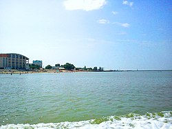 Beach in Primorsko-Akhtarsk | |
 Flag  Coat of arms | |
Location of Primorsko-Akhtarsk .mw-parser-output .locmap .od{position:absolute}.mw-parser-output .locmap .id{position:absolute;line-height:0}.mw-parser-output .locmap .l0{font-size:0;position:absolute}.mw-parser-output .locmap .pv{line-height:110%;position:absolute;text-align:center}.mw-parser-output .locmap .pl{line-height:110%;position:absolute;top:-0.75em;text-align:right}.mw-parser-output .locmap .pr{line-height:110%;position:absolute;top:-0.75em;text-align:left}.mw-parser-output .locmap .pv>div{display:inline;padding:1px}.mw-parser-output .locmap .pl>div{display:inline;padding:1px;float:right}.mw-parser-output .locmap .pr>div{display:inline;padding:1px;float:left}html.skin-theme-clientpref-night .mw-parser-output .od,html.skin-theme-clientpref-night .mw-parser-output .od .pv>div,html.skin-theme-clientpref-night .mw-parser-output .od .pl>div,html.skin-theme-clientpref-night .mw-parser-output .od .pr>div{background:#000;color:#fff}html.skin-theme-clientpref-night .mw-parser-output .locmap{filter:grayscale(0.6)}@media(prefers-color-scheme:dark){html.skin-theme-clientpref-os .mw-parser-output .locmap{filter:grayscale(0.6)}html.skin-theme-clientpref-os .mw-parser-output .od,html.skin-theme-clientpref-os .mw-parser-output .od .pv>div,html.skin-theme-clientpref-os .mw-parser-output .od .pl>div,html.skin-theme-clientpref-os .mw-parser-output .od .pr>div{background:#000;color:#fff}}  Primorsko-Akhtarsk Location of Primorsko-Akhtarsk  Primorsko-Akhtarsk Primorsko-Akhtarsk (Krasnodar Krai) | |
| Coordinates: 46°03′N 38°10′E / 46.050°N 38.167°E | |
| Country | Russia |
| Federal subject | Krasnodar Krai[1] |
| Administrative district | Primorsko-Akhtarsky District[1] |
| Town | Primorsko-Akhtarsk[1] |
| Founded | 1829 |
| Town status since | 1949 |
| Elevation | 2 m (7 ft) |
| Population | |
| • Total | 32,257 |
| • Estimate (2018)[3] | 32,048 (−0.6%) |
| • Capital of | Primorsko-Akhtarsky District,[1] Town of Primorsko-Akhtarsk[1] |
| • Municipal district | Primorsko-Akhtarsky Municipal District[4] |
| • Urban settlement | Primorsko-Akhtarskoye Urban Settlement[4] |
| • Capital of | Primorsko-Akhtarsky Municipal District,[4] Primorsko-Akhtarskoye Urban Settlement[4] |
| Time zone | UTC+3 (MSK |
| Postal code(s)[6] | 353860–353866 |
| OKTMO ID | 03641101001 |
| Website | prim-ahtarsk |
History edit
It was founded in 1829.[citation needed] Town status was granted to it in 1949.[citation needed]
A Russian Air Force base is located to the north east.
Administrative and municipal status edit
Within the framework of administrative divisions, Primorsko-Akhtarsk serves as the administrative center of Primorsko-Akhtarsky District.[1] As an administrative division, it is, together with three rural localities, incorporated within Primorsko-Akhtarsky District as the Town of Primorsko-Akhtarsk.[1] As a municipal division, the Town of Primorsko-Akhtarsk is incorporated within Primorsko-Akhtarsky Municipal District as Primorsko-Akhtarskoye Urban Settlement.[4]
Geography edit
Climate edit
| Month | Jan | Feb | Mar | Apr | May | Jun | Jul | Aug | Sep | Oct | Nov | Dec | Year |
|---|---|---|---|---|---|---|---|---|---|---|---|---|---|
| Record high °C (°F) | 17.5 (63.5) |
21.4 (70.5) |
26.5 (79.7) |
30.6 (87.1) |
36.1 (97.0) |
39.3 (102.7) |
40.7 (105.3) |
40.3 (104.5) |
37.3 (99.1) |
33.7 (92.7) |
24.5 (76.1) |
20.7 (69.3) |
40.7 (105.3) |
| Mean daily maximum °C (°F) | 2.5 (36.5) |
4.1 (39.4) |
9.5 (49.1) |
16.7 (62.1) |
23.0 (73.4) |
27.3 (81.1) |
30.1 (86.2) |
29.9 (85.8) |
24.1 (75.4) |
16.9 (62.4) |
9.2 (48.6) |
4.2 (39.6) |
16.5 (61.6) |
| Daily mean °C (°F) | −0.6 (30.9) |
0.1 (32.2) |
5.0 (41.0) |
11.6 (52.9) |
17.9 (64.2) |
22.5 (72.5) |
25.2 (77.4) |
24.6 (76.3) |
18.8 (65.8) |
12.2 (54.0) |
5.3 (41.5) |
1.1 (34.0) |
12.0 (53.6) |
| Mean daily minimum °C (°F) | −2.9 (26.8) |
−2.6 (27.3) |
2.0 (35.6) |
7.9 (46.2) |
13.9 (57.0) |
18.5 (65.3) |
20.9 (69.6) |
20.0 (68.0) |
14.8 (58.6) |
8.7 (47.7) |
2.6 (36.7) |
−1.2 (29.8) |
8.5 (47.4) |
| Record low °C (°F) | −27.2 (−17.0) |
−27.8 (−18.0) |
−17.4 (0.7) |
−4.8 (23.4) |
2.0 (35.6) |
8.0 (46.4) |
12.1 (53.8) |
7.8 (46.0) |
0.9 (33.6) |
−7.2 (19.0) |
−21.1 (−6.0) |
−22.8 (−9.0) |
−27.8 (−18.0) |
| Average precipitation mm (inches) | 54 (2.1) |
44 (1.7) |
47 (1.9) |
36 (1.4) |
48 (1.9) |
59 (2.3) |
45 (1.8) |
43 (1.7) |
45 (1.8) |
44 (1.7) |
45 (1.8) |
50 (2.0) |
560 (22.1) |
| Average extreme snow depth cm (inches) | 3 (1.2) |
3 (1.2) |
1 (0.4) |
0 (0) |
0 (0) |
0 (0) |
0 (0) |
0 (0) |
0 (0) |
0 (0) |
0 (0) |
1 (0.4) |
3 (1.2) |
| Average rainy days | 11 | 11 | 13 | 13 | 12 | 11 | 8 | 7 | 10 | 11 | 13 | 13 | 133 |
| Average snowy days | 9 | 9 | 6 | 0.3 | 0 | 0 | 0 | 0 | 0 | 0.4 | 3 | 9 | 102 |
| Average relative humidity (%) | 84 | 81 | 78 | 72 | 69 | 70 | 66 | 66 | 70 | 76 | 83 | 85 | 75 |
| Source: Погода и Климат[9] | |||||||||||||
References edit
Notes edit
- ^ a b c d e f g h Reference Information #34.01-707/13-03
- ^ a b Russian Federal State Statistics Service (2011). Всероссийская перепись населения 2010 года. Том 1 [2010 All-Russian Population Census, vol. 1]. Всероссийская перепись населения 2010 года [2010 All-Russia Population Census] (in Russian). Federal State Statistics Service.
- ^ "26. Численность постоянного населения Российской Федерации по муниципальным образованиям на 1 января 2018 года". Federal State Statistics Service. Retrieved January 23, 2019.
- ^ a b c d e Law #712-KZ
- ^ "Об исчислении времени". Официальный интернет-портал правовой информации (in Russian). June 3, 2011. Retrieved January 19, 2019.
- ^ Почта России. Информационно-вычислительный центр ОАСУ РПО. (Russian Post). Поиск объектов почтовой связи (Postal Objects Search) (in Russian)
- ^ Russian Federal State Statistics Service (May 21, 2004). Численность населения России, субъектов Российской Федерации в составе федеральных округов, районов, городских поселений, сельских населённых пунктов – районных центров и сельских населённых пунктов с населением 3 тысячи и более человек [Population of Russia, Its Federal Districts, Federal Subjects, Districts, Urban Localities, Rural Localities—Administrative Centers, and Rural Localities with Population of Over 3,000] (XLS). Всероссийская перепись населения 2002 года [All-Russia Population Census of 2002] (in Russian).
- ^ Всесоюзная перепись населения 1989 г. Численность наличного населения союзных и автономных республик, автономных областей и округов, краёв, областей, районов, городских поселений и сёл-райцентров [All Union Population Census of 1989: Present Population of Union and Autonomous Republics, Autonomous Oblasts and Okrugs, Krais, Oblasts, Districts, Urban Settlements, and Villages Serving as District Administrative Centers]. Всесоюзная перепись населения 1989 года [All-Union Population Census of 1989] (in Russian). Институт демографии Национального исследовательского университета: Высшая школа экономики [Institute of Demography at the National Research University: Higher School of Economics]. 1989 – via Demoscope Weekly.
- ^ "Климатические таблицы. Данные для Приморско-Ахтарска". Погода и Климат. Retrieved March 17, 2022.
Sources edit
- Управление по взаимодействию с органами местного самоуправления Администрации Краснодарского края. Справочная информация №34.01-707/13-03 от 23 мая 2013 г. «Реестр административно-территориальных единиц Краснодарского края». (Department of Cooperation with the Organs of the Local Self-Government of the Administration of Krasnodar Krai. Reference Information #34.01-707/13-03 of May 23, 2013 Registry of the Administrative-Territorial Units of Krasnodar Krai. ).
- Законодательное Собрание Краснодарского края. Закон №712-КЗ от 7 июня 2004 г «Об установлении границ муниципального образования Приморско-Ахтарский район, наделении его статусом муниципального района, образовании в его составе муниципальных образований — городского и сельских поселений — и установлении их границ», в ред. Закона №2435-КЗ от 3 февраля 2012 г. «О внесении изменений в отдельные законодательные акты Краснодарского края об установлении границ муниципальных образований». Вступил в силу со дня официального опубликования. Опубликован: "Кубанские новости", №104, 30 июня 2004 г. (Legislative Assembly of Krasnodar Krai. Law #712-KZ of June 7, 2004 On the Establishment of the Borders of the Municipal Formation of Primorsko-Akhtarsky District, on Granting It the Status of a Municipal District, on the Establishment of the Municipal Formations—Urban and Rural Settlements—Within Its Structure and on the Establishment of Their Borders, as amended by the Law #2435-KZ of February 3, 2012 On Amending Various Legislative Acts of Krasnodar Krai on the Establishment of the Borders of the Municipal Formations. Effective as of the day of the official publication.).