


Summary
The Provence Alps and Prealps (Alpes et Préalpes de Provence in French) are a mountain range in the south-western part of the Alps, located in Provence-Alpes-Côte d'Azur (France). Provence Alps and Prealps encompass the south-western area of the French Prealps.
| Provence Alps and Prealps | |
|---|---|
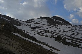 Tête de l'Estrop - south face | |
| Highest point | |
| Peak | Tête de l'Estrop |
| Elevation | 2,961 m (9,715 ft)[1] |
| Coordinates | 44°17′14″N 6°30′17″E / 44.28722°N 6.50472°E |
| Naming | |
| Native name | Alpes et Préalpes de Provence (French) |
| Geography | |
| Country | France |
| Région | Provence-Alpes-Côte d'Azur |
| Rivers | Durance, Verdon and Var |
| Parent range | Alps |
| Borders on | Maritime Alps, Dauphiné Alps, Dauphiné Prealps and Cottian Alps |
| Geology | |
| Orogeny | Alpine orogeny |
| Type of rock | Sedimentary rocks[2] |
Etymology edit
The Provence (French pronunciation: [pʁɔvɑ̃s]) is a historical region nowadays part of the administrative région of Provence-Alpes-Côte d'Azur.
Geography edit
Administratively the range belongs to the French departments of Vaucluse, Alpes-Maritimes and Alpes-de-Haute-Provence.
The western slopes of the range are drained by the Rhone river through the Durance and other tributaries while its south-eastern part is drained by the Var and several smaller rivers that flow directly to the Mediterranean Sea.
Notable summits edit

Some notable summits of the range are:
| Name | metres | feet |
|---|---|---|
| Tête de l'Estrop | 2,961 | 9,712 |
| Grande Séolane | 2,909 | 9,542 |
| Trois-Évêchés | 2,818 | 9,243 |
| Montagne du Cheval Blanc | 2,323 | 7,619 |
| Mourre de Chanier | 1,930 | 6,330 |
| Mont Ventoux | 1,912 | 6,271 |
| Montagne de Lure | 1,826 | 5,989 |
References edit
- ^ Highest summit elevation as reported on Géoportail of Institut Géographique National
- ^ Préalpes, article on Larousse encyclopedia (on line version:www.larousse.fr/encyclopedie)
Maps edit
- French official cartography (Institut Géographique National - IGN); on-line version: www.geoportail.fr Archived 2007-11-13 at the Wayback Machine