
KNOWPIA
WELCOME TO KNOWPIA

Puerto Rico Highway 177 
Summary
Puerto Rico Highway 177 (PR-177) is a main highway connecting the area of Cupey, San Juan, Puerto Rico to Bayamón, Puerto Rico. It passes through Guaynabo in the area known as Torrimar. It is divided in all of its length. In Bayamón, it ends in the intersection to Puerto Rico Highway 174 and Main Road, which connects to Puerto Rico Highway 2. In Cupey, it ends at Puerto Rico Highway 176.[3][4]
- Puerto Rico Highway 177
-
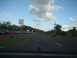 Heading east from Bayamón to Torrimar, Guaynabo
 -
 Heading west in Torrimar, Guaynabo


Highway 177 | ||||
|---|---|---|---|---|
| Ruta 177 | ||||
| Avenida Lomas Verdes[1] | ||||
| Route information | ||||
| Maintained by Puerto Rico DTPW | ||||
| Length | 10.4 km[2] (6.5 mi) | |||
| Major junctions | ||||
| West end | ||||
| East end | ||||
| Location | ||||
| Country | United States | |||
| Territory | Puerto Rico | |||
| Municipalities | Bayamón, Guaynabo, San Juan | |||
| Highway system | ||||
| ||||
| ||||

Major intersections edit
-
 PR-177 east at PR-889 intersection in Juan Sánchez, Bayamón
 -
 PR-177 west at PR-833 intersection in Frailes, Guaynabo
 -
 PR-52 south approaching exits 1A-B to PR-177 in Monacillo Urbano, San Juan


| Municipality | Location | km[2] | mi | Destinations | Notes | |||
|---|---|---|---|---|---|---|---|---|
| Bayamón | Minillas–Juan Sánchez line | 0.0 | 0.0 | Western terminus of PR-177 | ||||
| Juan Sánchez | 0.4 | 0.25 | ||||||
| 1.0 | 0.62 | PR-Avenida Los Filtros – Bayamón | ||||||
| 1.9– 2.0 | 1.2– 1.2 | PR-Avenida Norte – Frailes | Diamond interchange | |||||
| Guaynabo | Frailes | 2.8 | 1.7 | |||||
| 3.4 | 2.1 | |||||||
| 3.8 | 2.4 | Partial cloverleaf interchange | ||||||
| San Juan |
No major junctions | |||||||
| Guaynabo | Frailes | 4.6 | 2.9 | |||||
| 5.3 | 3.3 | |||||||
| San Juan | Monacillo Urbano–Monacillo line | 6.5 | 4.0 | |||||
| 7.1– 7.2 | 4.4– 4.5 | Partial cloverleaf interchange | ||||||
| Monacillo Urbano | 8.0 | 5.0 | ||||||
| 8.4 | 5.2 | PR-52 exits 1, 1A and 1B; partial cloverleaf interchange | ||||||
| Cupey | 10.3 | 6.4 | ||||||
| 10.4 | 6.5 | Eastern terminus of PR-177 | ||||||
| 1.000 mi = 1.609 km; 1.000 km = 0.621 mi | ||||||||
Related route edit
Highway 8177 | |
|---|---|
| Location | Guaynabo – San Juan |
| Length | 0.80 km[5] (0.50 mi; 2,600 ft) |
Puerto Rico Highway 8177 (PR-8177) is a road parallel to PR-177 between the municipalities of Guaynabo and San Juan.[6]
| Municipality | Location | km[5] | mi | Destinations | Notes |
|---|---|---|---|---|---|
| Guaynabo–San Juan municipal line | Frailes–Monacillo Urbano line | 0.80 | 0.50 | PR-177 | Western terminus of PR-8177; access to Guaynabo and Bayamón; unsigned |
| 0.00 | 0.00 | Eastern terminus of PR-8177; access to PR-177, Río Piedras and San Juan | |||
| 1.000 mi = 1.609 km; 1.000 km = 0.621 mi | |||||
See also edit
 Puerto Rico portal
 U.S. Roads portal
References edit
- ^ "pr.geoview.info". Retrieved 1 June 2019.
- ^ a b Google (6 March 2020). "PR-177" (Map). Google Maps. Google. Retrieved 6 March 2020.
- ^ National Geographic Maps (2011). Puerto Rico (Map). 1:125,000. Adventure Map (Book 3107). Evergreen, Colorado: National Geographic Maps. ISBN 978-1566955188. OCLC 756511572.
- ^ "Tránsito Promedio Diario (AADT)". Transit Data (Datos de Transito) (in Spanish). DTOP PR. pp. 92–93. Archived from the original on 1 April 2019.
- ^ a b Google (1 March 2020). "PR-8177" (Map). Google Maps. Google. Retrieved 1 March 2020.
- ^ "Carretera Santiago Iglesias Pantín, Monacillo Urbano". www.cartogiraffe.com. Retrieved 1 February 2022.
External links edit
Wikimedia Commons has media related to
- Carretera 177, Bayamón, Puerto Rico