


Summary
Pulusuk or Houk Island is a village and municipality in the state of Chuuk, Federated States of Micronesia.[1]
Pulusuk | |
|---|---|
Village | |
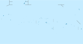
 Landsat picture of Pulusuk | |
| Country | Federated States of Micronesia |
| State | Chuuk |
It is a small island that lies at the end of a 55 km (34 mi) long submerged atoll. Pulusuk is part of the Pattiw group, located 244 km (152 mi) to the west of Chuuk.[2]
The first recorded sighting by Europeans was by Spanish naval officer Juan Antonio de Ibargoitia commanding the vessel Filipino in 1799. He charted it as Bartolomé.[3][4][5]
Houk Airfield edit
Houk Airfield | |||||||||||
|---|---|---|---|---|---|---|---|---|---|---|---|
| Summary | |||||||||||
| Airport type | Public | ||||||||||
| Owner | Government | ||||||||||
| Operator | Civil Government | ||||||||||
| Serves | Pulusuk | ||||||||||
| Runways | |||||||||||
| |||||||||||
Houk Airfield consists of a paved 1,350 feet (410 m) runway that cuts through the forested south end of the island.[6] The rudimentary airport is not serviced (no passenger terminal, no hangars or no fuel). Caroline Islands Air has chartered flights to the airfield.
References edit
- ^ Statoids.com, retrieved December 8, 2010
- ^ "Oceandots - Houk". Archived from the original on December 23, 2010. Retrieved 2014-08-23.
{{cite web}}: CS1 maint: bot: original URL status unknown (link) - ^ Robson, R.W. The Pacific Islands Handbook New York 1946. p.142
- ^ Sharp, Andrew The discovery of the Pacific Islands Oxford, 1960, p.183.
- ^ Brand, Donald D. The Pacific Basin: A History of its Geographical Explorations The American Geographical Society, New York, 1967, p.141.
- ^ "Federated States of Micronesia (FSM) Division of Civil Aviation | Houk (Pulusuk) Civil Airfield, Houk Island, Micronesia".
6°41′23″N 149°18′08″E / 6.6898°N 149.3021°E