


Summary
Pustoshka (Russian: Пусто́шка) is a town and the administrative center of Pustoshkinsky District in Pskov Oblast, Russia, located on the Krupeya River, 191 kilometers (119 mi) southeast of Pskov, the administrative center of the oblast. Population: 4,619 (2010 Census);[3] 5,509 (2002 Census);[10] 6,332 (1989 Census).[11]
Pustoshka
Пустошка | |
|---|---|
 Flea market in Pustoshka | |
 Coat of arms | |
Location of Pustoshka .mw-parser-output .locmap .od{position:absolute}.mw-parser-output .locmap .id{position:absolute;line-height:0}.mw-parser-output .locmap .l0{font-size:0;position:absolute}.mw-parser-output .locmap .pv{line-height:110%;position:absolute;text-align:center}.mw-parser-output .locmap .pl{line-height:110%;position:absolute;top:-0.75em;text-align:right}.mw-parser-output .locmap .pr{line-height:110%;position:absolute;top:-0.75em;text-align:left}.mw-parser-output .locmap .pv>div{display:inline;padding:1px}.mw-parser-output .locmap .pl>div{display:inline;padding:1px;float:right}.mw-parser-output .locmap .pr>div{display:inline;padding:1px;float:left}html.skin-theme-clientpref-night .mw-parser-output .od,html.skin-theme-clientpref-night .mw-parser-output .od .pv>div,html.skin-theme-clientpref-night .mw-parser-output .od .pl>div,html.skin-theme-clientpref-night .mw-parser-output .od .pr>div{background:#000;color:#fff}html.skin-theme-clientpref-night .mw-parser-output .locmap{filter:grayscale(0.6)}@media(prefers-color-scheme:dark){html.skin-theme-clientpref-os .mw-parser-output .locmap{filter:grayscale(0.6)}html.skin-theme-clientpref-os .mw-parser-output .od,html.skin-theme-clientpref-os .mw-parser-output .od .pv>div,html.skin-theme-clientpref-os .mw-parser-output .od .pl>div,html.skin-theme-clientpref-os .mw-parser-output .od .pr>div{background:#000;color:#fff}}  Pustoshka Location of Pustoshka 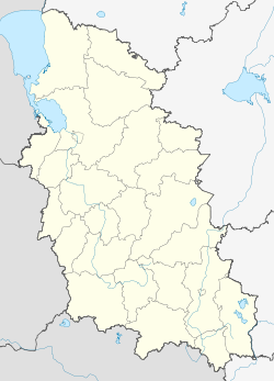 Pustoshka Pustoshka (Pskov Oblast) | |
| Coordinates: 56°20′N 29°23′E / 56.333°N 29.383°E | |
| Country | Russia |
| Federal subject | Pskov Oblast[1] |
| Administrative district | Pustoshkinsky District[1] |
| Founded | 1901 |
| Town status since | 1925[2] |
| Elevation | 160 m (520 ft) |
| Population | |
| • Total | 4,619 |
| • Estimate (2018)[4] | 4,017 (−13%) |
| • Capital of | Pustoshkinsky District[5] |
| • Municipal district | Pustoshkinsky Municipal District[6] |
| • Urban settlement | Pustoshka Urban Settlement[6] |
| • Capital of | Pustoshkinsky Municipal District,[7] Pustoshka Urban Settlement[6] |
| Time zone | UTC+3 (MSK |
| Postal code(s)[9] | 182300 |
| OKTMO ID | 58650101001 |
History edit
It was founded in 1901 due to the construction of a railway[citation needed] and was granted town status in 1925.[2] At the time, it was the administrative center of Pustoshkinskaya Volost of Sebezhsky Uyezd in Pskov Governorate.[citation needed]
On August 1, 1927, the uyezds and governorates were abolished and Pustoshkinsky District, with the administrative center in Pustoshka, was established as a part of Velikiye Luki Okrug of Leningrad Oblast.[12] It included parts of former Nevelsky, Opochetsky, and Sebezhsky Uyezds.[13] On June 3, 1929, Pustoshkinsky District was transferred to Western Oblast.[13] On July 23, 1930, the okrugs were also abolished and the districts were directly subordinated to the oblast.[12] On January 29, 1935, Western Oblast was abolished and the district was transferred to Kalinin Oblast, and on February 5 of the same year, Pustoshkinsky District became a part of Velikiye Luki Okrug of Kalinin Oblast,[12] one of the okrugs abutting the state boundaries of the Soviet Union. On May 4, 1938, the district was transferred to Opochka Okrug.[12] On February 5, 1941, the okrug was abolished.[12] Between July 16, 1941 and February 27, 1944, Pustoshka was occupied by German troops.[2] On August 22, 1944, the district was transferred to newly established Velikiye Luki Oblast.[12] On October 2, 1957, Velikiye Luki Oblast was abolished and Pustoshkinsky District was transferred to Pskov Oblast.[12] The district was abolished on February 1, 1963 but reinstated on January 12, 1965.[12]
Administrative and municipal status edit
Within the framework of administrative divisions, Pustoshka serves as the administrative center of Pustoshkinsky District,[5] to which it is directly subordinated.[1] As a municipal division, the town of Pustoshka is incorporated within Pustoshkinsky Municipal District as Pustoshka Urban Settlement.[6]
Economy edit
Industry edit
The biggest industrial enterprise is the milk production factory.[14]
Transportation edit
The railway connecting Moscow and Riga passes Pustoshka.
There are two significant highways crossing close to the town. The M9 Highway, which connects Moscow and Riga, runs in the east–west direction, whereas the M20 Highway connects St. Petersburg and Kyiv, running from north to south. There are also local roads.
Culture and recreation edit
Pustoshka contains one cultural heritage monument of federal significance and additionally three objects classified as cultural and historical heritage of local significance.[15] The federally protected monument is an archeological site, and the locally protected ones are monuments related to World War II.
Pustoshka is home to the Pustoshkinsky District Museum, founded in 1996.[16]
References edit

Notes edit
- ^ a b c d Law #833-oz stipulates that the borders of the administrative districts are identical to the borders of the municipal districts. The Law #420-oz, which describes the borders and the composition of the municipal districts, lists the town of Pustoshka as a part of Pustoshkinsky District.
- ^ a b c Энциклопедия Города России. Moscow: Большая Российская Энциклопедия. 2003. p. 368. ISBN 5-7107-7399-9.
- ^ a b Russian Federal State Statistics Service (2011). Всероссийская перепись населения 2010 года. Том 1 [2010 All-Russian Population Census, vol. 1]. Всероссийская перепись населения 2010 года [2010 All-Russia Population Census] (in Russian). Federal State Statistics Service.
- ^ "26. Численность постоянного населения Российской Федерации по муниципальным образованиям на 1 января 2018 года". Federal State Statistics Service. Retrieved January 23, 2019.
- ^ a b Государственный комитет Российской Федерации по статистике. Комитет Российской Федерации по стандартизации, метрологии и сертификации. №ОК 019-95 1 января 1997 г. «Общероссийский классификатор объектов административно-территориального деления. Код 58 250», в ред. изменения №278/2015 от 1 января 2016 г.. (State Statistics Committee of the Russian Federation. Committee of the Russian Federation on Standardization, Metrology, and Certification. #OK 019-95 January 1, 1997 Russian Classification of Objects of Administrative Division (OKATO). Code 58 250, as amended by the Amendment #278/2015 of January 1, 2016. ).
- ^ a b c d Law #420-oz
- ^ Федеральная служба государственной статистики. Федеральное агентство по технологическому регулированию и метрологии. №ОК 033-2013 1 января 2014 г. «Общероссийский классификатор территорий муниципальных образований. Код 58 650». (Federal State Statistics Service. Federal Agency on Technological Regulation and Metrology. #OK 033-2013 January 1, 2014 Russian Classification of Territories of Municipal Formations. Code 58 650. ).
- ^ "Об исчислении времени". Официальный интернет-портал правовой информации (in Russian). June 3, 2011. Retrieved January 19, 2019.
- ^ Почта России. Информационно-вычислительный центр ОАСУ РПО. (Russian Post). Поиск объектов почтовой связи (Postal Objects Search) (in Russian)
- ^ Russian Federal State Statistics Service (May 21, 2004). Численность населения России, субъектов Российской Федерации в составе федеральных округов, районов, городских поселений, сельских населённых пунктов – районных центров и сельских населённых пунктов с населением 3 тысячи и более человек [Population of Russia, Its Federal Districts, Federal Subjects, Districts, Urban Localities, Rural Localities—Administrative Centers, and Rural Localities with Population of Over 3,000] (XLS). Всероссийская перепись населения 2002 года [All-Russia Population Census of 2002] (in Russian).
- ^ Всесоюзная перепись населения 1989 г. Численность наличного населения союзных и автономных республик, автономных областей и округов, краёв, областей, районов, городских поселений и сёл-райцентров [All Union Population Census of 1989: Present Population of Union and Autonomous Republics, Autonomous Oblasts and Okrugs, Krais, Oblasts, Districts, Urban Settlements, and Villages Serving as District Administrative Centers]. Всесоюзная перепись населения 1989 года [All-Union Population Census of 1989] (in Russian). Институт демографии Национального исследовательского университета: Высшая школа экономики [Institute of Demography at the National Research University: Higher School of Economics]. 1989 – via Demoscope Weekly.
- ^ a b c d e f g h Administrative-Territorial Structure of Pskov Oblast, pp. 11–16
- ^ a b Пустошкинский район (август 1927 г. - июнь 1929 г.) (in Russian). Справочник истории административно-территориального деления Ленинградской области. Archived from the original on October 29, 2013. Retrieved June 27, 2014.
- ^ Экономика (in Russian). Портал муниципальных образований Псковской области. Retrieved August 27, 2012.
- ^ Памятники истории и культуры народов Российской Федерации (in Russian). Russian Ministry of Culture. Retrieved June 2, 2016.
- ^ Пустошкинский историко-краеведческий музей (in Russian). Администрация Псковской области. Retrieved August 24, 2012.
Sources edit
- Псковское областное Собрание депутатов. Закон №833-оз от 5 февраля 2009 г. «Об административно-территориальном устройстве Псковской области». Вступил в силу со дня официального опубликования. Опубликован: "Псковская правда", №20, 10 февраля 2009 г. (Pskov Oblast Council of Deputies. Law #833-oz of February 5, 2009 On the Administrative-Territorial Structure of Pskov Oblast. Effective as of the official publication date.).
- Псковское областное Собрание депутатов. Закон №420-оз от 28 февраля 2005 г. «Об установлении границ и статусе вновь образуемых муниципальных образований на территории Псковской области», в ред. Закона №1542-ОЗ от 5 июня 2015 г. «О внесении изменений в Закон Псковской области "Об установлении границ и статусе вновь образуемых муниципальных образований на территории Псковской области"». Вступил в силу со дня официального опубликования. Опубликован: "Псковская правда", №41–43, №44–46, №49–51, 4 марта 2005 г., 5 марта 2005 г., 11 марта 2005 г. (Pskov Oblast Council of Deputies. Law #420-oz of February 28, 2005 On Establishing the Borders and the Status of the Newly Formed Municipal Formations on the Territory of Pskov Oblast, as amended by the Law #1542-OZ of June 5, 2015 On Amending the Law of Pskov Oblast "On Establishing the Borders and the Status of the Newly Formed Municipal Formations on the Territory of Pskov Oblast". Effective as of the official publication date.).
- Архивный отдел Псковского облисполкома. Государственный архив Псковской области. "Административно-территориальное деление Псковской области (1917–1988 гг.). Справочник". (Administrative-Territorial Structure of Pskov Oblast (1917–1988). Reference.) Книга I. Лениздат, 1988