


Summary
Putatan is a barangay in Muntinlupa, Metro Manila, Philippines. The total land area of the barangay is 6.746 km2 (2.605 sq mi). According to the 2020 census, it has a population of 99,725 as of 2020.
Putatan | |
|---|---|
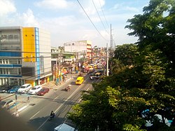 Manila South Road at the vicinity of Medical Center Muntinlupa | |
| Coordinates: .mw-parser-output .geo-default,.mw-parser-output .geo-dms,.mw-parser-output .geo-dec{display:inline}.mw-parser-output .geo-nondefault,.mw-parser-output .geo-multi-punct,.mw-parser-output .geo-inline-hidden{display:none}.mw-parser-output .longitude,.mw-parser-output .latitude{white-space:nowrap}14°23′54.12″N 121°2′10.96″E / 14.3983667°N 121.0363778°E | |
| Country | Philippines |
| Region | National Capital Region |
| City | Muntinlupa |
| District | 1st Legislative district of Muntinlupa |
| Government | |
| • Type | Barangay |
| • Barangay Captain | Gerardo Teves |
| • SK Chairperson | Cyrylle Kate Arciaga |
| Area | |
| • Total | 6.746 km2 (2.605 sq mi) |
| Population (2020)[citation needed] | |
| • Total | 99,725 |
| • Density | 15,000/km2 (38,000/sq mi) |
| Time zone | UTC+8 (PST) |
| Range | Marikina Valley Fault Ridge |
Putatan is located at the south of the City of Manila. It is bounded by barangays Alabang and Bayanan on the north, Laguna de Bay on the east, the Muntinlupa Poblacion on the south; and barangay Ayala Alabang on the west.
The barangay is also home to the city hall of Muntinlupa and its several departments.
Etymology edit
Putatan got its name from the tree called putat (Barringtonia asiatica), which grew in the area. Hence, Putatan means where putat blooms.[1] It was also alternatively or erroneously spelled as Pututan.[2]: 97
Subdivisions edit
While barangays are the administrative divisions of the city, and are legally part of the addresses of establishments and homes, residents also include their subdivision. Listed below are subdivisions in this barangay.[3]
- Agro Homes Subdivision
- Bayfair Subdivision
- Bruger Subdivision
- Camella Townhomes 1
- Camella Townhomes 2
- Camella Homes 1
- Camella Homes 2
- Camella Homes 2-D
- Camella Homes 2-E
- Country Homes
- Express View Subdivision
- Freedom Hills
- Freewill Subdivision
- God's Will Homes
- Gruenville Subdivision
- Jayson Ville
- Joasmerray Subdivision
- La Charina Homes
- Lakeview Homes 1
- Lakeview Homes 2
- Multiland/Midland Subdivision
- Mutual Homes Phase 1 & 2
- Mutual Homes Phase 3
- Neuwrain Subdivision
- PUPA Homes
- RCE Homes
- Segundina Townhomes
- SMB Hills
- Soldiers Hills Subdivision
- South Greenheights Subdivision
- South Superville Subdivision
- Summitville Subdivision
- Treelane Subdivision
- V.M. Townhomes
- Hillsview Homes
References edit
- ^ "Brgy. Putatan". City Government of Muntinlupa. Retrieved April 16, 2024.
- ^ Salonga, Isayas (1934). Rizal Province directory. Vol. 1. Manila: University of Michigan Digital Collections. Retrieved April 16, 2024.
- ^ "List of Subdivisions in the City of Muntinlupa". Archived from the original on 2016-01-14.
External links edit
- http://muntinlupacity.gov.ph/