
KNOWPIA
WELCOME TO KNOWPIA

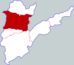
Qingfeng County 
Summary
Qingfeng County is a county located in the northeast of Henan province, bordering the provinces of Hebei to the northwest and Shandong to the east. It is under the administration of the prefecture-level city of Puyang. In the Han dynasty, Dunqiu County (simplified Chinese: 顿丘; traditional Chinese: 頓丘) was located somewhere near this area, possibly to the southwest of the modern day county. At the time, it was a part of Dong Commandery (simplified Chinese: 东郡; traditional Chinese: 東郡). Cao Cao was made governor of Dunqiu County, following his assignment as Captain of the Northern District (北都尉) of Luoyang (the capital at that time).
Qingfeng County
清丰县 | |
|---|---|
 Qingfeng in Puyang | |
 Puyang in Henan | |
| Coordinates: 35°53′06″N 115°06′14″E / 35.885°N 115.104°E | |
| Country | People's Republic of China |
| Province | Henan |
| Prefecture-level city | Puyang |
| Area | |
| • Total | 869 km2 (336 sq mi) |
| Population (2019) | |
| • Total | 628,400[1] |
| Time zone | UTC+8 (China Standard) |
| Postal code | 457300 |
| Qingfeng County | |||||||
|---|---|---|---|---|---|---|---|
| Traditional Chinese | 清豐縣 | ||||||
| Simplified Chinese | 清丰县 | ||||||
| |||||||
Administrative divisions edit
As 2012, this county is divided to 5 towns and 12 townships.[2]
- Towns
|
|
- Townships
|
|
Climate edit
| Climate data for Qingfeng (1991–2020 normals, extremes 1981–2010) | |||||||||||||
|---|---|---|---|---|---|---|---|---|---|---|---|---|---|
| Month | Jan | Feb | Mar | Apr | May | Jun | Jul | Aug | Sep | Oct | Nov | Dec | Year |
| Record high °C (°F) | 17.0 (62.6) |
24.6 (76.3) |
27.6 (81.7) |
33.8 (92.8) |
37.1 (98.8) |
41.6 (106.9) |
41.1 (106.0) |
36.7 (98.1) |
36.9 (98.4) |
35.3 (95.5) |
27.5 (81.5) |
22.5 (72.5) |
41.6 (106.9) |
| Mean daily maximum °C (°F) | 4.3 (39.7) |
8.5 (47.3) |
14.7 (58.5) |
21.0 (69.8) |
26.6 (79.9) |
32.2 (90.0) |
32.0 (89.6) |
30.4 (86.7) |
27.1 (80.8) |
21.5 (70.7) |
12.9 (55.2) |
6.0 (42.8) |
19.8 (67.6) |
| Daily mean °C (°F) | −1.5 (29.3) |
2.2 (36.0) |
8.3 (46.9) |
14.6 (58.3) |
20.3 (68.5) |
25.7 (78.3) |
27.0 (80.6) |
25.4 (77.7) |
20.7 (69.3) |
14.8 (58.6) |
6.8 (44.2) |
0.4 (32.7) |
13.7 (56.7) |
| Mean daily minimum °C (°F) | −5.8 (21.6) |
−2.5 (27.5) |
2.9 (37.2) |
8.7 (47.7) |
14.3 (57.7) |
19.8 (67.6) |
23.0 (73.4) |
21.6 (70.9) |
15.9 (60.6) |
9.6 (49.3) |
2.1 (35.8) |
−3.8 (25.2) |
8.8 (47.9) |
| Record low °C (°F) | −20.0 (−4.0) |
−18.9 (−2.0) |
−7.8 (18.0) |
−3.5 (25.7) |
2.9 (37.2) |
9.6 (49.3) |
16.0 (60.8) |
11.0 (51.8) |
2.6 (36.7) |
−2.6 (27.3) |
−20.2 (−4.4) |
−17.5 (0.5) |
−20.2 (−4.4) |
| Average precipitation mm (inches) | 5.4 (0.21) |
9.6 (0.38) |
13.1 (0.52) |
28.8 (1.13) |
44.8 (1.76) |
62.1 (2.44) |
154.9 (6.10) |
117.7 (4.63) |
56.7 (2.23) |
29.7 (1.17) |
22.0 (0.87) |
6.5 (0.26) |
551.3 (21.7) |
| Average precipitation days (≥ 0.1 mm) | 2.7 | 3.4 | 3.3 | 5.0 | 6.2 | 7.5 | 10.9 | 8.9 | 6.9 | 5.1 | 4.4 | 2.7 | 67 |
| Average snowy days | 3.1 | 2.8 | 0.7 | 0.3 | 0 | 0 | 0 | 0 | 0 | 0 | 1.1 | 2.3 | 10.3 |
| Average relative humidity (%) | 66 | 63 | 62 | 67 | 69 | 63 | 79 | 83 | 78 | 70 | 71 | 69 | 70 |
| Mean monthly sunshine hours | 125.1 | 136.7 | 184.5 | 209.4 | 231.3 | 211.8 | 175.8 | 176.1 | 166.8 | 165.6 | 140.0 | 128.8 | 2,051.9 |
| Percent possible sunshine | 40 | 44 | 49 | 53 | 53 | 49 | 40 | 42 | 45 | 48 | 46 | 43 | 46 |
| Source: China Meteorological Administration[3][4] | |||||||||||||
References edit
- ^ 最新人口信息 www.hongheiku.com (in Chinese). hongheiku. Retrieved 2021-01-12.
- ^ 濮阳市-行政区划网 www.xzqh.org (in Chinese). XZQH. Retrieved 2012-05-24.
- ^ 中国气象数据网 – WeatherBk Data (in Simplified Chinese). China Meteorological Administration. Retrieved 12 August 2023.
- ^ 中国气象数据网 (in Simplified Chinese). China Meteorological Administration. Retrieved 12 August 2023.
- Romance of the Three Kingdoms/Chapter 1
- Cao Cao