


Summary
Qinglong Manchu Autonomous County (Chinese: 青龙满族自治县, Manchu: ᠨᡳᠣᠸᠠᠩᡤᡳᠶᠠᠨ ᠮᡠᡩᡠᡵᡳ ᠮᠠᠨᠵᡠ ᡠᡴᠰᡠᡵᠠ ᡯᡳᡷᠶ ᡥᡳᠶᠠᠨ) is a Manchu autonomous county in northeastern Hebei province, China, bordering Liaoning Province to the north and east and located in the eastern part of the Yan Mountains. It is under the administration of the prefecture-level city of Qinhuangdao, and, as of 2004[update], had a population of 520,000 residing in an area of 3,309 km2 (1,278 sq mi). Bordering county-level divisions are: Lingyuan and Jianchang County (Liaoning) to the north, Liaoning's Suizhong County and Qinhuangdao city proper to the east, Qian'an and Lulong County to the south, and Kuancheng Manchu Autonomous County and Qianxi County to the west.
Qinglong County
青龙县 ᠨᡳᠣᠸᠠᠩᡤᡳᠶᠠᠨ ᡥᡳᠶᠠᠨ | |
|---|---|
青龙满族自治县 • ᠨᡳᠣᠸᠠᠩᡤᡳᠶᠠᠨ ᠮᡠᡩᡠᡵᡳ ᠮᠠᠨᠵᡠ ᡠᡴᠰᡠᡵᠠ ᡯᡳᡷᠶ ᡥᡳᠶᠠᠨ Qinglong Manchu Autonomous County | |
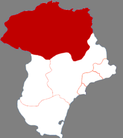 Qinglong in Qinhuangdao | |
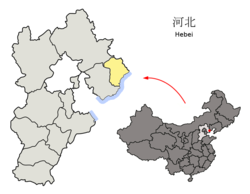 Qinhuangdao in Hebei | |
| Coordinates: 40°24′27″N 118°56′59″E / 40.4076°N 118.9497°E | |
| Country | China |
| Province | Hebei |
| Prefecture-level city | Qinhuangdao |
| County seat | Duyanglu Subdistrict |
| Area | |
| • Total | 3,309 km2 (1,278 sq mi) |
| Elevation | 239 m (784 ft) |
| Population (2020 census)[1] | |
| • Total | 431,138 |
| • Density | 130/km2 (340/sq mi) |
| Time zone | UTC+8 (China Standard) |
| Postal code | 066500 |
| Area code | +86 335 |
| Website | www |
| Qinglong Manchu Autonomous County | |||||||
|---|---|---|---|---|---|---|---|
| Chinese name | |||||||
| Simplified Chinese | 青龙满族自治县 | ||||||
| Traditional Chinese | 青龍滿族自治縣 | ||||||
| Literal meaning | Blue (or teal) Dragon Man-ethnicity Autonomous County | ||||||
| |||||||
| Manchu name | |||||||
| Manchu script | ᠨᡳᠣᠸᠠᠩᡤᡳᠶᠠᠨ ᠮᡠᡩᡠᡵᡳ ᠮᠠᠨᠵᡠ ᡠᡴᠰᡠᡵᠠ ᡯᡳᡷᠶ ᡥᡳᠶᠠᠨ | ||||||
| Möllendorff | niowanggiyan muduri manju uksura dzijy hiyan | ||||||
During the 1976 Tangshan earthquake 180,000 buildings in Qinglong collapsed, but no fatalities occurred.[2]
Administrative divisions edit
Qinglong administers 1 subdistrict, 11 towns and 14 townships:[3]
|
Subdistrict:
Towns:
|
Townships:
|
Climate edit
Qinglong has a monsoon-influenced, humid continental climate (Köppen Dwa), with long, cold, and very dry winters, and hot, rainy summers. Spring and autumn are short with some rainfall. The monthly 24-hour average temperature in January is −8.0 °C (17.6 °F), and 24.5 °C (76.1 °F) in July, and the annual mean is 9.6 °C (49.3 °F). The mountainous location means that diurnal temperature variation is rather large, but precipitation is enhanced: the total precipitation is 656.4 millimetres (25.8 in), with close to 60% of it falling in July and August alone.
| Climate data for Qinglong (1991–2020 normals) | |||||||||||||
|---|---|---|---|---|---|---|---|---|---|---|---|---|---|
| Month | Jan | Feb | Mar | Apr | May | Jun | Jul | Aug | Sep | Oct | Nov | Dec | Year |
| Record high °C (°F) | 13.8 (56.8) |
17.4 (63.3) |
26.8 (80.2) |
31.3 (88.3) |
36.6 (97.9) |
38.0 (100.4) |
39.0 (102.2) |
37.5 (99.5) |
34.5 (94.1) |
29.0 (84.2) |
21.7 (71.1) |
14.6 (58.3) |
39.0 (102.2) |
| Mean daily maximum °C (°F) | 0.3 (32.5) |
4.2 (39.6) |
10.9 (51.6) |
19.1 (66.4) |
25.5 (77.9) |
28.8 (83.8) |
30.1 (86.2) |
29.4 (84.9) |
25.2 (77.4) |
17.9 (64.2) |
8.5 (47.3) |
1.7 (35.1) |
16.8 (62.2) |
| Daily mean °C (°F) | −7.5 (18.5) |
−3.3 (26.1) |
4.0 (39.2) |
12.3 (54.1) |
18.7 (65.7) |
22.5 (72.5) |
24.8 (76.6) |
23.6 (74.5) |
18.0 (64.4) |
10.1 (50.2) |
1.5 (34.7) |
−5.4 (22.3) |
9.9 (49.9) |
| Mean daily minimum °C (°F) | −13.0 (8.6) |
−9.3 (15.3) |
−2.3 (27.9) |
5.5 (41.9) |
11.5 (52.7) |
16.5 (61.7) |
20.2 (68.4) |
18.9 (66.0) |
12.2 (54.0) |
4.1 (39.4) |
−3.7 (25.3) |
−10.5 (13.1) |
4.2 (39.5) |
| Record low °C (°F) | −26.3 (−15.3) |
−23.2 (−9.8) |
−18.0 (−0.4) |
−6.2 (20.8) |
1.6 (34.9) |
6.1 (43.0) |
12.1 (53.8) |
9.5 (49.1) |
0.1 (32.2) |
−8.0 (17.6) |
−19.2 (−2.6) |
−22.2 (−8.0) |
−26.3 (−15.3) |
| Average precipitation mm (inches) | 2.8 (0.11) |
3.4 (0.13) |
8.7 (0.34) |
25.1 (0.99) |
49.5 (1.95) |
100.6 (3.96) |
223.8 (8.81) |
151.3 (5.96) |
53.6 (2.11) |
30.5 (1.20) |
11.5 (0.45) |
2.6 (0.10) |
663.4 (26.11) |
| Average precipitation days (≥ 0.1 mm) | 2.1 | 2.3 | 3.5 | 5.2 | 7.7 | 11.3 | 13.3 | 10.6 | 7.3 | 5.0 | 3.3 | 2.1 | 73.7 |
| Average snowy days | 3.0 | 3.2 | 2.7 | 0.8 | 0 | 0 | 0 | 0 | 0 | 0.4 | 2.7 | 3.4 | 16.2 |
| Average relative humidity (%) | 51 | 47 | 42 | 44 | 51 | 65 | 77 | 77 | 72 | 65 | 58 | 55 | 59 |
| Mean monthly sunshine hours | 204.4 | 201.3 | 243.9 | 250.9 | 274.9 | 235.8 | 193.8 | 222.6 | 227.5 | 219.1 | 182.6 | 188.4 | 2,645.2 |
| Percent possible sunshine | 68 | 66 | 65 | 63 | 61 | 53 | 43 | 53 | 62 | 64 | 62 | 66 | 61 |
| Source 1: China Meteorological Administration[4][5] | |||||||||||||
| Source 2: Weather China[6] | |||||||||||||
See also edit
- Zushan Mountain: Mountain in the Qinglong region
References edit
- ^ "权威发布!秦皇岛人口最新统计数据来了!" (in Chinese). The Paper. 2021-06-24.
- ^ Col, Jeanne-Marie (2016-11-05). "Successful Earthquake Mitigation in Qinglong County during the Great Tangshan Earthquake: Lessons for Hurricane Katrina in the United States". Chinese Public Administration Review. 4 (1/2): 9. doi:10.22140/cpar.v4i1/2.70. ISSN 1539-6754.
- ^ 2022年统计用区划代码:青龙满族自治县 (in Chinese). National Bureau of Statistics of the People's Republic of China.
- ^ 中国气象数据网 – WeatherBk Data (in Simplified Chinese). China Meteorological Administration. Retrieved 25 August 2023.
- ^ 中国气象数据网 (in Simplified Chinese). China Meteorological Administration. Retrieved 25 August 2023.
- ^ 青龙 - 气象数据 -中国天气网 (in Chinese). Weather China. Retrieved 20 November 2022.