


Summary
Qonayev (also Konaev) (Kazakh: Қонаев / Qonaev, [qɔnɑjəf]; Russian: Конаев, previously known as Kapshagay, Kazakh: Қапшағай / Qapşağai; Russian: Капшагай or Капчагай), is a city within and the administrative center of the Almaty Region of Kazakhstan.[2] It is located on the Ili River, and has been built along with the construction of Kapshagay Dam on that river in the 1960s. The dam has formed Kapchagay Reservoir (a.k.a. Lake Kapshagai), a popular weekend destination for beach-goers from Almaty.[3] Population: 39,855 (2009 Census results);[4] 33,428 (1999 Census results).[4]
Qonayev
Qonaev Қонаев Kapchagay • Қапчағай • Konaev | |
|---|---|
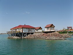 On Lake Kapshagai | |
 Flag | |
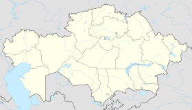 Qonayev Location of Qonayev in Kazakhstan | |
| Coordinates: 43°53′0″N 77°5′0″E / 43.88333°N 77.08333°E | |
| Country | Kazakhstan |
| Region | Almaty Region |
| Government | |
| • Akim | Askhat Berdikhanov[1] |
| Population (2019) | |
| • Total | 61,677 |
| Time zone | UTC+6 (Almaty Time) |
| Area code | 72772 |
Many of Qonayev's inhabitants fled the city after the dissolution of the Soviet Union, but its population saw a resurgence in 2000 and has since returned to pre-dissolution numbers.[5]
President Kassym-Jomart Tokayev's reforms of 17 March 2022 included provisions which renamed Kapshagay to Konaev (after Dinmukhamed Kunaev) and made the city the new capital of Almaty Region following its old capital, Taldykorgan, being separated from the region and becoming the capital of the newly created Zhetysu Region.[6]
Geography edit
It is located on the shore of the Kapchagai reservoir, on the Ili River near its intersection with the railway, 76 km north of Almaty.[7]
Climate edit
| Climate data for Qonayev (1991–2020) | |||||||||||||
|---|---|---|---|---|---|---|---|---|---|---|---|---|---|
| Month | Jan | Feb | Mar | Apr | May | Jun | Jul | Aug | Sep | Oct | Nov | Dec | Year |
| Mean daily maximum °C (°F) | −2.1 (28.2) |
1.1 (34.0) |
10.2 (50.4) |
19.3 (66.7) |
25.2 (77.4) |
30.6 (87.1) |
32.7 (90.9) |
31.9 (89.4) |
26.1 (79.0) |
17.6 (63.7) |
8.1 (46.6) |
0.7 (33.3) |
16.8 (62.2) |
| Daily mean °C (°F) | −7.2 (19.0) |
−4.3 (24.3) |
4.0 (39.2) |
12.3 (54.1) |
17.9 (64.2) |
23.1 (73.6) |
25.3 (77.5) |
24.0 (75.2) |
18.2 (64.8) |
10.3 (50.5) |
2.4 (36.3) |
−3.9 (25.0) |
10.2 (50.4) |
| Mean daily minimum °C (°F) | −11.7 (10.9) |
−8.8 (16.2) |
−1.0 (30.2) |
5.9 (42.6) |
10.8 (51.4) |
15.6 (60.1) |
17.7 (63.9) |
15.9 (60.6) |
10.4 (50.7) |
4.0 (39.2) |
−2.1 (28.2) |
−7.9 (17.8) |
4.1 (39.4) |
| Average precipitation mm (inches) | 18.5 (0.73) |
18.1 (0.71) |
24.3 (0.96) |
36.3 (1.43) |
39.1 (1.54) |
32.4 (1.28) |
34.1 (1.34) |
14.8 (0.58) |
12.8 (0.50) |
24.9 (0.98) |
29.1 (1.15) |
21.2 (0.83) |
305.6 (12.03) |
| Average precipitation days (≥ 1.0 mm) | 4.9 | 4.9 | 5.5 | 6.7 | 6.6 | 5.4 | 5.3 | 3.3 | 2.4 | 4.6 | 5.4 | 5.3 | 60.3 |
| Source: NOAA[8] | |||||||||||||
Administrative divisions edit
- the city of Qonayev;
- Zarechny rural district;
- Shengeldinsky rural district.
See also edit
References edit
- ^ "Назначен аким Конаева". tengrinews.kz (in Russian). 19 April 2024.
- ^ National Geospatial-Intelligence Agency. Geonames database entry. (search) Accessed 12 May 2011.
- ^ "Kapchagay travel guide | Caravanistan". Caravanistan. Retrieved 6 August 2018.
- ^ a b "Население Республики Казахстан" [Population of the Republic of Kazakhstan] (in Russian). Департамент социальной и демографической статистики. Retrieved 8 December 2013.
- ^ "Kapchagay". Retrieved 6 April 2021.
- ^ "В Казахстане появится четыре новых региона". Interfax.ru (in Russian). Retrieved 20 April 2022.
- ^ "Капчагай". tochka-na-karte.ru.
- ^ "World Meteorological Organization Climate Normals for 1991-2020 — Qonayev". National Oceanic and Atmospheric Administration. Retrieved 2 January 2024.