
KNOWPIA
WELCOME TO KNOWPIA

Quebec Route 271 
Summary
Route 271 is a two-lane north/south highway on the south shore of the Saint Lawrence River in Quebec, Canada. Its northern terminus is in Sainte-Croix at the junction of Route 132, and the southern terminus is at the junction of Route 173 in Saint-Georges.
Route 271 | ||||
|---|---|---|---|---|
 | ||||
| Route information | ||||
| Length | 123 km[1] (76 mi) | |||
| Major junctions | ||||
| North end | ||||
| South end | ||||
| Location | ||||
| Country | Canada | |||
| Province | Quebec | |||
| Major cities | Laurier-Station, Saint-Georges | |||
| Highway system | ||||
| ||||

Towns along Route 271 edit
- Sainte-Croix
- Notre-Dame-du-Sacré-Coeur-d'Issoudun
- Laurier-Station
- Saint-Flavien
- Dosquet
- Sainte-Agathe-de-Lotbinière
- Saint-Jacques-de-Leeds
- Saint-Pierre-de-Broughton
- Sacré-Coeur-de-Jésus
- Sainte-Clotide-de-Beauce
- Saint-Éphrem-de-Beauce
- Saint-Benoît-Labre
- Saint-Georges
-
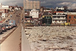 David-Roy bridge in Saint-Georges.
 -
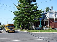
 Route 271 in Saint-Benoît-Labre.
 -
 Intersection with Routes 218 in Sainte-Agathe.
 -
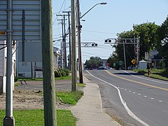
 Intersection with Route 116 in Dosquet.
 -
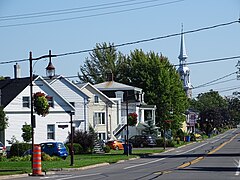 Principale street in Saint-Flavien.
 -
 Boulevard Saint-Joseph à Laurier-Station.


See also edit
References edit
- ^ Ministère des transports, "Distances routières", page (?), Les Publications du Québec, 2005
External links edit
- Route 271 on Google Maps
- Provincial Route Map (Courtesy of the Quebec Ministry of Transportation) (in French)