
KNOWPIA
WELCOME TO KNOWPIA

Querqueville 
Summary
Querqueville (French pronunciation: [kɛʁkəvil]) is a former commune in the Manche department in north-western France. On 1 January 2016, it was merged into the new commune of Cherbourg-en-Cotentin.[2]
Querqueville | |
|---|---|
Part of Cherbourg-en-Cotentin | |
 View of the cemetery | |
 Coat of arms | |
Location of Querqueville .mw-parser-output .locmap .od{position:absolute}.mw-parser-output .locmap .id{position:absolute;line-height:0}.mw-parser-output .locmap .l0{font-size:0;position:absolute}.mw-parser-output .locmap .pv{line-height:110%;position:absolute;text-align:center}.mw-parser-output .locmap .pl{line-height:110%;position:absolute;top:-0.75em;text-align:right}.mw-parser-output .locmap .pr{line-height:110%;position:absolute;top:-0.75em;text-align:left}.mw-parser-output .locmap .pv>div{display:inline;padding:1px}.mw-parser-output .locmap .pl>div{display:inline;padding:1px;float:right}.mw-parser-output .locmap .pr>div{display:inline;padding:1px;float:left}html.skin-theme-clientpref-night .mw-parser-output .od,html.skin-theme-clientpref-night .mw-parser-output .od .pv>div,html.skin-theme-clientpref-night .mw-parser-output .od .pl>div,html.skin-theme-clientpref-night .mw-parser-output .od .pr>div{background:#000;color:#fff}html.skin-theme-clientpref-night .mw-parser-output .locmap{filter:grayscale(0.6)}@media(prefers-color-scheme:dark){html.skin-theme-clientpref-os .mw-parser-output .locmap{filter:grayscale(0.6)}html.skin-theme-clientpref-os .mw-parser-output .od,html.skin-theme-clientpref-os .mw-parser-output .od .pv>div,html.skin-theme-clientpref-os .mw-parser-output .od .pl>div,html.skin-theme-clientpref-os .mw-parser-output .od .pr>div{background:#000;color:#fff}}  Querqueville  Querqueville | |
| Coordinates: 49°39′51″N 1°41′38″W / 49.6642°N 1.6939°W | |
| Country | France |
| Region | Normandy |
| Department | Manche |
| Arrondissement | Cherbourg |
| Canton | La Hague |
| Commune | Cherbourg-en-Cotentin |
| Area 1 | 5.56 km2 (2.15 sq mi) |
| Population (2019)[1] | 5,036 |
| • Density | 910/km2 (2,300/sq mi) |
| Demonym | Querquevillais |
| Time zone | UTC+01:00 (CET) |
| • Summer (DST) | UTC+02:00 (CEST) |
| Postal code | 50460 |
| Elevation | 0–115 m (0–377 ft) (avg. 50 m or 160 ft) |
| Website | www.ville-querqueville.fr |
| 1 French Land Register data, which excludes lakes, ponds, glaciers > 1 km2 (0.386 sq mi or 247 acres) and river estuaries. | |

The Chapel of Saint Germanus (Chapelle Saint-Germain) with its trefoil floorplan incorporates elements of one of the earliest surviving places of Christian worship in the Cotentin Peninsula - perhaps second only to the Gallo-Roman baptistry at Port-Bail.
Heraldry edit
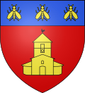 |
The arms of Querqueville are blazoned: Gules, a trefoil chapel Or, pierced and open sable, on a chief azure, three bees Or.
|
History edit
During WII, Querqueville Airfield (Advanced Landing Ground) was rebuilt on a former French Navy airfield.
See also edit
References edit
Wikimedia Commons has media related to Querqueville.