
KNOWPIA
WELCOME TO KNOWPIA

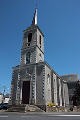
Quilly, Loire-Atlantique 
Summary
Quilly (French pronunciation: [kiji] ⓘ; Breton: Killig) is a commune in the Loire-Atlantique department in western France.[3]
Quilly | |
|---|---|
Commune | |
 | |
 Coat of arms | |
Location of Quilly .mw-parser-output .locmap .od{position:absolute}.mw-parser-output .locmap .id{position:absolute;line-height:0}.mw-parser-output .locmap .l0{font-size:0;position:absolute}.mw-parser-output .locmap .pv{line-height:110%;position:absolute;text-align:center}.mw-parser-output .locmap .pl{line-height:110%;position:absolute;top:-0.75em;text-align:right}.mw-parser-output .locmap .pr{line-height:110%;position:absolute;top:-0.75em;text-align:left}.mw-parser-output .locmap .pv>div{display:inline;padding:1px}.mw-parser-output .locmap .pl>div{display:inline;padding:1px;float:right}.mw-parser-output .locmap .pr>div{display:inline;padding:1px;float:left}html.skin-theme-clientpref-night .mw-parser-output .od,html.skin-theme-clientpref-night .mw-parser-output .od .pv>div,html.skin-theme-clientpref-night .mw-parser-output .od .pl>div,html.skin-theme-clientpref-night .mw-parser-output .od .pr>div{background:#000;color:#fff}html.skin-theme-clientpref-night .mw-parser-output .locmap{filter:grayscale(0.6)}@media(prefers-color-scheme:dark){html.skin-theme-clientpref-os .mw-parser-output .locmap{filter:grayscale(0.6)}html.skin-theme-clientpref-os .mw-parser-output .od,html.skin-theme-clientpref-os .mw-parser-output .od .pv>div,html.skin-theme-clientpref-os .mw-parser-output .od .pl>div,html.skin-theme-clientpref-os .mw-parser-output .od .pr>div{background:#000;color:#fff}}  Quilly  Quilly | |
| Coordinates: 47°27′45″N 1°57′07″W / 47.4625°N 1.9519°W | |
| Country | France |
| Region | Pays de la Loire |
| Department | Loire-Atlantique |
| Arrondissement | Saint-Nazaire |
| Canton | Blain |
| Government | |
| • Mayor (2020–2026) | Valérie Gautier[1] |
| Area 1 | 17.67 km2 (6.82 sq mi) |
| Population (2021)[2] | 1,488 |
| • Density | 84/km2 (220/sq mi) |
| Time zone | UTC+01:00 (CET) |
| • Summer (DST) | UTC+02:00 (CEST) |
| INSEE/Postal code | 44139 /44750 |
| Elevation | 1–37 m (3.3–121.4 ft) |
| 1 French Land Register data, which excludes lakes, ponds, glaciers > 1 km2 (0.386 sq mi or 247 acres) and river estuaries. | |
Population edit
| Year | Pop. | ±% p.a. |
|---|---|---|
| 1968 | 837 | — |
| 1975 | 781 | −0.98% |
| 1982 | 793 | +0.22% |
| 1990 | 859 | +1.00% |
| 1999 | 905 | +0.58% |
| 2007 | 1,180 | +3.37% |
| 2012 | 1,334 | +2.48% |
| 2017 | 1,380 | +0.68% |
| Source: INSEE[4] | ||
See also edit
References edit
- ^ "Répertoire national des élus: les maires" (in French). data.gouv.fr, Plateforme ouverte des données publiques françaises. 13 September 2022.
- ^ "Populations légales 2021". The National Institute of Statistics and Economic Studies. 28 December 2023.
- ^ Commune de Quilly (44139), INSEE
- ^ Population en historique depuis 1968, INSEE
Wikimedia Commons has media related to Quilly (Loire-Atlantique).