


Summary
RAF Cowden was a Royal Air Force bombing range, near to the village of Aldbrough, East Riding of Yorkshire, England. The site was used by the RAF and other air forces between 1959 and 1998, though the land part of the site was used by the army for training in the Second World War. Since closure, explosive ordnance disposal (EOD) teams have had to visit the site on numerous occasions due to erosion of the cliffs by the North Sea revealing old practise bombs.
| RAF Cowden | |
|---|---|
| Great Cowden, East Riding of Yorkshire in England | |
 RAF Cowden Air Weapon Range | |
 RAF Cowden Location of RAF Cowden | |
| Coordinates | 53°50′53″N 0°06′47″W / 53.848°N 0.113°W |
| Grid reference | TA241412 |
| Type | Bombing range |
| Area | 600 acres (240 ha) |
| Site information | |
| Owner | Ministry of Defence |
| Operator | Royal Air Force |
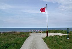
| Open to the public | Yes, limited by EOD operations |
| Site history | |
| Built | 1940 |
| In use | 1940–c. 1945 army use 1959–1998 air forces use |
| Fate | Closed, partly remediated |
History edit
The Yorkshire coast has been home to at least five aerial bombing and gunnery ranges; one during the First World War at RAF Marske,[1] one at Skipsea, which was brought into use in the 1920s,[2][3] short-lived bombing ranges at North Frodingham and Roos during the Second World War,[4] and the Cold War range at Cowden. Land at Great Cowden was requisitioned in 1940 for Aldbrough RAC tank range, which involved the permanent removal of some residents.[5] The buildings left in the villages of Great and Little Cowden were then destroyed as part of the creation of the range.[6] The range was used extensively for training during the Second World War, becoming abandoned later, but then, in 1953, the War Office purchased over 200 acres (81 ha) of land to develop the range.[7][8]
The site totalled 600 acres (240 ha),[note 1] and used between 1959 and 1998 as a bombing range by the Royal Air Force and NATO air forces.[10][11] Cowden was equipped with two target railways, and various static targets on land and on the area of the range out to sea. However, the railway was believed to only have been used for tank training.[12] Pilots would often run south eastwards over RAF Cowden, using Hornsea Mere as a landmark and waypoint to guide them onto the range.[13] The range was equipped with four "reinforced concrete quadrant towers", located at TA232415, TA232414, TA240406, and TA244401. By 1992, only one of the towers was still standing, and was deemed to be at low risk of destruction.[14] However, the rate of erosion at the site was 90 feet (27.4 m) between June 1994 and July 1997.[15]
During the 1980s, the Building Research Establishment, had a test centre for piles at the site. The test bed was into the lowland clay till.[16][17] Erosion of the cliff edge forced the closure of the site in 1998.[18] As the site is being eroded by the action of the North Sea, the beach is often closed whilst Explosive Ordnance Disposal teams deal with the bombs.[19][20] The RAF had an EoD team based permanently at the site until 2013, when regular visits were instituted instead.[21]
In April 2001, the site was also investigated as a possible depository of ash from burnt carcasses of cattle who had contracted foot and mouth disease.[22] Also in 2001, claims were made by military veterans and local people that depleted uranium (DU) shells were used by A-10 Tankbuster aircraft on the range. The Ministry of Defence denied this stating that only two locations in the United Kingdom had been used to fire DU; Eskmeer in Cumbria and Kirkcudbright in Scotland.[23] At the same time, there was a desire to convert the site into a nature reserve, which required No. 5131 (BD) Squadron RAF to start a long programme of deactivating and destroying ordnance left at the site.[24]
In February 2021, Brimstone Site Investigation[25] was awarded a £1.5 million contract to clear ordnance from the site over a four-year period. The contract was the first of its kind awarded to a civilian company by the Defence Infrastructure Organisation (DIO).[26] By the May 2021, they had cleared over 10,000 items or ordnance, with an expected 650,000 items still awaiting disposal.[21]
The site is set to be disposed of from 2022.[27]
Accidents edit
In March 1961, a Hawker Hunter of No. 1 Squadron stalled on an approach run over the range. It crashed into the sea, and the pilot was killed. The airframe (XE604), was written off.[28]
Names edit
Whilst being used by the Army during the Second World War, the site was known as Aldbrough RAC. When it was being used as an air weapons range, it was known variously as RAF Cowden,[29] RAF Cowden Sands,[12] RAF Great Cowden,[30] RAF Cowden AWR,[31] AWR Cowden,[32] Cowden Air Range,[33] and Cowden Range.[34]
Notes edit
References edit
- ^ McEntee-Taylor, Carole (2015). From Colonial Warrior to Western Front Flyer : the Five Wars of Sydney Herbert Bywater Harris. Barnsley, South Yorkshire: Pen & Sword. p. 159. ISBN 978-1-47382-359-4.
- ^ Halpenny, Bruce Barrymore (1990). Action stations (2 ed.). Wellingborough: Stephens. p. 5. ISBN 0-85059-532-0.
- ^ "North division: Skipsea | British History Online". www.british-history.ac.uk. Retrieved 6 February 2021.
- ^ "RANGES (Code B, 62): Roos: practice bombing range requirements". alpha.nationalarchives.gov.uk. Retrieved 6 February 2021.
- ^ Brigham, Buglas & George 2008, p. 87.
- ^ "Rapid coastal zone assessment survey Yorkshire and Lincolnshire: from Bempton to Donna Nook" (PDF). historicengland.org.uk. Historic England. 15 August 2018. p. 105. Retrieved 6 February 2021.
- ^ "North division: Mappleton | British History Online". www.british-history.ac.uk. Retrieved 6 February 2021.
- ^ "Tank Range, Yorkshire - Wednesday 24 May 1950 - Hansard - UK Parliament". hansard.parliament.uk. Retrieved 6 February 2021.
- ^ "Estate Baseline 2009" (PDF). assets.publishing.service.gov.uk. p. 12. Retrieved 6 February 2021.
- ^ "Military clears 1,000 bombs off East Yorkshire beach". BBC News. 7 August 2020. Retrieved 6 February 2021.
- ^ Riley, Anna; Gray, Charles (7 August 2020). "Pictures show 170 bombs found hidden on Yorkshire beach overnight - A 600-acre area of the beach was formerly used by the RAF and US Air Force as a practice bombing range until 1998". infoweb.newsbank.com. Retrieved 6 February 2021.
- ^ a b Historic England. "Great Cowden Air Gunnery Range (915915)". Research records (formerly PastScape). Retrieved 4 February 2021.
- ^ Delve, Ken (2006). Northern England : Co. Durham, Cumbria, Isle of Man, Lancashire, Merseyside, Manchester, Northumberland, Tyne & Wear, Yorkshire. Marlborough: Crowood Press. p. 294. ISBN 1-86126-809-2.
- ^ Historic England. "Quadrant Tower (915927)". Research records (formerly PastScape). Retrieved 6 February 2021.
- ^ "Compensation in the matter of a notice of reference between..." (PDF). urban rim.org.uk. Lands Tribunal. p. 28. Retrieved 6 February 2021.
- ^ Sands, M J, ed. (1992). Piling, European practice and worldwide trends : proceedings of a conference organized by the Institution of Civil Engineers, and held in London on 7-9 April 1992. London: T. Telford. p. 246. ISBN 0-7277-1698-0.
- ^ Hobbs, P R N; Jones, L D; Kirkham, M P (2015). "Slope Dynamics Project Report: Holderness Coast - Aldbrough, Drilling & Instrumentation, 2012- 2015" (PDF). nora.nerc.ac.uk. British Geological Survey. p. 36. Retrieved 6 February 2021.
- ^ Burkeman, Oliver (1 September 2000). "Erosion tips RAF shells on to beach". The Guardian. Retrieved 6 February 2021.
- ^ "The beach where it's not safe to pick up the shells". The Yorkshire Post. 26 July 2012. Retrieved 6 February 2021.
- ^ "Cowden Beach closed for safety reasons". GOV.UK. 10 July 2020. Retrieved 6 February 2021.
- ^ a b Wood, Alexandra (29 August 2021). "Huge task to clear up explosives on beach". The Yorkshire Post. p. 9. ISSN 0963-1496.
- ^ "Site is tested as burial ground". infoweb.newsbank.com. 21 April 2001. Retrieved 6 February 2021.
- ^ "Radioactive ammunition could have been used at coastal range". infoweb.newsbank.com. 5 February 2001. Retrieved 6 February 2021.
- ^ Bentham, Martin (29 April 2001). "Bombs cleared from beach wanted as nature reserve". The Telegraph. Retrieved 6 February 2021.
- ^ "Contract awarded to clear unexploded ordnance from Mappleton Beach". GOV.UK. Retrieved 10 March 2023.
- ^ Wood, Alexandra (6 February 2021). "Bombs on beach to be dealt with by private firm". The Yorkshire Post. p. 11. ISSN 0963-1496.
- ^ "Disposal database: House of Commons report". Retrieved 26 November 2021.
- ^ Ranter, Harro. "Accident Hawker Hunter FGA Mk 9 XE604, 02 Mar 1961". aviation-safety.net. Retrieved 6 February 2021.
- ^ "RAF Cowden". discovery.nationalarchives.gov.uk. Retrieved 6 February 2021.
- ^ Brigham, Buglas & George 2008, p. 104.
- ^ Whidborne, R. StJ (1994). Report on the accident involving Royal Air Force Tornado GR1, ZG 754 and Bell 206B JetRanger III, G-BHYW at Farleton Knott near Kendal, Cumbria on 23 June 1993. London: H.M.S.O. p. 4. ISBN 0-11-551283-7.
- ^ "Competing For Quality". hansard.parliament.uk. Retrieved 5 February 2021.
- ^ Fletcher, Harry R (1993). Air Force bases : Air bases outside the United States of America, vol. II. Washington D C: USAF. p. 128. OCLC 71400593.
- ^ "Cowden Range Byelaws" (PDF). Assets.publishing.service.gov.uk. p. 1. Retrieved 6 February 2021.
Sources edit
- Brigham, T; Buglas, J; George, R (2008). "Rapid Coastal Zone Assessment Yorkshire & Lincolnshire, Bempton to Donna Nook" (PDF). archaeologydataservice.ac.uk. Humber Field Archaeology & English Heritage. Retrieved 4 February 2021.
External links edit
- Video of EOD team in action
- Plan of the range (page 9)