


Summary
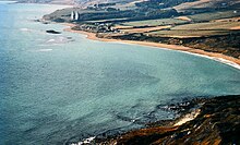
RAF Ringstead is a former Royal Air Force radar station at Ringstead Bay, Dorset, England. It is notable for having served three separate functions: first as a Chain Home early-warning radar station during WWII and then, during the Cold War, as a Rotor station and then, finally, as a USAF Tropospheric scatter station. The first of these functions commenced in 1942; the last of the functions ceased in 1974. The structural remains were Grade II listed in 2020.[1]

Chain Home edit
Chain Home was a ring of early warning radar stations built around the coastline as part of WWII defences from the late 1930s onwards.[1]
RAF Ringstead Chain Home Radar Station (known as AMES12B and CH12B) was built in 1941, and was fully operational by March 1942. [1] It was designed with well-dispersed structures: doubled-up transmitter and receiver blocks, a substation and a standby set house in earth-bound bunkers, four 325ft steel transmitter aerial masts and two 240ft self-supporting timber receiver aerial towers. [1] Ringstead Chain Home was stood down in 1945. [1]
Rotor station edit
In 1952, the former Chain Home station was refurbished into a Rotor station site (known as SRD).[1] The Rotor programme was developed to update previous wartime radar technology and to install more capable radar systems to detect and locate fast-flying jets.[1] The former Chain Home station became the technical site of the Rotor station; Upton Farm, 2 km to the north, became the domestic site, where personnel were accommodated.[1] It closed in 1956. [1]
Tropospheric scatter edit

In 1963, a USAF Tropospheric scatter station was established at Ringstead to provide a cross-channel relay link from High Wycombe Atomic Joint Co-Ordination Centre to a counterpart network in Gorramendi, near Elizondo, in the Spanish Pyrenees.[1][2] Two parabolic aerials were erected as part of this refurbishment.[1] The Tropospheric Scatter station was operated by USAF No 6 Detachment, 2180 Communications Squadron, [3] and closed in 1974. [1]
Legacy edit
The Tropospheric Scatter station parabolic aerials were dismantled in 1975.[3] The Wessex Hang Gliding Club use the field where the aerials were formerly located for emergency landings.[4]
The bunker is on land owned by the National Trust, and the Trust occasionally run open days.[5]
The radar station was listed Grade II in 2020, as one of the best-preserved Chain Home stations in southwest England, and as such a rare example of its type.[1] One of the two transmitting blocks is proposed for conversion to holiday accommodation.[1] Planning permission was granted in 2021 for a conversion designed by Lipton Plant Architects.[6]
See also edit
References edit
- ^ a b c d e f g h i j k l m n "Historic England List Entry No 1472715". Retrieved 26 August 2021.
- ^ "Subterranea Britannica: ACE High NATO Communications System". Retrieved 26 August 2021.
- ^ a b "Geograph: SY7681 – Ringstead Bay c 1970". Retrieved 26 August 2021.
- ^ "Hang Gliding History: Ringstead". hghistory.org. Retrieved 26 August 2021.
- ^ "Where Can We Go: Ringstead Bay Radar Station Open Day". wherecanwego.com. Retrieved 26 August 2021.
- ^ Lea, Martin (31 July 2021). "How war bunker at Ringstead will look when it becomes holiday accommodation". Dorset Echo. Retrieved 26 August 2021.
50°38′04″N 2°20′37″W / 50.634353°N 2.3435399°W