


Summary
Rajouri is a district in the Jammu division of Indian-administered Jammu and Kashmir in the disputed Kashmir region.[1] The Line of Control, between the Indian- and Pakistani-administered Jammu and Kashmir, lies to its west, Poonch to its north, the Reasi district to the east and the Jammu district to its south. Rajouri is famous for its "Kalari" (made from milk).[2] Representing an ancient principality, Rajouri was a joint district, along with Reasi, at the time of princely state's accession to India in 1947. The two tehsils were separated and Rajouri was merged with the Poonch district. Rajouri again became a separate district along with Reasi in 1968 till 2006 when both were separated again. The Rajouri district comprises 13 tehsils (boroughs). The land is mostly fertile and mountainous. Maize, wheat and rice are the main crops of the area and the main source of the irrigation is the river Tawi that originates from the mountains of Pir Panjal.
Rajouri district | |
|---|---|
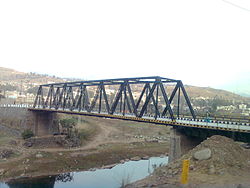 Bridge in Rajouri | |
Interactive map of Rajouri district![Rajouri district is in the Jammu division (shown with neon blue boundary) of Indian-administered Jammu and Kashmir (shaded in tan in the disputed Kashmir region[1]](http://upload.wikimedia.org/wikipedia/commons/thumb/3/33/Jammu_and_Kashmir_Rajouri_district.svg/250px-Jammu_and_Kashmir_Rajouri_district.svg.png) Rajouri district is in the Jammu division (shown with neon blue boundary) of Indian-administered Jammu and Kashmir (shaded in tan in the disputed Kashmir region[1] | |
| Coordinates (Rajouri): 33°23′N 74°19′E / 33.38°N 74.31°E | |
| Administering country | India |
| Union Territory | Jammu and Kashmir |
| Division | Jammu |
| Headquarters | Rajouri |
| Tehsils | 1.Rajouri 2.Manjakote 3.Darhal 4.Qila Darhal 5.Thana Mandi 6.Kotranka 7.Khawas 8.Teryath 9.Kalakote 10.Beri Pattan 11.Sunderbani 12.Nowshera 13.Siot |
| Government | |
| • Vidhan Sabha constituencies | 4 seats |
| Area | |
| • Total | 2,630 km2 (1,020 sq mi) |
| Population (2011) | |
| • Total | 642,415 |
| • Density | 240/km2 (630/sq mi) |
| • Urban | 8.1% |
| Demographics | |
| • Literacy | 68.17% |
| • Sex ratio | 860 |
| Time zone | UTC+05:30 (IST) |
| Vehicle registration | JK-11 |
| Website | http://rajouri.nic.in/ |
Geography edit


10miles
The Rajouri district is bordered on the west by Pakistan-controlled Azad Kashmir's Kotli district, on the north by the Indian-controlled part of Poonch district, on the east by the Reasi district and on the south by Jammu district.
The northern parts of the Rajouri district are in the Pir Panjal range, especially the Thanamandi and Darhal tehsils. However, The Rajouri Tawi River (also called Naushera Tawi) and its many tributaries flow through the mountain valleys, making them habitable. The Ansi River similarly waters the Budhal tehsil.
In the south, there is a wide valley between the Tain Dhar and Kali Dhar ranges (part of the Outer Hills of the Himalayas), which is called either Naushera Valley or Lam-Khuiratta Valley. In between these two ranges, there is a lower range called Koti Dhar, which divides the valley into two parts.[3] The Line of Control between the Indian-administered and Pakistani-administered Kashmir regions runs along the southern Kali Dhar range for part of the way and the Koti Dhar range for the rest.
The old Mughal Road into the Kashmir Valley used to come up from Bhimber, and pass through the Naushera and Rajouri towns to the Pir Panjal Pass. This is now cut off by the Line of Control. Also cut off is the roadway between Sunderbani and Kotli, which used to run in the Lam-Khuiratta valley.
History edit
Ancient history edit
According to some historians, a second branch of Aryan emigrants crossed the Himalayas in the north and west and settled in Rajouri and Poonch area. Rajouri, BhimberGali and Naushera were integrated within the territory of Abhisar, which was one of the hill states of the Punjab Kingdom. Early records of incomplete nature show that in the 4th century B.C.E., there existed in the north west of India a federal type of political set up in which Abhisar with its capital Rajouri was also incorporated. At the time of Alexander's invasion, Rajouri was at the summit of its splendour. In the Mauryan period, the town of Rajouri was a great trade centre.
Early modern history edit
During the Mughal rule, the Muslim Jarral Rajput rulers or Raja agreed to a treaty with the Mughal Empire and thus, were given the title 'Raja' and 'Mirza'. Descendants of the Jarral Rajput Dynasty continue to use these titles. Albaruni visited Rajouri with Sultan Masud (Son of Sultan Mahmud) in 1036 C.E. In his book "India" he wrote the name of Rajouri as Raja Vari. Srivar, the writer of 'Raj Tirangini' written during the administration of Sultan Zain-Ul-Abdin, also named this area as Raja Vari. It is believed that Raja Vari is a variant of Rajapuri. Mirza Zafarulla Khan, the writer of 'Tarikh Rajgan-E-Rajour' illustrated in his book that this place was in the beginning known as Raj-Avar and then altered from Rajour to Rajouri. But the old people in the villages still label the place as Rajour. With the course of time the name changed from Raja's Raj Avar to Raja Puri, Rajpuri to Raj Vari, Raj Vari to Raj Vara, Raj Vara to Raj Avar, Raj Avar to Rajour and then Rajour to Rajouri. As per Rajtirangini of Kalhan, Rajouri emerged as a principality in about 1003 C.E. The first ruler of this kingdom was Raja Prithvi Pal (A gadaria king) from 1033 to 1194 C.E. Raja Prithvi Pal defended Pir Panchal Pass at the time of incursion of Sultan Mehmud in 1021 C.E. Raja Sangram Pal safeguarded his Principality Rajouri when Raja Harash of Kashmir attacked his country in 1089 A.D. Sangram Pal fought so courageously that Raja Harash was obliged to return from Prithvi Pal fort without capturing Rajouri. Jaral Muslim Rajas rebuilt Rajouri city at the time of their rule. A number of forts, sarais, mosques and baradaris were constructed.
The area of the Rajouri principality included proper Rajouri, Thanna, Bagla Azim Garh, Behrote, Chingus, Darhal, Nagrota and Phalyana etc.
Modern history edit
In 1813, Gulab Singh of Jammu captured Rajouri for the Sikh Empire of Maharaja Ranjit Singh, by defeating Raja Agar Ullah Khan.[4] After this, Rajouri became part of the Sikh Empire. But parts of it were given as jagirs to Rahim Ullah Khan (a half-brother of Agar Ullah Khan) and other parts to Gulab Singh.[5]
Following the First Anglo-Sikh War and the Treaty of Amritsar (1846), all the territories between the Ravi River and the Indus were transferred to Gulab Singh, and he was recognised as an independent Maharaja of Jammu and Kashmir. Thus Rajouri became a part of the princely state of Jammu and Kashmir.[6] Gulab Singh changed the name of Rajouri to Rampur. He appointed Mian Hathu as Governor of Rajouri, who remained in Rajouri up to 1856.[7] Mian Hathu constructed a stunning temple in between Thanna Nallah in close proximity to Rajouri city. He also built Rajouri Fort at Dhannidhar village.[citation needed]
After Mian Hathu, Rajouri was transformed into a tehsil and affiliated with Bhimber district. In 1904, this tehsil was separated from Bhimber and affiliated with the Reasi district.[6]
Partition edit
After the Partition of India and the accession of Jammu and Kashmir to India in October 1947, there followed the First Kashmir War between India and Pakistan. The Pakistani raiders, along with the rebels and deserters from the western districts of the state, captured Rajauri on 7 November 1947. The 30,000 Hindus and Sikhs living in Rajauri were reportedly killed, wounded or abducted.[8][9][10] Rajauri was recaptured on 12 April 1948 by the 19 Infantry Brigade of the Indian Army under the command of Second Lieutenant Rama Raghoba Rane. Rane, despite being wounded, launched a bold tank assault by conveying the tanks over the Tawi river bed in order to avoid the road blocks along the main road.[11] When the Indian Army entered the town, the captors had fled, having destroyed most of the town and killing all its inhabitants. After the arrival of the Army, some 1,500 refugees that had fled to the hills, including women and children, returned to the town.[12]
The ceasefire line at the end of the War ran to the west of the Rajouri district.
Inside India edit
Soon after the war, the Rajouri and Reasi tehsils were separated. The Rajouri tehsil was merged with the Indian-administered Poonch district to form the Poonch-Rajouri district.[6] The Reasi tehsil was merged with the Udhampur district.
On 1 January 1968, the two tehsils were reunited and the resulting district was named the Rajouri district.[6]
The Reasi tehsil was also separated out in 2006 into a separate Reasi district. The present Rajouri district comprises the 1947 Rajouri tehsil.
Pakistan Air Force airstrike edit
On 27 February 2019, Pakistan air force (PAF) crossed the Line of Control (LoC) and carried out airstrikes against multiple targets in Rajouri District. Pakistan Air Force officials asserted that their target was supply depot of Indian military and had struck at 6 locations in Indian-administered Kashmir. PAF officials also claimed that they have successfully achieved their targets.[13][14] Indian military officials confirmed that the airstrike took place and identified Narian, Lam Jhangar and Kerri in Rajouri district, and Hamiphur area in Poonch district as the targets of the attacks. Indian military officials further stated that the bombs landed in deserted area and caused no damage. Indian Army 25 division headquarters and ammunition and supply depot were the intended targets of the airstrikes as per Indian military officials' claims.[15][16][17]
2023 Rajouri attacks edit
On 1 January 2023, some militants broke into three houses in Dangri village of Rajouri district and opened fire on civilians resulting into death of four and injuring many other. On 2 January 2023, an Improvised Explosive Device IED blasted near the same attack site which results into death of a minor child and injuring five people.[18]
Organisation edit
The Rajouri district comprises the subdistrict sunderbani, nowshera, Kotranka, kalakote & tehsils are Rajouri, Darhal, Sunderbani, Budhal, kotranka, khawas, Manjakote Nowshera, Thanamandi, and Kalakot.[19]
There are 19 blocks: Rajouri, Darhal, kotranka Sunderbani, Doongi, Nowshera, Kalakote, Manjakote, Thanamandi and Budhal, Dhangri, khawas, Lamberi, Moghla, Panjgrain,Plangar,Qila darhal,Rajnagar,Seri,Siot,.[20] Each block consists of a number of panchayats.
During recent reviews conducted by administration. It is planned to construct 400/132kv & 400/220 kv station at Rajori to resolve the electrical power supply to the statved[check spelling] area of Rajouri, Poonch Mendhar. This Grid station will be based on latest GIS technology of electrical technology.
Rajouri has its own deemed University Baba Ghulam Shah Badshah University popularly known as BGSBU which offers various Diploma, UG and PG courses. It also has one Government Medical College GMC Rajouri along with other degree colleges.
Politics edit
The district has four assembly constituencies: Nowshera, Darhal, Rajouri and Kalakote,[21] and 14 district development council constituencies: Budhal New, Budhal Old-A, Budhal Old-B, Darhal, Dhangri, Doongi, Kalakote, Manjakote, Moughla, Nowshera, Rajouri, Seri, Sunderbani and Thanamandi.[22] Rajouri District comes under Anantnag-Rajouri Lok Sabha Constituency.[23]
Demographics edit
| Year | Pop. | ±% |
|---|---|---|
| 1901 | 136,281 | — |
| 1911 | 146,823 | +7.7% |
| 1921 | 157,430 | +7.2% |
| 1931 | 166,126 | +5.5% |
| 1941 | 184,049 | +10.8% |
| 1951 | 177,789 | −3.4% |
| 1961 | 171,529 | −3.5% |
| 1971 | 217,373 | +26.7% |
| 1981 | 302,500 | +39.2% |
| 1991 | 384,435 | +27.1% |
| 2001 | 483,284 | +25.7% |
| 2011 | 642,415 | +32.9% |
| † 1951 and 1991 populations are estimated Source: Census of India[24] | ||
According to the 2011 census Rajouri district has a population of 642,415.[2] This gives it a ranking of 518th in India (out of a total of 640).[2] The district has a population density of 235 inhabitants per square kilometre (610/sq mi).[2] Its population growth rate over the decade 2001–2011 was 28.14%.[2] Rajouri has a sex ratio of 863 females for every 1000 males[2] (which varies with religion), and a literacy rate of 68.54%. The Scheduled Castes and Scheduled Tribes account for 7.5% and 36.2% of the population of the district.[27]
Though Urdu and English are the main mediums of instruction, the main native languages are Pahari-Pothwari and Gujari. Pahari is mainly spoken by the Pahari Tribal community that forms majority of Rajouri District. Gujari is mainly spoken by the Gujjar and Bakarwal which contribute much Muslim population of Rajouri. Kashmiri and Dogri are both spoken by small minorities.
| Rajouri district: religion, gender ratio, and % urban of population, according to the 2011 Census.[25] | |||||||||
|---|---|---|---|---|---|---|---|---|---|
| Hindu | Muslim | Christian | Sikh | Buddhist | Jain | Other | Not stated | Total | |
| Total | 221,880 | 402,879 | 983 | 15,513 | 189 | 26 | 3 | 942 | 642,415 |
| 34.54% | 62.71% | 0.15% | 2.41% | 0.03% | 0.00% | 0.00% | 0.15% | 100.00% | |
| Male | 124,925 | 209,548 | 730 | 9,426 | 165 | 18 | 2 | 537 | 345,351 |
| Female | 96,955 | 193,331 | 253 | 6,087 | 24 | 8 | 1 | 405 | 297,064 |
| Gender ratio (% female) | 43.7% | 48.0% | 25.7% | 39.2% | 12.7% | 30.8% | 33.3% | 43.0% | 46.2% |
| Sex ratio (no. of females per 1,000 males) |
776 | 923 | 347 | 646 | – | – | – | 754 | 860 |
| Urban | 31,243 | 17,244 | 278 | 3,452 | 32 | 7 | 1 | 57 | 52,314 |
| Rural | 190,637 | 385,635 | 705 | 12,061 | 157 | 19 | 2 | 885 | 590,101 |
| % Urban | 14.1% | 4.3% | 28.3% | 22.3% | 16.9% | 26.9% | 33.3% | 6.1% | 8.1% |
Notable people edit
- Banda Singh Bahadur, a famous sikh warrior and a commander of the Khalsa army
- Ravinder Raina, BJP state president, J&K.
- Nadeem Iqbal, a cross country skier.
- Shakeel Ahmed, Scientist.
- Arjumman Mughal, Indian actress.
- Peter Qasim, the longest-serving detainee in Australian immigration detention.
- Abdul Samad Farooq, Indian cricketeer
- Dr. Shahid Iqbal, IAS.
- Chowdhary Mohmmad Hussain, Indian Politician.
See also edit
References edit
- ^ a b c The application of the term "administered" to the various regions of Kashmir and a mention of the Kashmir dispute is supported by the tertiary sources (a) through (d), reflecting due weight in the coverage. Although "controlled" and "held" are also applied neutrally to the names of the disputants or to the regions administered by them, as evidenced in sources (f) through (h) below, "held" is also considered politicized usage, as is the term "occupied," (see (i) below).
(a) Kashmir, region Indian subcontinent, Encyclopaedia Britannica, retrieved 15 August 2019 (subscription required) Quote: "Kashmir, region of the northwestern Indian subcontinent ... has been the subject of dispute between India and Pakistan since the partition of the Indian subcontinent in 1947. The northern and western portions are administered by Pakistan and comprise three areas: Azad Kashmir, Gilgit, and Baltistan, the last two being part of a territory called the Northern Areas. Administered by India are the southern and southeastern portions, which constitute the state of Jammu and Kashmir but are slated to be split into two union territories.";
(b) Pletcher, Kenneth, Aksai Chin, Plateau Region, Asia, Encyclopaedia Britannica, retrieved 16 August 2019 (subscription required) Quote: "Aksai Chin, Chinese (Pinyin) Aksayqin, portion of the Kashmir region, at the northernmost extent of the Indian subcontinent in south-central Asia. It constitutes nearly all the territory of the Chinese-administered sector of Kashmir that is claimed by India to be part of the Ladakh area of Jammu and Kashmir state.";
(c) "Kashmir", Encyclopedia Americana, Scholastic Library Publishing, 2006, p. 328, ISBN 978-0-7172-0139-6 C. E Bosworth, University of Manchester Quote: "KASHMIR, kash'mer, the northernmost region of the Indian subcontinent, administered partlv by India, partly by Pakistan, and partly by China. The region has been the subject of a bitter dispute between India and Pakistan since they became independent in 1947";
(d) Osmańczyk, Edmund Jan (2003), Encyclopedia of the United Nations and International Agreements: G to M, Taylor & Francis, pp. 1191–, ISBN 978-0-415-93922-5 Quote: "Jammu and Kashmir: Territory in northwestern India, subject to a dispute betw een India and Pakistan. It has borders with Pakistan and China."
(e) Talbot, Ian (2016), A History of Modern South Asia: Politics, States, Diasporas, Yale University Press, pp. 28–29, ISBN 978-0-300-19694-8 Quote: "We move from a disputed international border to a dotted line on the map that represents a military border not recognized in international law. The line of control separates the Indian and Pakistani administered areas of the former Princely State of Jammu and Kashmir.";
(f) Kashmir, region Indian subcontinent, Encyclopaedia Britannica, retrieved 15 August 2019 (subscription required) Quote: "... China became active in the eastern area of Kashmir in the 1950s and has controlled the northeastern part of Ladakh (the easternmost portion of the region) since 1962.";
(g) Bose, Sumantra (2009), Kashmir: Roots of Conflict, Paths to Peace, Harvard University Press, pp. 294, 291, 293, ISBN 978-0-674-02855-5 Quote: "J&K: Jammu and Kashmir. The former princely state that is the subject of the Kashmir dispute. Besides IJK (Indian-controlled Jammu and Kashmir. The larger and more populous part of the former princely state. It has a population of slightly over 10 million, and comprises three regions: Kashmir Valley, Jammu, and Ladakh.) and AJK ('Azad" (Free) Jammu and Kashmir. The more populous part of Pakistani-controlled J&K, with a population of approximately 2.5 million. AJK has six districts: Muzaffarabad, Mirpur, Bagh, Kodi, Rawalakot, and Poonch. Its capital is the town of Muzaffarabad. AJK has its own institutions, but its political life is heavily controlled by Pakistani authorities, especially the military), it includes the sparsely populated "Northern Areas" of Gilgit and Baltistan, remote mountainous regions which are directly administered, unlike AJK, by the Pakistani central authorities, and some high-altitude uninhabitable tracts under Chinese control."
(h) Fisher, Michael H. (2018), An Environmental History of India: From Earliest Times to the Twenty-First Century, Cambridge University Press, p. 166, ISBN 978-1-107-11162-2 Quote: "Kashmir’s identity remains hotly disputed with a UN-supervised “Line of Control” still separating Pakistani-held Azad (“Free”) Kashmir from Indian-held Kashmir.";
(i) Snedden, Christopher (2015), Understanding Kashmir and Kashmiris, Oxford University Press, p. 10, ISBN 978-1-84904-621-3 Quote:"Some politicised terms also are used to describe parts of J&K. These terms include the words 'occupied' and 'held'." - ^ a b c d e f "District Census 2011". Census2011.co.in. 2011. Retrieved 30 September 2011.
- ^ Cheema, Crimson Chinar 2015, pp. 75–77.
- ^ Panikkar, Gulab Singh 1930, p. 31.
- ^ Panikkar, Gulab Singh 1930, p. 40.
- ^ a b c d Sudhir S. Bloeria, Militancy in Rajouri and Poonch, South Asia Terrorism Portal, 2001.
- ^ Bloeria, Sudhir S. (2000), Pakistan's Insurgency Vs India's Security: Tackling Militancy in Kashmir, Manas Publications, p. 37, ISBN 978-81-7049-116-3
- ^ Prasad, Sri Nandan; Pal, Dharm (1 January 1987). Operations in Jammu & Kashmir, 1947-48. History Division, Ministry of Defence, Government of India. pp. 49–50.
- ^ V. K. Singh, Leadership in the Indian Army 2005, p. 160.
- ^ Ramachandran, Empire's First Soldiers 2008, p. 171.
- ^ Rama Raghoba Rane received a Param Vir Chakra for his gallantry.
- ^ Sarkar, Outstanding Victories of the Indian Army 2016, pp. 37–40.
- ^ "India say it doesn't want to further escalation after Pakistan air strike". Samaa Tv. 27 February 2019.
- ^ "Pakistan Says It Has Captured One Indian Air Force Pilot And Not Two as Claimed Earlier". News18. 28 February 2019.
- ^ "Inside story of India's airstrike and Pakistan's counter-attack". The Week. 2 March 2019.
- ^ "Pakistan jets violate Indian airspace in Kashmir's Nowshera, drop bombs". The Week. 27 February 2019.
- ^ "Pakistani jets violate Indian air space, enter border areas of Nowshera sector in J-K's Rajouri district". Daily Hunt India. 27 February 2019.
- ^ "Rajouri: Four Killed, Six Injured in 'Indiscriminate Firing' by Militants". The Wire (India). 2 January 2023. Retrieved 2 January 2023.
- ^ Rajouri tehsil map, MapsOfIndia, retrieved 26 November 2016.
- ^ Statement showing the number of blocks in respect of 22 Districts of Jammu and Kashmir State including newly Created Districts Archived 10 September 2008 at the Wayback Machine dated 2008-03-13, accessed 2008-08-30
- ^ "Administrative Set Up". rajouri.nic.in. Retrieved 21 November 2016.
- ^ "SEC". ceojk.nic.in. Retrieved 15 January 2021.
- ^ Pargal, Sanjeev. "Rajouri-Poonch now part of Anantnag LS seat, Reasi distt goes to Jammu Parl segment". Daily excelsior.
- ^ "A-2 Decadal Variation In Population Since 1901". Censusindia.gov.in. Retrieved 9 August 2019.
- ^ a b c C-1 Population By Religious Community – Jammu & Kashmir (Report). Office of the Registrar General & Census Commissioner, India. Retrieved 28 July 2020.
- ^ C-16 Population By Mother Tongue – Jammu & Kashmir (Report). Office of the Registrar General & Census Commissioner, India. Retrieved 18 July 2020.
- ^ "Rajouri District Population, Jammu & Kashmir, List of Tehsils in Rajouri". Censusindia2011.com. Retrieved 10 June 2023.
Bibliography edit
- Cheema, Brig Amar (2015), The Crimson Chinar: The Kashmir Conflict: A Politico Military Perspective, Lancer Publishers, ISBN 978-81-7062-301-4
- Panikkar, K. M. (1930), Gulab Singh, London: Martin Hopkinson Ltd
- Ramachandran, D. P. (2008), Empire's First Soldiers, Lancer Publishers, pp. 171–, ISBN 978-0-9796174-7-8
- Sarkar, Col. Bhaskar (2016), Outstanding Victories of the Indian Army, 1947-1971, Lancer Publishers, pp. 40–, ISBN 978-1-897829-73-8
- Singh, V. K. (2005), Leadership in the Indian Army: Biographies of Twelve Soldiers, SAGE Publications, pp. 160–, ISBN 978-0-7619-3322-9
External links edit
- Official website
- Rajouri Social Network
- Rajouri District marked on OpenStreetMap
- Rajouri Tehsil Map, MapsOfIndia, retrieved 25 November 2016.