
KNOWPIA
WELCOME TO KNOWPIA

Reisdorf 
Summary
Reisdorf (Luxembourgish: Reisduerf) is a commune and small town in eastern Luxembourg, on the river Sauer. It is part of the canton of Diekirch.
Reisdorf
Reisduerf | |
|---|---|
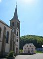
 Reisdorf seen from the north | |
 Coat of arms | |
 Map of Luxembourg with Reisdorf highlighted in orange, and the canton in dark red | |
| Coordinates: 49°52′00″N 6°16′00″E / 49.8667°N 6.2667°E | |
| Country | |
| Canton | Diekirch |
| Area | |
| • Total | 14.84 km2 (5.73 sq mi) |
| • Rank | 80th of 100 |
| Highest elevation | 406 m (1,332 ft) |
| • Rank | 44th of 100 |
| Lowest elevation | 175 m (574 ft) |
| • Rank | 15th of 100 |
| Population (2023) | |
| • Total | 1,353 |
| • Rank | 96th of 100 |
| • Density | 91/km2 (240/sq mi) |
| • Rank | 70th of 100 |
| Time zone | UTC+1 (CET) |
| • Summer (DST) | UTC+2 (CEST) |
| LAU 2 | LU0000608 |
| Website | reisdorf.lu |
In 2024, the town of Reisdorf itself, which lies in the centre of the commune, had a population of 708.[1] Other towns within the commune include Bigelbach, Hoesdorf, and Wallendorf-Pont. It’s also the starting point of a branch of the River Sûre.
Population edit
Gallery edit
-
 Reisdorf town hall
 -
 Reisdorf town hall and church
 -
 Wayside cross at the N10, just outside the town
 -
 Panorama between Reisdorf and Beaufort


References edit
External links edit
 Media related to Reisdorf (Luxembourg) at Wikimedia Commons