


Summary
The Renmark Paringa Council is a local government area located adjacent to the Victorian border, in the Riverland, South Australia. The area is known for its various fruit production, and is heavily dependent on the River Murray as a water source. The council seat is at Renmark.[4]
| Renmark Paringa Council South Australia | |||||||||||||||
|---|---|---|---|---|---|---|---|---|---|---|---|---|---|---|---|
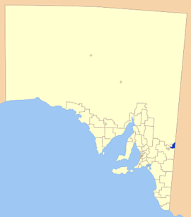 Location of the Renmark Paringa Council | |||||||||||||||
| Population | 9,783 (LGA 2021)[1] | ||||||||||||||
| • Density | 10,686/km2 (27,680/sq mi) | ||||||||||||||
| Established | 1996 | ||||||||||||||
| Area | 915.5 km2 (353.5 sq mi) | ||||||||||||||
| Mayor | Neil Martinson[2] | ||||||||||||||
| Council seat | Renmark | ||||||||||||||
| Region | Murray and Mallee[3] | ||||||||||||||
| State electorate(s) | Chaffey | ||||||||||||||
| Federal division(s) | Barker | ||||||||||||||
| Website | Renmark Paringa Council | ||||||||||||||
| |||||||||||||||
History edit
The earliest inhabitants of the district area were the Naralte aboriginal people, who lived on the food provided by the river and surrounding areas. The word 'Renmark' is thought to be derived from the Naralte word for 'red mud'.[5]
The first European to explore the district was Captain Charles Sturt who rowed a whale boat down the Murrumbidgee in 1829, searching for Australia's 'inland sea' and reached the junction with the Murray River on 14 January 1830.
The Canadian Chaffey brothers are honoured as founders of Renmark, and were invited to Australia to create an irrigation colony at Mildura. After delays in the Mildura project, an agreement for the establishment of an irrigation colony at Renmark was signed in 1887. Vineyards and fruit blocks slowly emerged throughout the district, sealing the fate of the district as a fruit and wine growing region.
In 1893, the ‘Renmark Irrigation Trust’ was established to provide water to the growers. In the early years, the Trust also played the primary role in the administration and governing of the settlement.[5]
The 'Town of Renmark' and the 'District Council of Paringa' were established not long after.[6]
The Renmark Paringa Council came into existence on 1 July 1996 with the amalgamation of the District Council of Paringa and the Town of Renmark.[7]
Geography edit
Renmark and Paringa are the largest towns and the centres of the district; it also contains a number of smaller towns and localities, including Chaffey, Cooltong, Crescent, Gurra Gurra, Lyrup, Mundic Creek, Murtho, Old Calperum, Pike River, Renmark South, Renmark West, Wonuarra and Yamba, and parts of Monash and Renmark North.[8]
Economy edit
The towns in the district are heavily reliant on irrigated orchards and vineyards, with water supplied by the river. Sheep grazing and dryland farming of various cereal crops are the main land uses east of the river, with farming and horticulture to the west of the river.[6]
While wine grape production is the most important industry, there are also large nut and citrus plantations in the region, as well as vegetable and stone fruit production.[9]
Tourism is an important component of the economy, especially during summer school holidays. The district experiences in an influx of tourists during this period, attracted mainly by the River Murray. Houseboats are common along the stretch of river in the district, with other water sports such as water skiing, jet skiing and fishing common. There is a wide range of accommodation in the district.[9]
Councillors edit
| Ward | Councillor | Notes | |
|---|---|---|---|
| Mayor[2] | Peter Hunter | ||
| Unsubdivided[2] | Margaret Howie | ||
| James John | |||
| Maria Spano | |||
| Ben Townsend | |||
| David Sims | |||
| Stephanie Brauer | |||
| Jack Gibb | |||
| Frank Turton | |||
The Renmark Paringa Council has a directly-elected mayor.[10]
See also edit
References edit
- ^ Australian Bureau of Statistics (28 June 2022). "Renmark Paringa (Local Government Area)". Australian Census 2021 QuickStats. Retrieved 28 June 2022.
- ^ a b c "Councillors". Renmark Paringa Council. Retrieved 31 March 2016.
- ^ "Murray and Mallee SA Government region" (PDF). The Government of South Australia. Retrieved 10 October 2014.
- ^ "Renmark Paringa Council". Retrieved 31 March 2016.
- ^ a b Renmark Paringa Council, Strategic Plan, retrieved 2 May 2007
- ^ a b Planning SA, Development Plan (PDF), archived from the original (PDF) on 30 August 2007, retrieved 2 May 2007
- ^ "Council". Renmark Paringa Council. Retrieved 31 March 2016.
- ^ "Location SA Map Viewer". Government of South Australia. Retrieved 31 March 2016.
- ^ a b Renmark Paringa Council, Council Profile, retrieved 2 May 2007
- ^ "Election Results 2014" (PDF). Local Government Association of South Australia. Retrieved 31 March 2016.
External links edit
- Council’s website
- LGA page
34°10′12″S 140°44′56″E / 34.17°S 140.748889°E