


Summary
Rheingau-Taunus is a Kreis (district) in the west of Hesse, Germany. Rheingau-Taunus-Kreis is part of the Darmstadt region; its main administrative seat is Bad Schwalbach. Outposted sections of the local administration are located in Idstein and Rüdesheim am Rhein.
Rheingau-Taunus | |
|---|---|
 Flag  Coat of arms | |
 | |
| Country | Germany |
| State | Hesse |
| Adm. region | Darmstadt |
| Capital | Bad Schwalbach |
| Government | |
| • District admin. | Sandro Zehner (CDU) |
| Area | |
| • Total | 811.11 km2 (313.17 sq mi) |
| Population (31 December 2022)[1] | |
| • Total | 189,614 |
| • Density | 230/km2 (610/sq mi) |
| Time zone | UTC+01:00 (CET) |
| • Summer (DST) | UTC+02:00 (CEST) |
| Vehicle registration | RÜD, SWA |
| Website | www |
Neighbouring districts are the Hessian districts of Limburg-Weilburg, Hochtaunuskreis, Main-Taunus-Kreis, district-free Wiesbaden and Mainz-Bingen and Rhein-Lahn which are located in Rhineland-Palatinate.
History edit
From 983 to 1803, the Rheingau area belonged to the Electorate of Mainz and was then merged into the new Duchy of Nassau.
The Untertaunus region was part of the Earldom of Katzenelnbogen. From 1816 onward, the whole area of the district became part of the Duchy of Nassau. After the 1866 Austro-Prussian war, Nassau was annexed by Prussia and formed the new province of Hesse-Nassau.
In 1867, the province was divided into districts. Therefore, the districts of Rheingau and Untertaunus were created.
After the Second World War and the creation of Hesse in 1946, these two districts remained unchanged. Only in 1977, because administrative borders were redrawn, the districts of Rheingau and Untertaunus merged and thus formed the Rheingau-Taunus district.
Geography edit
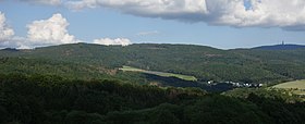
The district covers the western part of the Taunus mountains. The river Rhine forms the district's border in the south.
Politics edit
District council edit
Recent district elections had the following results:[2]
| Parties and voter communities | % 2016 |
Seats 2016 |
% 2011 |
Seats 2011 |
% 2006 |
Seats 2006 |
% 2001 |
Seats 2001 | |
| CDU | Christian Democratic Union | 35.3 | 21 | 35.8 | 22 | 39.8 | 24 | 39.1 | 28 |
| SPD | Social Democratic Party | 24.1 | 15 | 30.8 | 19 | 33.6 | 20 | 37.2 | 26 |
| GRÜNE | Alliance 90/The Greens | 11.2 | 7 | 18.9 | 12 | 10.3 | 6 | 10.0 | 7 |
| FDP | Free Democratic Party | 6.8 | 4 | 5.0 | 3 | 6.1 | 4 | 6.5 | 5 |
| DIE LINKE | The Left | 3.2 | 2 | 2.3 | 1 | — | — | — | — |
| FWG | Freie Wähler Gemeinschaft Rheingau-Taunus (Independent Voters Community) | 6.0 | 4 | 7.2 | 4 | 7.5 | 5 | 4.5 | 3 |
| REP | The Republicans | — | — | — | — | 2.7 | 2 | 2.7 | 2 |
| AFD | Alternative for Germany | 13.4 | 8 | — | — | — | — | — | — |
| Total | 100.0 | 61 | 100.0 | 61 | 100.0 | 61 | 100.0 | 71 | |
| Voter turnout % | 53.2 | 51.4 | 50.0 | 55.6 | |||||
Coat of arms edit
The coat of arms combines the coat of arms of the two former districts - in the bottom right the Mainz wheel taken from the Rheingau district, in the top left the lion of Nassau from the former Untertaunuskreis.
Subdivisions edit

Towns edit
Municipalities edit
References edit
- ^ "Bevölkerung in Hessen am 31.12.2022 nach Gemeinden" (XLS) (in German). Hessisches Statistisches Landesamt. June 2023.
- ^ Hessisches Statistisches Landesamt: Final result of district election (in German).
External links edit
 Media related to Rheingau-Taunus-Kreis at Wikimedia Commons
- Official website (in German)
- Rheingau Daily Photo Blog
50°08′54″N 8°04′24″E / 50.148403°N 8.073267°E