
KNOWPIA
WELCOME TO KNOWPIA

Richemont, Seine-Maritime 
Summary
Richemont (French pronunciation: [ʁiʃmɔ̃]) is a commune in the Seine-Maritime department in the Normandy region in northern France.
Richemont | |
|---|---|
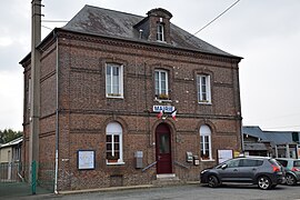 The town hall in Richemont | |
Location of Richemont .mw-parser-output .locmap .od{position:absolute}.mw-parser-output .locmap .id{position:absolute;line-height:0}.mw-parser-output .locmap .l0{font-size:0;position:absolute}.mw-parser-output .locmap .pv{line-height:110%;position:absolute;text-align:center}.mw-parser-output .locmap .pl{line-height:110%;position:absolute;top:-0.75em;text-align:right}.mw-parser-output .locmap .pr{line-height:110%;position:absolute;top:-0.75em;text-align:left}.mw-parser-output .locmap .pv>div{display:inline;padding:1px}.mw-parser-output .locmap .pl>div{display:inline;padding:1px;float:right}.mw-parser-output .locmap .pr>div{display:inline;padding:1px;float:left}html.skin-theme-clientpref-night .mw-parser-output .od,html.skin-theme-clientpref-night .mw-parser-output .od .pv>div,html.skin-theme-clientpref-night .mw-parser-output .od .pl>div,html.skin-theme-clientpref-night .mw-parser-output .od .pr>div{background:#000;color:#fff}html.skin-theme-clientpref-night .mw-parser-output .locmap{filter:grayscale(0.6)}@media(prefers-color-scheme:dark){html.skin-theme-clientpref-os .mw-parser-output .locmap{filter:grayscale(0.6)}html.skin-theme-clientpref-os .mw-parser-output .od,html.skin-theme-clientpref-os .mw-parser-output .od .pv>div,html.skin-theme-clientpref-os .mw-parser-output .od .pl>div,html.skin-theme-clientpref-os .mw-parser-output .od .pr>div{background:#000;color:#fff}}  Richemont  Richemont | |
| Coordinates: 49°48′34″N 1°38′44″E / 49.8094°N 1.6456°E | |
| Country | France |
| Region | Normandy |
| Department | Seine-Maritime |
| Arrondissement | Dieppe |
| Canton | Gournay-en-Bray |
| Intercommunality | CC Aumale - Blangy-sur-Bresle |
| Government | |
| • Mayor (2021–2026) | Marylène Paul[1] |
| Area 1 | 10.69 km2 (4.13 sq mi) |
| Population (2021)[2] | 440 |
| • Density | 41/km2 (110/sq mi) |
| Time zone | UTC+01:00 (CET) |
| • Summer (DST) | UTC+02:00 (CEST) |
| INSEE/Postal code | 76527 /76390 |
| Elevation | 152–221 m (499–725 ft) (avg. 206 m or 676 ft) |
| 1 French Land Register data, which excludes lakes, ponds, glaciers > 1 km2 (0.386 sq mi or 247 acres) and river estuaries. | |
It was the namesake for Richmond, North Yorkshire in England, which was itself the namesake for many other places around the world such as Richmond, Virginia in the United States.
Geography edit
A forestry and farming village situated in the Pays de Bray at the junction of the D60 with the D920 road, some 28 miles (45 km) southeast of Dieppe.
Population edit
| Year | Pop. | ±% p.a. |
|---|---|---|
| 1968 | 478 | — |
| 1975 | 459 | −0.58% |
| 1982 | 461 | +0.06% |
| 1990 | 450 | −0.30% |
| 1999 | 447 | −0.07% |
| 2007 | 471 | +0.66% |
| 2012 | 483 | +0.50% |
| 2017 | 453 | −1.27% |
| Source: INSEE[3] | ||
Places of interest edit
- The church of St. Michel, dating from the thirteenth century.
See also edit
References edit
- ^ "Répertoire national des élus: les maires". data.gouv.fr, Plateforme ouverte des données publiques françaises (in French). 9 August 2021.
- ^ "Populations légales 2021". The National Institute of Statistics and Economic Studies. 28 December 2023.
- ^ Population en historique depuis 1968, INSEE
Wikimedia Commons has media related to Richemont (Seine-Maritime).