


Summary
Riverhead is a small, historically predominantly working-class town located at the head of the Waitematā Harbour in the north-west of Auckland, New Zealand. It is located on the northwestern shores of the Upper Waitematā Harbour, north-east of the towns of Kumeū and Huapai.
Riverhead | |
|---|---|
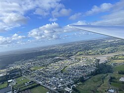 Riverhead seen from a glider at 1201 feet | |
 | |
| Coordinates: 36°45′29″S 174°35′31″E / 36.758°S 174.592°E | |
| Country | New Zealand |
| Region | Auckland Region |
| Ward | Rodney ward |
| Local board | Rodney Local Board |
| Electorates | |
| Government | |
| • Territorial Authority | Auckland Council |
| Area | |
| • Total | 2.16 km2 (0.83 sq mi) |
| Population (June 2023)[2] | |
| • Total | 3,770 |
| • Density | 1,700/km2 (4,500/sq mi) |
| Postcode | 0820 |
Traditionally known as Rangitōpuni, the area was an important transportation link for Tāmaki Māori, due to Te Tōangaroa, a portage where waka could be hauled between the Kaipara Harbour and the Waitematā Harbour. European settlement began in 1844 when a kauri mill was established at Riverhead, and the settlement became an important port for reaching the Kaipara Harbour from the 1850s. Riverhead developed as a community in the 1860s around the mill, which had been converted into the largest flour mill in the wider Auckland area. In 1874, a railway between Kumeū and Riverhead along the route of the Te Tōangaroa portage, which helped develop Riverhead and the Kumeū River valley areas, and closed in 1881 when a direct railway between Helensville and Auckland bypassed Riverhead.
Riverhead became an important centre for the kauri gum trade from the 1880s until the early 20th century, and in 1927, an exotic Pinus radiata forest called the Riverhead Forest was established to the north of the town.
History edit


The area is traditionally a part of rohe of the tribe Te Kawerau ā Maki and Ngāti Whātua o Kaipara, who referred to the wider area was known as Rangitōpuni.[3][4][5][6] The name commemorates a day of peace-making between Te Kawerau ā Maki and other tribes in the early 19th century, and refers to the act of gifting dog-skin cloaks (tōpuni) that marked this day.[3] There were many kāinga (villages) and localities to the West of Te Wairoa-ō-Kahu (the name for the Upper Waitematā Harbour), including Taurangatira, Maraeroa, Ngongetepara, Te Rarawaru, Onekiritea, Tahingamanu and Pītoitoi.[3] The harbour around Riverhead was a source of seasonal shark and snapper for various Tāmaki Māori groups.[7]
The area was an important transportation node due to Te Tōangaroa, a portage where waka could be hauled between the Kaipara Harbour and the Waitematā Harbour, via the Kaipara and Kumeū rivers.[8][3]
European settlement of Riverhead began in 1844, when a kauri mill was established at Riverhead, due to the access the area had to the Waitematā Harbour, and the adjacent Rangitōpuni Stream providing fresh water and a way to power the mill.[9] The mill operated between 1845 and 1856, after which it was repurposed as the Waitemata Flour Mill, the largest provider of flour in the Auckland Region.[9] John Brigham's flour mill was sold in 1859 to his employee, John Lamb, who helped Riverhead develop into a village around the flour mill.[10]
During the 1850s, a dray road was established primarily by Ngāti Whātua, which connected Riverhead and the Kumeū River, leading Riverhead to become known as the gateway to accessing the Kaipara Harbour. The track was narrow and often difficult to navigate due to poor weather conditions, leading to goods and people to be bottlenecked at Riverhead. In 1865, the Government funded road improvements to the track,[11] and the Riverhead Hotel was established in either 1870 or 1871.[12]
In 1875 after four years of construction, a railway between Kumeū and Riverhead was opened near the former dray road,[13] which helped develop the Kumeū area.[14] The line operated from 1875 to 1881 as a link from Auckland to regions north, with Riverhead acting as the transition point from ferry to railway. When the North Auckland Line connected Kumeū with Auckland via rail in 1881, the coastal shipping became unnecessary, and with no reason to continue operating, the railway to Riverhead was closed.[15]
In 1876 the flour mill was relocated to central Auckland, and by the 1890s the Riverhead mill was repurposed a third time, as a paper mill.[9] In the late 19th and early 20th centuries, Riverhead, Swanson and Henderson became major locations for the kauri gum digging trade.[16] In 1914, the paper mill closed.[9] After this time, Riverhead became known as a tobacco growing area.[9] St Philip's Church was established at Riverhead in 1926.[17]
During the 1920s, the rural area north of Riverhead was intended to be developed into farmland. Instead the government established Riverhead Forest, an exotic Pinus radiata timber forest. The first tree planting began in 1927, with the majority of the forest planted by 1933.[18][19] As the forest matured, Riverhead began to be known for timber processing.[9]
Local government edit
From 1876 until 1974, Riverhead was administered by the Waitemata County, a large rural county north and west of the city of Auckland.[20] After this, Riverhead became a part of Rodney County.[21] In 1989, the county was abolished, and in its place the Rodney District was formed. Rodney District Council was amalgamated into Auckland Council in November 2010.[22]
Within the Auckland Council, Riverhead is a part of the Rodney local government area governed by the Rodney Local Board. It is a part of the Rodney ward, which elects one councillor to the Auckland Council.
For general elections, Riverhead is in the Kaipara ki Mahurangi and Te Tai Tokerau electorates.
Demographics edit
Riverhead covers 2.16 km2 (0.83 sq mi)[1] and had an estimated population of 3,770 as of June 2023,[2] with a population density of 1,745 people per km2.
| Year | Pop. | ±% p.a. |
|---|---|---|
| 2006 | 1,305 | — |
| 2013 | 1,362 | +0.61% |
| 2018 | 2,802 | +15.52% |
| Source: [23] | ||
Before the 2023 census, Riverhead had a larger boundary, covering 4.05 km2 (1.56 sq mi).[1] Using that boundary, Riverhead had a population of 2,802 at the 2018 New Zealand census, an increase of 1,440 people (105.7%) since the 2013 census, and an increase of 1,497 people (114.7%) since the 2006 census. There were 864 households, comprising 1,422 males and 1,380 females, giving a sex ratio of 1.03 males per female. The median age was 35.2 years (compared with 37.4 years nationally), with 699 people (24.9%) aged under 15 years, 450 (16.1%) aged 15 to 29, 1,437 (51.3%) aged 30 to 64, and 219 (7.8%) aged 65 or older.
Ethnicities were 86.3% European/Pākehā, 10.1% Māori, 3.4% Pacific peoples, 9.1% Asian, and 2.6% other ethnicities. People may identify with more than one ethnicity.
The percentage of people born overseas was 24.6, compared with 27.1% nationally.
Although some people chose not to answer the census's question about religious affiliation, 61.3% had no religion, 28.4% were Christian, 0.2% had Māori religious beliefs, 2.1% were Hindu, 0.4% were Buddhist and 1.5% had other religions.
Of those at least 15 years old, 603 (28.7%) people had a bachelor's or higher degree, and 225 (10.7%) people had no formal qualifications. The median income was $52,600, compared with $31,800 nationally. 759 people (36.1%) earned over $70,000 compared to 17.2% nationally. The employment status of those at least 15 was that 1,299 (61.8%) people were employed full-time, 321 (15.3%) were part-time, and 48 (2.3%) were unemployed.[23]
Education edit
Riverhead School is a coeducational full primary (years 1–8) school with a roll of 437 students as at February 2024.[24][25] The school was built in 1872, and substantially rebuilt in 1960.[26]
References edit
- ^ a b c "ArcGIS Web Application". statsnz.maps.arcgis.com. Retrieved 18 March 2024.
- ^ a b "Population estimate tables - NZ.Stat". Statistics New Zealand. Retrieved 25 October 2023.
- ^ a b c d Te Kawerau ā Maki; The Trustees of Te Kawerau Iwi Settlement Trust; The Crown (22 February 2014). "Te Kawerau ā Maki Deed of Settlement Schedule" (PDF). Retrieved 10 May 2022.
- ^ Murdoch, Graeme (1990). "Nga Tohu o Waitakere: the Maori Place Names of the Waitakere River Valley and its Environs; their Background History and an Explanation of their Meaning". In Northcote-Bade, James (ed.). West Auckland Remembers, Volume 1. West Auckland Historical Society. p. 14. ISBN 0-473-00983-8.
- ^ Lutz, Heike; Chan, Theresa (2011). North Shore heritage – North Shore area studies and scheduled items list: volume 2 parts 6+ (PDF). Heritage Consultancy Services (Report). Auckland Council. Retrieved 7 July 2023.
- ^ Heritage Consultancy Services (1 July 2011). North Shore Heritage - Thematic Review Report Volume 1 (PDF) (Report). Auckland Council. ISBN 978-1-927169-21-6. Retrieved 29 June 2023.
- ^ High Court of New Zealand (9 February 2021). "In the High Court of New Zealand: Auckland Registry CIV-2015-404-002033 Between Ngāti Whātua Ōrākei Trust and Attorney-General and Marutūāhu Rōpū Limited Partnership" (PDF). Retrieved 1 March 2022 – via Ngāti Whātua Ōrākei.
- ^ Diamond & Hayward 1990, pp. 38–39.
- ^ a b c d e f Cameron, Ewen; Hayward, Bruce; Murdoch, Graeme (2008). A Field Guide to Auckland: Exploring the Region's Natural and Historical Heritage (rev. ed.). Random House New Zealand. p. 158. ISBN 978-1-86962-1513.
- ^ Dunsford 2002, pp. 23.
- ^ Dunsford 2002, pp. 22–23.
- ^ Dunsford 2002, pp. 29.
- ^ Dunsford 2002, pp. 31–32.
- ^ Dunsford 2002, pp. 33.
- ^ Dunsford 2002, pp. 37.
- ^ Hayward, Bruce W. (1989). Kauri Gum and the Gumdiggers. The Bush Press. p. 4. ISBN 0-908608-39-X.
- ^ Dunsford 2002, pp. 91.
- ^ Lamb, Harriet (2001). "RIVERHEAD: AN URBAN FOREST". New Zealand Geographic. Archived from the original on 20 January 2021. Retrieved 11 March 2022.
- ^ McClure, Margaret (1 August 2016). "Auckland places". Te Ara. Archived from the original on 4 November 2021. Retrieved 8 November 2021.
- ^ Reidy, Jade (2009). "How the West Was Run". In Macdonald, Finlay; Kerr, Ruth (eds.). West: The History of Waitakere. Random House. pp. 238–239. ISBN 9781869790080.
- ^ Rounthwaite, Valerie (1989), The Story of Rural Glenfield, Takapuna: Takapuna City Council, pp. 84–85, OCLC 37482407, Wikidata Q123499466
- ^ Blakeley, Roger (2015). "The planning framework for Auckland 'super city': an insider's view". Policy Quarterly. 11 (4). doi:10.26686/pq.v11i4.4572. ISSN 2324-1101.
- ^ a b "Statistical area 1 dataset for 2018 Census". Statistics New Zealand. March 2020. Riverhead (115900). 2018 Census place summary: Riverhead
- ^ "New Zealand Schools Directory". New Zealand Ministry of Education. Retrieved 14 March 2024.
- ^ Education Counts: Riverhead School
- ^ "HISTORY - Riverhead School". Riverhead School. Retrieved 8 December 2010.
Bibliography edit
- Diamond, John T.; Hayward, Bruce W. (1990). "Prehistoric Sites in West Auckland". In Northcote-Bade, James (ed.). West Auckland Remembers, Volume 1. West Auckland Historical Society. pp. 33–41. ISBN 0-473-00983-8.
- Dunsford, Deborah (2002). Doing It Themselves: the Story of Kumeu, Huapai and Taupaki. Huapai-Kumeu Lions Club. ISBN 0-473-08969-6.
External links edit
- Riverhead School website