KNOWPIA
WELCOME TO KNOWPIA
Summary
Rocca di Neto is a town and comune of the province of Crotone in the Calabria region of southern Italy. It is crossed by the Neto river from which it takes its current name; until 1863 it was known as Rocca Ferdinandea in honour of king Ferdinand I of Two Sicilies.
Rocca di Neto | |
|---|---|
| Comune di Rocca di Neto | |
 | |
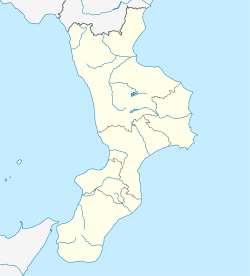
Location of Rocca di Neto .mw-parser-output .locmap .od{position:absolute}.mw-parser-output .locmap .id{position:absolute;line-height:0}.mw-parser-output .locmap .l0{font-size:0;position:absolute}.mw-parser-output .locmap .pv{line-height:110%;position:absolute;text-align:center}.mw-parser-output .locmap .pl{line-height:110%;position:absolute;top:-0.75em;text-align:right}.mw-parser-output .locmap .pr{line-height:110%;position:absolute;top:-0.75em;text-align:left}.mw-parser-output .locmap .pv>div{display:inline;padding:1px}.mw-parser-output .locmap .pl>div{display:inline;padding:1px;float:right}.mw-parser-output .locmap .pr>div{display:inline;padding:1px;float:left}html.skin-theme-clientpref-night .mw-parser-output .od,html.skin-theme-clientpref-night .mw-parser-output .od .pv>div,html.skin-theme-clientpref-night .mw-parser-output .od .pl>div,html.skin-theme-clientpref-night .mw-parser-output .od .pr>div{background:#000;color:#fff}html.skin-theme-clientpref-night .mw-parser-output .locmap{filter:grayscale(0.6)}@media(prefers-color-scheme:dark){html.skin-theme-clientpref-os .mw-parser-output .locmap{filter:grayscale(0.6)}html.skin-theme-clientpref-os .mw-parser-output .od,html.skin-theme-clientpref-os .mw-parser-output .od .pv>div,html.skin-theme-clientpref-os .mw-parser-output .od .pl>div,html.skin-theme-clientpref-os .mw-parser-output .od .pr>div{background:#000;color:#fff}}  Rocca di Neto Location of Rocca di Neto in Italy  Rocca di Neto Rocca di Neto (Calabria) | |
| Coordinates: 39°11′25″N 17°0′20″E / 39.19028°N 17.00556°E | |
| Country | Italy |
| Region | Calabria |
| Province | Crotone (KR) |
| Frazioni | Setteporte, Topanello |
| Government | |
| • Mayor | Tommaso Blandino |
| Area | |
| • Total | 43 km2 (17 sq mi) |
| Elevation | 180 m (590 ft) |
| Population (31 December 2010)[2] | |
| • Total | 5,657 |
| • Density | 130/km2 (340/sq mi) |
| Demonym | Rocchitani |
| Time zone | UTC+1 (CET) |
| • Summer (DST) | UTC+2 (CEST) |
| Postal code | 88821 |
| Dialing code | 0962 |
| Patron saint | St. Martin of Tours |
| Saint day | 11 November |
References edit


