


Summary
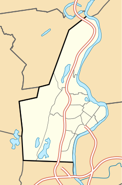
Rock Valley, sometimes referred to as West Holyoke,[3][4] is a neighborhood in Holyoke, Massachusetts located to the west of the city center, approximately 3 miles (4.8 km) from downtown, bordering Easthampton, Southampton, Westfield, and West Springfield. Rock Valley is historically Holyoke's second oldest village after Elmwood, with its eponymous burial ground dating to around 1777, and families having settled in the area as early as 1745.[5] Predating the construction of the Hadley Falls Dam, it originated as the western section of the 3rd parish ("Ireland Parish") of West Springfield.[6] Today, the neighborhood contains several historic Federal and Colonial homesteads, in addition to many modern developments adjacent to agricultural and wetland tracts.[1][6][7][8]
Rock Valley | |
|---|---|
 Rock Valley Road streetscape | |
 Rock Valley  Rock Valley  Rock Valley | |
| Coordinates: 42°11′38.33″N 72°40′33.33″W / 42.1939806°N 72.6759250°W | |
| Country | United States |
| State | Massachusetts |
| City | Holyoke |
| Wards | 5, 7 |
| Precincts | 5A, 7A |
| Settled | c. 1745 |
| Area | |
| • Total | 5.95 sq mi (15.4 km2) |
| Elevation | 312 ft (95 m) |
| ZIP code | 01040 |
| Area code | 413 |
| GNIS feature ID | 608798[2] |
Even into the 20th century, the area retained an agrarian character, but was met with concern by residents who believed their neighborhood to be falling behind the progress made by the rest of the city during its sudden industrial growth. In 1921, the West Holyoke Improvement Association was founded by a number of concerned for the purpose of representing the interests of the neighborhood before the city government. Renamed the Rock Valley Improvement League in 1955,[4] among the issues they lobbied for was the electrification of streets lights in the area, construction of a community center, and development of new playgrounds for children.[9][10] The association would hold many neighborhood dinners and events for a number of years as well, and having achieved many of the aforementioned goals fell into relative obscurity.
In 1930, the area briefly gained international attention when a former supply route to Westfield built by soldiers of the 104th Infantry was dedicated in Massachusetts as the Apremont Highway in a joint ceremony between Holyoke and Westfield. The 104th was the first American military unit to receive a foreign decoration for valor and the first foreign recipients of the French Croix de Guerre, for liberating Apremont-la-Forêt in the First World War.[11]
Further reading edit
- "HLY.800 Rock Valley Cemetery". Massachusetts Cultural Resource Information System (MACRIS). Massachusetts Historical Commission, Secretary of the Commonwealth of Massachusetts. November 2016.
References edit
- ^ a b Spatial analysis of "Holyoke Neighborhoods" (PDF). Archived from the original (PDF) on 2 August 2017. Retrieved 3 Jun 2016.
- ^ a b "Rock Valley, Holyoke, Massachusetts". Geographic Names Information System. United States Geological Survey, United States Department of the Interior. Retrieved 13 February 2018.
- ^ "New Hiking Trail Coming to West Holyoke by 2018". WWLP 22 News. September 29, 2016. Archived from the original on July 1, 2018.
- ^ a b [Query- "Rock Valley Improvement League, Inc."], Massachusetts Corp. Card Search, Corporation Cards of the Commonwealth of Massachusetts, Secretary of the Commonwealth. "West Holyoke Improvement League, Inc...Oct. 11, 1955– Name chg. to Rock Valley Improvement League, Inc."
- ^ "Holyoke Cemetery Being Neglected, Observers Feel, Rock Valley Burying Ground Has Become Weed-Grown Patch, Two Revolutionary Soldiers Rest There". Springfield Republican. Springfield, Mass. June 5, 1938. p. 5.
- ^ a b "MACRIS inventory record for Rock Valley Cemetery, Holyoke". Commonwealth of Massachusetts. Retrieved 2014-06-18.
- ^ "MACRIS inventory record for Nathan Spooner House". Commonwealth of Massachusetts. Retrieved 2014-06-18.
- ^ "MACRIS inventory record for Dank House". Commonwealth of Massachusetts. Retrieved 2014-06-18.
- ^ "Rock Valley Recreation Development Plan Aired". Springfield Union. Springfield, Mass. April 20, 1967. p. 37.
Proposed playground facilities for the Rock Valley area were outlined by Mayor Daniel F. Dibble at a meeting of the Rock Valley Improvement League this week
- ^ "Holyoke- An Early Cotton Mill in the West Holyoke District; West Holyoke of Today and Its Loud Demand on City to Grant It Some Modern Improvements". Springfield Republican. Springfield, Mass. September 18, 1921. p. 10.
- ^ "Apremont Way Between Holyoke and Westfield Is Formally Dedicated". Springfield Republican. Springfield, Mass. June 6, 1930.
[In a letter from the mayor of Apremont] 'I can never thank too much,' it read, 'in the name of the commune of Apremont La Forget [sic] the brave soldiers of the 26th American division and especially the 104th infantry, who really contributed to the deliverance of our village...we have never forgotten you here–everything is a reminder of your generous presence. The village square is named Place d'Holyoke, in memory of the city of that name...the main street is the Rue Belle Skinner, given this honor in memory of the great friend of the commune, a woman with a big heart