
KNOWPIA
WELCOME TO KNOWPIA

Rodemack 
Summary
Rodemack (French pronunciation: [ʁɔdmak]; German: Rodemachern; Lorraine Franconian/Luxembourgish: Roudemaacher [ˈʀəʊdəmaːχɐ], Ruedemaacher) is a commune in the Moselle department in Grand Est in northeastern France.
Rodemack | |
|---|---|
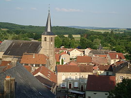 The church and surroundings in Rodemack | |
 Flag  Coat of arms | |
Location of Rodemack .mw-parser-output .locmap .od{position:absolute}.mw-parser-output .locmap .id{position:absolute;line-height:0}.mw-parser-output .locmap .l0{font-size:0;position:absolute}.mw-parser-output .locmap .pv{line-height:110%;position:absolute;text-align:center}.mw-parser-output .locmap .pl{line-height:110%;position:absolute;top:-0.75em;text-align:right}.mw-parser-output .locmap .pr{line-height:110%;position:absolute;top:-0.75em;text-align:left}.mw-parser-output .locmap .pv>div{display:inline;padding:1px}.mw-parser-output .locmap .pl>div{display:inline;padding:1px;float:right}.mw-parser-output .locmap .pr>div{display:inline;padding:1px;float:left}html.skin-theme-clientpref-night .mw-parser-output .od,html.skin-theme-clientpref-night .mw-parser-output .od .pv>div,html.skin-theme-clientpref-night .mw-parser-output .od .pl>div,html.skin-theme-clientpref-night .mw-parser-output .od .pr>div{background:#000;color:#fff}html.skin-theme-clientpref-night .mw-parser-output .locmap{filter:grayscale(0.6)}@media(prefers-color-scheme:dark){html.skin-theme-clientpref-os .mw-parser-output .locmap{filter:grayscale(0.6)}html.skin-theme-clientpref-os .mw-parser-output .od,html.skin-theme-clientpref-os .mw-parser-output .od .pv>div,html.skin-theme-clientpref-os .mw-parser-output .od .pl>div,html.skin-theme-clientpref-os .mw-parser-output .od .pr>div{background:#000;color:#fff}}  Rodemack  Rodemack | |
| Coordinates: 49°28′11″N 6°14′13″E / 49.4697°N 6.2369°E | |
| Country | France |
| Region | Grand Est |
| Department | Moselle |
| Arrondissement | Thionville |
| Canton | Yutz |
| Intercommunality | CC de Cattenom et Environs |
| Government | |
| • Mayor (2020–2026) | Olivier Kormann[1] |
| Area 1 | 9.96 km2 (3.85 sq mi) |
| Population (2021)[2] | 1,287 |
| • Density | 130/km2 (330/sq mi) |
| Time zone | UTC+01:00 (CET) |
| • Summer (DST) | UTC+02:00 (CEST) |
| INSEE/Postal code | 57588 /57570 |
| Elevation | 154–242 m (505–794 ft) (avg. 180 m or 590 ft) |
| 1 French Land Register data, which excludes lakes, ponds, glaciers > 1 km2 (0.386 sq mi or 247 acres) and river estuaries. | |
Localities of the commune: Esing, Faulbach, Semming.
edit
- Jean-Marie Pelt (1933-2015), French botanist-ecologist, founder of the European Institute of Ecology (Metz).
- The barons of Rodemack, lineage of the nobility of the Holy Roman Empire, which has its roots in Rodemack.
- Pierre Hemmer (1950-2013), one of the Internet pioneers in Switzerland.
- Princess Cecilia of Sweden
See also edit
References edit
- ^ "Répertoire national des élus: les maires" (in French). data.gouv.fr, Plateforme ouverte des données publiques françaises. 13 September 2022.
- ^ "Populations légales 2021". The National Institute of Statistics and Economic Studies. 28 December 2023.
External links edit
 Media related to Rodemack at Wikimedia Commons