


Summary
Rogersville is a former village in Northumberland County, New Brunswick, built around the Intersection of New Brunswick Route 126 and New Brunswick Route 440. It was an incorporated village until the end of 2022 and is now part of the village of Nouvelle-Arcadie.
Rogersville | |
|---|---|
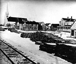 Rogersville in 1910 | |
 Rogersville The location of Rogersville within New Brunswick | |
| Coordinates: 46°44′05″N 65°25′46″W / 46.73472°N 65.42938°W | |
| Country | Canada |
| Province | New Brunswick |
| County | Northumberland County |
| Municipality | Nouvelle-Arcadie |
| incorporated | November 9, 1966 |
| Area | |
| • Land | 7.19 km2 (2.78 sq mi) |
| Population (2021)[1] | |
| • Total | 1,193 |
| • Density | 165.9/km2 (430/sq mi) |
| • Change (2016–21) | |
| Time zone | UTC−4 (AST) |
| • Summer (DST) | UTC−3 (ADT) |
| Area code | 506 |
History edit
The village is named in honour of the Roman Catholic Bishop, the Most Reverend James Rogers, late Bishop of Chatham, New Brunswick. Rogersville is the home of two Trappist (Order of Cistercians of the Strict Observance) monasteries, Notre-Dame de l'Assomption Abbey (Our Lady of the Assumption Abbey for women) and Notre Dame du Calvaire Abbey (Our Lady of Calvary Abbey for men).
It is also the burial place of the man considered the Father of Modern Acadia—(Bishop) Monseigneur Marcel-Francois Richard, and the site of a monument containing his sarcophagus.
On 1 January 2023, Rogersville annexed all or part of seven local service districts to form the new village of Nouvelle-Arcadie.[2][3] The community's name remains in official use.[4]
Present day edit
It is served by Via Rail's train the Ocean which stops at the Rogersville railway station.
Demographics edit
In the 2021 Census of Population conducted by Statistics Canada, Rogersville had a population of 1,193 living in 544 of its 576 total private dwellings, a change of 2.3% from its 2016 population of 1,166. With a land area of 7.19 km2 (2.78 sq mi), it had a population density of 165.9/km2 (429.7/sq mi) in 2021.[1]
|
Income (2015)[6]
|
Mother tongue (2016) [6]
|
Places of note edit
- Co-Op store
- Ocean Spray Cranberry Fields
Border communities edit
- Acadie Siding
- Pleasant Ridge
- Collette
- Shediac Ridge
- Saint-Athanase
- Saint-Pierre
- Sapin-Court
- Young Ridge
Notable people edit
See also edit
References edit
- ^ a b c "Census Profile of Rogersville, Village (VL)". Statistics Canada. 6 December 2022. Retrieved 21 January 2023.
- ^ "Local Governments Establishment Regulation – Local Governance Act". Government of New Brunswick. 12 October 2022. Retrieved 21 January 2023.
- ^ "RSC 6 Kent Regional Service Commission". Government of New Brunswick. Retrieved 21 January 2023.
- ^ "Proposed entity names reflect strong ties to nature and history" (Press release). Irishtown, New Brunswick: Government of New Brunswick. 25 May 2022. Retrieved 21 January 2023.
- ^ Statistics Canada: 1996, 2001, 2006 census
- ^ a b c "Census Profile, 2016 Census: Rogersville, Village [Census subdivision], New Brunswick". Statistics Canada. Retrieved September 24, 2019.
External links edit
- Official website
46°43′N 65°25′W / 46.717°N 65.417°W