


Summary
Ronda, officially the Municipality of Ronda (Cebuano: Lungsod sa Ronda; Tagalog: Bayan ng Ronda), is a 5th class municipality in the province of Cebu, Philippines. According to the 2020 census, it has a population of 21,005 people.[3]
Ronda | |
|---|---|
| Municipality of Ronda | |
 Ronda, Cebu | |
 Flag  Seal | |
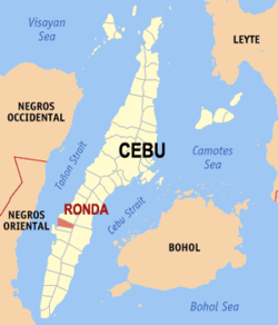 Map of Cebu with Ronda highlighted | |
OpenStreetMap .mw-parser-output .locmap .od{position:absolute}.mw-parser-output .locmap .id{position:absolute;line-height:0}.mw-parser-output .locmap .l0{font-size:0;position:absolute}.mw-parser-output .locmap .pv{line-height:110%;position:absolute;text-align:center}.mw-parser-output .locmap .pl{line-height:110%;position:absolute;top:-0.75em;text-align:right}.mw-parser-output .locmap .pr{line-height:110%;position:absolute;top:-0.75em;text-align:left}.mw-parser-output .locmap .pv>div{display:inline;padding:1px}.mw-parser-output .locmap .pl>div{display:inline;padding:1px;float:right}.mw-parser-output .locmap .pr>div{display:inline;padding:1px;float:left}html.skin-theme-clientpref-night .mw-parser-output .od,html.skin-theme-clientpref-night .mw-parser-output .od .pv>div,html.skin-theme-clientpref-night .mw-parser-output .od .pl>div,html.skin-theme-clientpref-night .mw-parser-output .od .pr>div{background:#000;color:#fff}html.skin-theme-clientpref-night .mw-parser-output .locmap{filter:grayscale(0.6)}@media(prefers-color-scheme:dark){html.skin-theme-clientpref-os .mw-parser-output .locmap{filter:grayscale(0.6)}html.skin-theme-clientpref-os .mw-parser-output .od,html.skin-theme-clientpref-os .mw-parser-output .od .pv>div,html.skin-theme-clientpref-os .mw-parser-output .od .pl>div,html.skin-theme-clientpref-os .mw-parser-output .od .pr>div{background:#000;color:#fff}}  Ronda Location within the Philippines | |
| Coordinates: 10°00′01″N 123°24′34″E / 10.000256°N 123.409508°E | |
| Country | Philippines |
| Region | Central Visayas |
| Province | Cebu |
| District | 7th district |
| Founded | 1913 |
| Barangays | 14 (see Barangays) |
| Government | |
| • Type | Sangguniang Bayan |
| • Mayor | Terence Mariano Y. Blanco |
| • Vice Mayor | Rocky T. Gabatan |
| • Representative | Peter John D. Calderon |
| • Municipal Council | Members |
| • Electorate | 15,641 voters (2022) |
| Area | |
| • Total | 57.10 km2 (22.05 sq mi) |
| Elevation | 46 m (151 ft) |
| Highest elevation | 275 m (902 ft) |
| Lowest elevation | 0 m (0 ft) |
| Population (2020 census)[3] | |
| • Total | 21,005 |
| • Density | 370/km2 (950/sq mi) |
| • Households | 5,450 |
| Economy | |
| • Income class | 5th municipal income class |
| • Poverty incidence | 21.20 |
| • Revenue | ₱ 97.63 million (2020) |
| • Assets | ₱ 290.7 million (2020) |
| • Expenditure | ₱ 129.4 million (2020) |
| • Liabilities | ₱ 48.64 million (2020) |
| Service provider | |
| • Electricity | Cebu 1 Electric Cooperative (CEBECO 1) |
| Time zone | UTC+8 (PST) |
| ZIP code | 6034 |
| PSGC | 072239000 |
| IDD : area code | +63 (0)32 |
| Native languages | Cebuano Tagalog |
Ronda is one of the eight municipalities comprising the 7th Congressional District Cebu Province. It is 91 kilometres (57 mi) from Cebu City.
Etymology edit
Ronda (which is named after a town in Malaga) is usually attributed to the Spanish word ”ronda” which means ”to round” or ”to patrol” but evidence suggests Ronda is derived from Arunda, presumably of Celtic origin however its meaning is uncertain.
Oral traditions suggest that the town was named “Holoyaw” before the Spanish conquest. ‘’Holoyaw’’ refers to a type of banana that was abundant in the area. Others posit the name’s origin to Jolo as the southern parts of the Visayas was infamous to being vulnerable to raids by Muslim pirates. However, Jolo is just a recent orthographic innovation from earlier “Xoló”, with the “x” being pronounced as /ʃ/ (the sh in English ship).
Geography edit
Ronda is bordered to the north by the town of Dumanjug, to the west is the Tañon Strait, to the east is the town of Argao, and to the south is the town of Alcantara.
Barangays edit
Ronda is politically subdivided into 14 barangays. Each barangay consists of puroks and some have sitios.
| PSGC | Barangay | Population | ±% p.a. | |||
|---|---|---|---|---|---|---|
| 2020[3] | 2010[5] | |||||
| 072239001 | Butong | 7.7% | 1,617 | 1,610 | 0.04% | |
| 072239002 | Can‑abuhon | 4.4% | 930 | 780 | 1.77% | |
| 072239003 | Canduling | 6.4% | 1,353 | 1,329 | 0.18% | |
| 072239004 | Cansalonoy | 4.0% | 846 | 709 | 1.78% | |
| 072239005 | Cansayahon | 9.3% | 1,947 | 1,799 | 0.79% | |
| 072239006 | Ilaya | 7.8% | 1,630 | 1,455 | 1.14% | |
| 072239007 | Langin | 6.0% | 1,262 | 1,251 | 0.09% | |
| 072239008 | Libo‑o | 5.7% | 1,198 | 931 | 2.55% | |
| 072239009 | Malalay | 5.5% | 1,165 | 974 | 1.81% | |
| 072239010 | Palanas | 8.3% | 1,739 | 1,504 | 1.46% | |
| 072239011 | Poblacion | 9.5% | 1,992 | 1,990 | 0.01% | |
| 072239012 | Santa Cruz | 15.3% | 3,224 | 2,768 | 1.54% | |
| 072239013 | Tupas | 2.8% | 592 | 711 | −1.81% | |
| 072239014 | Vive | 4.1% | 865 | 771 | 1.16% | |
| Total | 21,005 | 18,582 | 1.23% | |||
Climate edit
| Climate data for Ronda, Cebu | |||||||||||||
|---|---|---|---|---|---|---|---|---|---|---|---|---|---|
| Month | Jan | Feb | Mar | Apr | May | Jun | Jul | Aug | Sep | Oct | Nov | Dec | Year |
| Mean daily maximum °C (°F) | 29 (84) |
30 (86) |
31 (88) |
32 (90) |
32 (90) |
30 (86) |
30 (86) |
30 (86) |
30 (86) |
29 (84) |
29 (84) |
29 (84) |
30 (86) |
| Mean daily minimum °C (°F) | 23 (73) |
22 (72) |
23 (73) |
24 (75) |
25 (77) |
25 (77) |
24 (75) |
24 (75) |
24 (75) |
24 (75) |
24 (75) |
23 (73) |
24 (75) |
| Average precipitation mm (inches) | 42 (1.7) |
34 (1.3) |
40 (1.6) |
61 (2.4) |
124 (4.9) |
188 (7.4) |
190 (7.5) |
191 (7.5) |
189 (7.4) |
186 (7.3) |
124 (4.9) |
73 (2.9) |
1,442 (56.8) |
| Average rainy days | 10.0 | 8.5 | 9.5 | 12.8 | 22.3 | 26.8 | 28.4 | 27.9 | 27.3 | 27.6 | 20.5 | 13.1 | 234.7 |
| Source: Meteoblue[6] | |||||||||||||
Demographics edit

| Year | Pop. | ±% p.a. |
|---|---|---|
| 1903 | 9,662 | — |
| 1918 | 11,192 | +0.98% |
| 1939 | 11,936 | +0.31% |
| 1948 | 11,563 | −0.35% |
| 1960 | 10,565 | −0.75% |
| 1970 | 11,535 | +0.88% |
| 1975 | 12,006 | +0.81% |
| 1980 | 12,939 | +1.51% |
| 1990 | 15,264 | +1.67% |
| 1995 | 16,561 | +1.54% |
| 2000 | 16,808 | +0.32% |
| 2007 | 17,214 | +0.33% |
| 2010 | 18,582 | +2.82% |
| 2015 | 20,360 | +1.76% |
| 2020 | 21,005 | +0.62% |
| Source: Philippine Statistics Authority[7][5][8][9] | ||
Economy edit
Education edit
The public schools in the town of Ronda are administered by one school district under the Schools Division of Cebu Province.
Elementary schools:
- Butong Elementary School — Butong
- Can-abujon Elementary School — Can-abujon
- Cansalonoy Elementary School — Cansalonoy
- Cansayahon Elementary School — Cansayahon
- Langin Elementary School — Langin
- Liboo Elementary School — Libo-o
- Madanglog Elementary School — Vive
- Ronda Central Elementary School — Palanas
- Sta. Cruz Elementary School — Sta. Cruz
- Tupas Elementary School — Libo-o
High schools:
- Langin National High School — Vive
- Ronda National High School — Palanas
Private schools:
- Academia de Nuestra Señora, Inc. — J.P. Rizal Street, Poblacion
References edit
- ^ Municipality of Ronda | (DILG)
- ^ "2015 Census of Population, Report No. 3 – Population, Land Area, and Population Density" (PDF). Philippine Statistics Authority. Quezon City, Philippines. August 2016. ISSN 0117-1453. Archived (PDF) from the original on May 25, 2021. Retrieved July 16, 2021.
- ^ a b c Census of Population (2020). "Region VII (Central Visayas)". Total Population by Province, City, Municipality and Barangay. Philippine Statistics Authority. Retrieved 8 July 2021.
- ^ "PSA Releases the 2018 Municipal and City Level Poverty Estimates". Philippine Statistics Authority. 15 December 2021. Retrieved 22 January 2022.
- ^ a b Census of Population and Housing (2010). "Region VII (Central Visayas)" (PDF). Total Population by Province, City, Municipality and Barangay. National Statistics Office. Retrieved 29 June 2016.
- ^ "Ronda: Average Temperatures and Rainfall". Meteoblue. Retrieved 10 May 2020.
- ^ Census of Population (2015). "Region VII (Central Visayas)". Total Population by Province, City, Municipality and Barangay. Philippine Statistics Authority. Retrieved 20 June 2016.
- ^ Censuses of Population (1903–2007). "Region VII (Central Visayas)". Table 1. Population Enumerated in Various Censuses by Province/Highly Urbanized City: 1903 to 2007. National Statistics Office.
{{cite encyclopedia}}: CS1 maint: numeric names: authors list (link) - ^ "Province of Cebu". Municipality Population Data. Local Water Utilities Administration Research Division. Retrieved 17 December 2016.
- ^ "Poverty incidence (PI):". Philippine Statistics Authority. Retrieved December 28, 2020.
- ^ "Estimation of Local Poverty in the Philippines" (PDF). Philippine Statistics Authority. 29 November 2005.
- ^ "2003 City and Municipal Level Poverty Estimates" (PDF). Philippine Statistics Authority. 23 March 2009.
- ^ "City and Municipal Level Poverty Estimates; 2006 and 2009" (PDF). Philippine Statistics Authority. 3 August 2012.
- ^ "2012 Municipal and City Level Poverty Estimates" (PDF). Philippine Statistics Authority. 31 May 2016.
- ^ "Municipal and City Level Small Area Poverty Estimates; 2009, 2012 and 2015". Philippine Statistics Authority. 10 July 2019.
- ^ "PSA Releases the 2018 Municipal and City Level Poverty Estimates". Philippine Statistics Authority. 15 December 2021. Retrieved 22 January 2022.
External links edit
- Philippine Standard Geographic Code