


Summary
Roura (French pronunciation: [ʁuʁa]) is a commune of French Guiana, an overseas region and department of France located in South America. The city of Roura is bordered by Matoury and Montsinéry-Tonnegrande in the North, Kourou and Saint-Elie in the North West and West, and finally by Régina in the South and East.[3]
Roura | |
|---|---|
 Roura as seen from the Oyak River | |
 Coat of arms | |
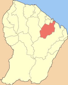 Location of the commune (in red) within French Guiana | |
Location of Roura Coordinates: .mw-parser-output .geo-default,.mw-parser-output .geo-dms,.mw-parser-output .geo-dec{display:inline}.mw-parser-output .geo-nondefault,.mw-parser-output .geo-multi-punct,.mw-parser-output .geo-inline-hidden{display:none}.mw-parser-output .longitude,.mw-parser-output .latitude{white-space:nowrap}4°43′27″N 52°19′17″W / 4.7242°N 52.3215°W | |
| Country | France |
| Overseas region and department | French Guiana |
| Arrondissement | Cayenne |
| Intercommunality | CA Centre Littoral |
| Government | |
| • Mayor (2020–2026) | Jean-Claude Labrador[1] |
| Area 1 | 3,902.5 km2 (1,506.8 sq mi) |
| Population (2021)[2] | 3,409 |
| • Density | 0.87/km2 (2.3/sq mi) |
| Time zone | UTC−03:00 |
| INSEE/Postal code | 97310 /97311 |
| Elevation | 0–462 m (0–1,516 ft) (avg. 231 m or 758 ft) |
| 1 French Land Register data, which excludes lakes, ponds, glaciers > 1 km2 (0.386 sq mi or 247 acres) and river estuaries. | |
History edit
The town of Roura was founded in 1675 by Jesuits. In 1786, Marquis de Lafayette attempted an early emancipation of the slaves by allowing small scale agriculture on the savanna Gabriel near Roury. The experiment failed, and was abandoned in 1796.[4] Between 1809 and 1817, Roura was captured by the Portuguese and part of Brazil. In 1848, slavery was abolished.[5]
Cacao is a village of Hmong farmers. The population were refugees from Laos who were resettled in French Guiana in[6] 1977[7] The reasoning was that living, and working conditions were similar to their native land.[8]
Population edit
| Year | Pop. | ±% p.a. |
|---|---|---|
| 1967 | 393 | — |
| 1974 | 401 | +0.29% |
| 1982 | 943 | +11.28% |
| 1990 | 1,314 | +4.23% |
| 1999 | 1,791 | +3.50% |
| 2007 | 2,823 | +5.85% |
| 2012 | 3,050 | +1.56% |
| 2017 | 3,783 | +4.40% |
| Source: INSEE[9] | ||
Roads edit

The city of Roura is home to 2 main roads.
Nature edit
In 1998, the Kaw-Roura Marshland Nature Reserve was established, and covers an area of 94,700 hectares between Roura and Régina,[12] and is sometimes nicknamed "the Everglades of Guyana".[13]
The Trésor Regional Nature Reserve is a 2,464 hectares nature reserve[14] situated on the flank of the Kaw Mountain.[15] It became a protected area in 2010.[14]
Villages edit
See also edit
References edit
- ^ "Répertoire national des élus: les maires" (in French). data.gouv.fr, Plateforme ouverte des données publiques françaises. 13 September 2022.
- ^ "Populations légales 2021". The National Institute of Statistics and Economic Studies. 28 December 2023.
- ^ "City of Roura". Map France (in French). Retrieved 1 June 2020.
- ^ "Vestiges archéologiques". Roura.gf (in French). Retrieved 1 June 2020.
- ^ "Histoire de la commune". Roura.gf (in French). Retrieved 1 June 2020.
- ^ "Cacao: an authentic Hmong village". Air France. Retrieved 16 March 2021.
- ^ "Bourg de Cacao". Roura.gf via Wikimix (in French). Archived from the original on August 3, 2020. Retrieved 16 March 2021.
- ^ "Des Hmongs en Guyane". ANAI Asso.org (National Association of Elders and Friends of Indochina) (in French). Retrieved 16 March 2021.
- ^ Population en historique depuis 1968, INSEE
- ^ "Etude de la biodiversité et des paysages dans le cadre de l'aménagement et l'entretien de la route RD6, communes de Roura et Régina, Guyane" (PDF). Reserves Naturelles (in French). Retrieved 1 June 2020.
- ^ "Prudence, nouveau glissement de terrain sur la RN2 à 40 kilomètres de l'intersection de Cacao". Guyane, la Première (in French). Retrieved 31 May 2020.
- ^ "KAW-ROURA MARSHLANDS NATURE RESERVE". Petit Futé (in French). Retrieved 16 March 2021.
- ^ "Guide Kaw". Petit Futé (in French). Retrieved 16 March 2021.
- ^ a b "FR9300073 - Trésor". Inventaire National du Patrimoine Nature (in French). Retrieved 16 March 2021.
- ^ "Présentation". Reserve Tresor (in French). Retrieved 16 March 2021.
External links edit
- Official website of the commune (in French)