
KNOWPIA
WELCOME TO KNOWPIA

Roy E. Ray Airport 
Summary
Roy E. Ray Airport (FAA LID: 5R7) is a privately owned, public-use airport located three nautical miles (4 mi, 6 km) northeast of the central business district of Bayou La Batre, a city in Mobile County, Alabama, United States.[1]
Roy E. Ray Airport | |||||||||||
|---|---|---|---|---|---|---|---|---|---|---|---|
 NAIP aerial image, 20 August 2006 | |||||||||||
| Summary | |||||||||||
| Airport type | Public | ||||||||||
| Owner | Hillery W. Grice | ||||||||||
| Serves | Bayou La Batre, Alabama | ||||||||||
| Elevation AMSL | 87 ft / 27 m | ||||||||||
| Coordinates | 30°27′19″N 088°12′40″W / 30.45528°N 88.21111°W | ||||||||||
| Map | |||||||||||
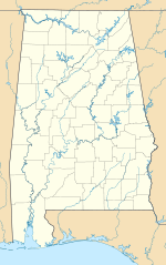 5R7 Location of airport in Alabama  5R7 5R7 (the United States) | |||||||||||
| Runways | |||||||||||
| |||||||||||
| Statistics (2017) | |||||||||||
| |||||||||||
Facilities and aircraft edit
Roy E. Ray Airport covers an area of 41 acres (17 ha) at an elevation of 87 feet (27 m) above mean sea level. It has one runway designated 18/36 with a turf surface measuring 2,000 by 150 feet (610 x 46 m).[1]
For the 12-month period ending May 12, 2011, the airport had 6,978 aircraft operations, an average of 19 per day. At that time there were 35 aircraft based at this airport: 91% single-engine, 6% multi-engine and 3% ultralight.[1]
See also edit
References edit
External links edit
- Aerial image as of 11 February 1997 from USGS The National Map
- Resources for this airport:
- FAA airport information for 5R7
- AirNav airport information for 5R7
- FlightAware airport information and live flight tracker
- SkyVector aeronautical chart for 5R7