
KNOWPIA
WELCOME TO KNOWPIA

Rucphen 
Summary
Rucphen (pronounced [ˈrʏkfə(n)] ⓘ) is a municipality and a town in the southern Netherlands between Roosendaal and Etten-Leur, south of the railway, but without a train-station.
Rucphen | |
|---|---|
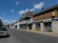
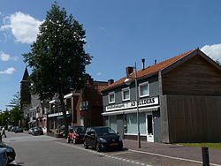 Street through Rucphen | |
 Flag  Coat of arms | |
 Location in North Brabant | |
| Coordinates: 51°32′N 4°35′E / 51.533°N 4.583°E | |
| Country | Netherlands |
| Province | North Brabant |
| Government | |
| • Body | Municipal council |
| • Mayor | Marjolein van der Meer-Mohr (VVD) |
| Area | |
| • Total | 64.48 km2 (24.90 sq mi) |
| • Land | 64.41 km2 (24.87 sq mi) |
| • Water | 0.07 km2 (0.03 sq mi) |
| Elevation | 10 m (30 ft) |
| Population (January 2021)[4] | |
| • Total | 23,080 |
| • Density | 358/km2 (930/sq mi) |
| Demonym | Rucphenaar |
| Time zone | UTC+1 (CET) |
| • Summer (DST) | UTC+2 (CEST) |
| Postcode | 4710–4722, 4735 |
| Area code | 0165 |
| Website | www |
Population centres edit
- Sint Willebrord ('t Heike) (pop.: 9,320)
- Sprundel (5,090)
- Rucphen (4,580)
- Zegge (2,210)
- Schijf (1,430)
Topography edit

Dutch Topographic map of the municipality of Rucphen, June 2015
Notable people edit
- Hendrik Detmers (1761 in Sprundel – 1825) a Dutch general in the Battle of Waterloo
- Dick Jaspers (born 1965 in Sint Willebrord) a Dutch professional carom billiards player
- John Kerstens (born 1965 in Zegge) a Dutch politician and former trade union leader
- Donny Gorter (born 1988) a Dutch professional footballer with over 200 club caps
- Tessa ter Sluis (born 1995 in Sint Willebrord) a Dutch professional squash player
Gallery edit
-
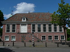 Oude Raadhuis van Rucphen
 -
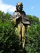 Heilig Hartbeeld aan de zijkant van de Martinuskerk in Rucphen
 -
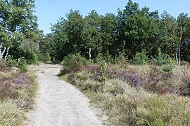 Rucphense Heide
 -
 Dorpsstraat in Sint Willebrord


See also edit
References edit
- ^ "mr. Marjolein van der Meer Mohr" (in Dutch). Gemeente Rucphen. Archived from the original on 6 June 2014. Retrieved 3 June 2014.
- ^ "Kerncijfers wijken en buurten 2020" [Key figures for neighbourhoods 2020]. StatLine (in Dutch). CBS. 24 July 2020. Retrieved 19 September 2020.
- ^ "Postcodetool for 4715RK". Actueel Hoogtebestand Nederland (in Dutch). Het Waterschapshuis. Retrieved 3 June 2014.
- ^ "Bevolkingsontwikkeling; regio per maand" [Population growth; regions per month]. CBS Statline (in Dutch). CBS. 1 January 2021. Retrieved 2 January 2022.
External links edit
 Media related to Rucphen at Wikimedia Commons
- Official website