
KNOWPIA
WELCOME TO KNOWPIA

Saint-Amand-Villages 
Summary
Saint-Amand-Villages (French pronunciation: [sɛ̃.t‿amɑ̃ vilaʒ]) is a commune in the department of Manche, northwestern France. The municipality was established on 1 January 2017 by merger of the former communes of Saint-Amand (the seat) and Placy-Montaigu.[3]
Saint-Amand-Villages | |
|---|---|
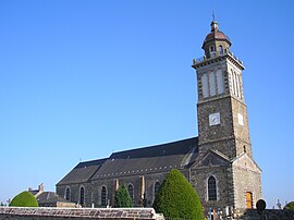 The church in Saint-Amand | |
Location of Saint-Amand-Villages .mw-parser-output .locmap .od{position:absolute}.mw-parser-output .locmap .id{position:absolute;line-height:0}.mw-parser-output .locmap .l0{font-size:0;position:absolute}.mw-parser-output .locmap .pv{line-height:110%;position:absolute;text-align:center}.mw-parser-output .locmap .pl{line-height:110%;position:absolute;top:-0.75em;text-align:right}.mw-parser-output .locmap .pr{line-height:110%;position:absolute;top:-0.75em;text-align:left}.mw-parser-output .locmap .pv>div{display:inline;padding:1px}.mw-parser-output .locmap .pl>div{display:inline;padding:1px;float:right}.mw-parser-output .locmap .pr>div{display:inline;padding:1px;float:left}html.skin-theme-clientpref-night .mw-parser-output .od,html.skin-theme-clientpref-night .mw-parser-output .od .pv>div,html.skin-theme-clientpref-night .mw-parser-output .od .pl>div,html.skin-theme-clientpref-night .mw-parser-output .od .pr>div{background:#000;color:#fff}html.skin-theme-clientpref-night .mw-parser-output .locmap{filter:grayscale(0.6)}@media(prefers-color-scheme:dark){html.skin-theme-clientpref-os .mw-parser-output .locmap{filter:grayscale(0.6)}html.skin-theme-clientpref-os .mw-parser-output .od,html.skin-theme-clientpref-os .mw-parser-output .od .pv>div,html.skin-theme-clientpref-os .mw-parser-output .od .pl>div,html.skin-theme-clientpref-os .mw-parser-output .od .pr>div{background:#000;color:#fff}}  Saint-Amand-Villages  Saint-Amand-Villages | |
| Coordinates: 49°02′35″N 0°57′50″W / 49.043°N 0.964°W | |
| Country | France |
| Region | Normandy |
| Department | Manche |
| Arrondissement | Saint-Lô |
| Canton | Condé-sur-Vire |
| Intercommunality | Saint-Lô Agglo |
| Government | |
| • Mayor (2020–2026) | Jean Lebouvier[1] |
| Area 1 | 38.19 km2 (14.75 sq mi) |
| Population (2021)[2] | 2,520 |
| • Density | 66/km2 (170/sq mi) |
| Time zone | UTC+01:00 (CET) |
| • Summer (DST) | UTC+02:00 (CEST) |
| INSEE/Postal code | 50444 /50160 |
| 1 French Land Register data, which excludes lakes, ponds, glaciers > 1 km2 (0.386 sq mi or 247 acres) and river estuaries. | |
Population edit
| Year | Pop. | ±% p.a. |
|---|---|---|
| 1968 | 1,633 | — |
| 1975 | 1,506 | −1.15% |
| 1982 | 1,765 | +2.29% |
| 1990 | 2,006 | +1.61% |
| 1999 | 2,182 | +0.94% |
| 2007 | 2,387 | +1.13% |
| 2012 | 2,550 | +1.33% |
| 2017 | 2,529 | −0.17% |
| Source: INSEE[4] | ||
See also edit
References edit
Wikimedia Commons has media related to Saint-Amand-Villages.
- ^ "Répertoire national des élus: les maires" (in French). data.gouv.fr, Plateforme ouverte des données publiques françaises. 13 September 2022.
- ^ "Populations légales 2021". The National Institute of Statistics and Economic Studies. 28 December 2023.
- ^ Arrêté préfectoral 22 July 2016 (in French)
- ^ Population en historique depuis 1968, INSEE