
KNOWPIA
WELCOME TO KNOWPIA

Saint-Ganton 
Summary
Saint-Ganton (French pronunciation: [sɛ̃ ɡɑ̃tɔ̃]; Gallo: Saent-Ganton, Breton: Sant-Weganton) is a commune in the Ille-et-Vilaine department in Brittany in northwestern France.
Saint-Ganton
| |
|---|---|
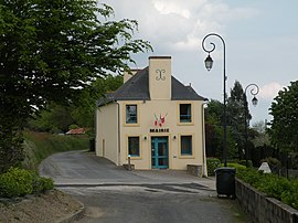 The town hall of Saint-Ganton | |
Location of Saint-Ganton .mw-parser-output .locmap .od{position:absolute}.mw-parser-output .locmap .id{position:absolute;line-height:0}.mw-parser-output .locmap .l0{font-size:0;position:absolute}.mw-parser-output .locmap .pv{line-height:110%;position:absolute;text-align:center}.mw-parser-output .locmap .pl{line-height:110%;position:absolute;top:-0.75em;text-align:right}.mw-parser-output .locmap .pr{line-height:110%;position:absolute;top:-0.75em;text-align:left}.mw-parser-output .locmap .pv>div{display:inline;padding:1px}.mw-parser-output .locmap .pl>div{display:inline;padding:1px;float:right}.mw-parser-output .locmap .pr>div{display:inline;padding:1px;float:left}html.skin-theme-clientpref-night .mw-parser-output .od,html.skin-theme-clientpref-night .mw-parser-output .od .pv>div,html.skin-theme-clientpref-night .mw-parser-output .od .pl>div,html.skin-theme-clientpref-night .mw-parser-output .od .pr>div{background:#000;color:#fff}html.skin-theme-clientpref-night .mw-parser-output .locmap{filter:grayscale(0.6)}@media(prefers-color-scheme:dark){html.skin-theme-clientpref-os .mw-parser-output .locmap{filter:grayscale(0.6)}html.skin-theme-clientpref-os .mw-parser-output .od,html.skin-theme-clientpref-os .mw-parser-output .od .pv>div,html.skin-theme-clientpref-os .mw-parser-output .od .pl>div,html.skin-theme-clientpref-os .mw-parser-output .od .pr>div{background:#000;color:#fff}}  Saint-Ganton  Saint-Ganton | |
| Coordinates: 47°45′57″N 1°53′20″W / 47.7658°N 1.8889°W | |
| Country | France |
| Region | Brittany |
| Department | Ille-et-Vilaine |
| Arrondissement | Redon |
| Canton | Redon |
| Intercommunality | Redon Agglomération |
| Government | |
| • Mayor (2020–2026) | Fabienne Cottais[1] |
| Area 1 | 14.08 km2 (5.44 sq mi) |
| Population (2021)[2] | 419 |
| • Density | 30/km2 (77/sq mi) |
| Time zone | UTC+01:00 (CET) |
| • Summer (DST) | UTC+02:00 (CEST) |
| INSEE/Postal code | 35268 /35550 |
| Elevation | 25–102 m (82–335 ft) |
| 1 French Land Register data, which excludes lakes, ponds, glaciers > 1 km2 (0.386 sq mi or 247 acres) and river estuaries. | |
Population edit
| Year | Pop. | ±% |
|---|---|---|
| 1962 | 476 | — |
| 1968 | 490 | +2.9% |
| 1975 | 461 | −5.9% |
| 1982 | 405 | −12.1% |
| 1990 | 381 | −5.9% |
| 1999 | 388 | +1.8% |
| 2011 | 418 | +7.7% |
See also edit
References edit
- ^ "Répertoire national des élus: les maires". data.gouv.fr, Plateforme ouverte des données publiques françaises (in French). 9 August 2021.
- ^ "Populations légales 2021". The National Institute of Statistics and Economic Studies. 28 December 2023.
External links edit
Wikimedia Commons has media related to Saint-Ganton.
- Mayors of Ille-et-Vilaine Association (in French)
See also edit