


Summary
Saint-Ghislain (French pronunciation: [sɛ̃ ɡilɛ̃] ⓘ; Picard: Saint-Guilagne; Walloon: Sint-Guilin) is a city and municipality of Wallonia located in the province of Hainaut, Belgium.
Saint-Ghislain
Saint-Guilagne (Picard) | |
|---|---|
 Saint-Ghislain: the former town hall (1752), the new church, and the tower of the old church (16th century) | |
 Flag  Coat of arms | |
Location of Saint-Ghislain .mw-parser-output .locmap .od{position:absolute}.mw-parser-output .locmap .id{position:absolute;line-height:0}.mw-parser-output .locmap .l0{font-size:0;position:absolute}.mw-parser-output .locmap .pv{line-height:110%;position:absolute;text-align:center}.mw-parser-output .locmap .pl{line-height:110%;position:absolute;top:-0.75em;text-align:right}.mw-parser-output .locmap .pr{line-height:110%;position:absolute;top:-0.75em;text-align:left}.mw-parser-output .locmap .pv>div{display:inline;padding:1px}.mw-parser-output .locmap .pl>div{display:inline;padding:1px;float:right}.mw-parser-output .locmap .pr>div{display:inline;padding:1px;float:left}html.skin-theme-clientpref-night .mw-parser-output .od,html.skin-theme-clientpref-night .mw-parser-output .od .pv>div,html.skin-theme-clientpref-night .mw-parser-output .od .pl>div,html.skin-theme-clientpref-night .mw-parser-output .od .pr>div{background:#000;color:#fff}html.skin-theme-clientpref-night .mw-parser-output .locmap{filter:grayscale(0.6)}@media(prefers-color-scheme:dark){html.skin-theme-clientpref-os .mw-parser-output .locmap{filter:grayscale(0.6)}html.skin-theme-clientpref-os .mw-parser-output .od,html.skin-theme-clientpref-os .mw-parser-output .od .pv>div,html.skin-theme-clientpref-os .mw-parser-output .od .pl>div,html.skin-theme-clientpref-os .mw-parser-output .od .pr>div{background:#000;color:#fff}}  Saint-Ghislain Location in Belgium
Location of Saint-Ghislain in Hainaut 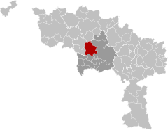 | |
| Coordinates: 50°27′N 03°49′E / 50.450°N 3.817°E | |
| Country | |
| Community | French Community |
| Region | Wallonia |
| Province | Hainaut |
| Arrondissement | Mons |
| Government | |
| • Mayor | Daniel Olivier (PS) |
| • Governing party/ies | PS - MR & Citoyens |
| Area | |
| • Total | 70.59 km2 (27.25 sq mi) |
| Population (2018-01-01)[1] | |
| • Total | 23,335 |
| • Density | 330/km2 (860/sq mi) |
| Postal codes | 7330-7334 |
| NIS code | 53070 |
| Area codes | 065 |
| Website | www.saint-ghislain.be |
On 1 January 2018 the municipality had 23,335 inhabitants. The total area is 70.18 square kilometres (27.10 sq mi), giving a population density of 333 inhabitants per square kilometre (860/sq mi).
The municipality consists of the following districts: Baudour, Hautrage, Neufmaison, Saint-Ghislain, Sirault, Tertre et Villerot.
History edit
The town is named after Saint Ghislain. In the 7th century, with two unknown disciples Ghislain made a clearing in the vicinity of Castrilocus (now Mons), later taking up his abode at a place called Ursidongus, where he built an oratory or chapel dedicated to Saints Peter and Paul. Ursidongus was later named after him.
Economy edit
Google chose Saint-Ghislain in 2007 to host its new major European datacenter.
People born in Saint-Ghislain edit
- Johannes Ockeghem, composer (between 1410 and 1425)
References edit
- ^ "Wettelijke Bevolking per gemeente op 1 januari 2018". Statbel. Retrieved 9 March 2019.
External links edit
 Media related to Saint-Ghislain at Wikimedia Commons