


Summary
Saint-Inglevert (French pronunciation: [sɛ̃.t‿ɛ̃ɡləvɛʁ]; West Flemish: Santingeveld) is a commune in the Pas-de-Calais department in the Hauts-de-France region of France.[3]
Saint-Inglevert | |
|---|---|
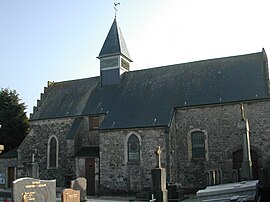 The church of Saint-Inglevert | |
 Coat of arms | |
Location of Saint-Inglevert .mw-parser-output .locmap .od{position:absolute}.mw-parser-output .locmap .id{position:absolute;line-height:0}.mw-parser-output .locmap .l0{font-size:0;position:absolute}.mw-parser-output .locmap .pv{line-height:110%;position:absolute;text-align:center}.mw-parser-output .locmap .pl{line-height:110%;position:absolute;top:-0.75em;text-align:right}.mw-parser-output .locmap .pr{line-height:110%;position:absolute;top:-0.75em;text-align:left}.mw-parser-output .locmap .pv>div{display:inline;padding:1px}.mw-parser-output .locmap .pl>div{display:inline;padding:1px;float:right}.mw-parser-output .locmap .pr>div{display:inline;padding:1px;float:left}html.skin-theme-clientpref-night .mw-parser-output .od,html.skin-theme-clientpref-night .mw-parser-output .od .pv>div,html.skin-theme-clientpref-night .mw-parser-output .od .pl>div,html.skin-theme-clientpref-night .mw-parser-output .od .pr>div{background:#000;color:#fff}html.skin-theme-clientpref-night .mw-parser-output .locmap{filter:grayscale(0.6)}@media(prefers-color-scheme:dark){html.skin-theme-clientpref-os .mw-parser-output .locmap{filter:grayscale(0.6)}html.skin-theme-clientpref-os .mw-parser-output .od,html.skin-theme-clientpref-os .mw-parser-output .od .pv>div,html.skin-theme-clientpref-os .mw-parser-output .od .pl>div,html.skin-theme-clientpref-os .mw-parser-output .od .pr>div{background:#000;color:#fff}}  Saint-Inglevert  Saint-Inglevert | |
| Coordinates: 50°52′33″N 1°44′37″E / 50.8758°N 1.7436°E | |
| Country | France |
| Region | Hauts-de-France |
| Department | Pas-de-Calais |
| Arrondissement | Boulogne-sur-Mer |
| Canton | Desvres |
| Intercommunality | CC Terre des Deux Caps |
| Government | |
| • Mayor (2020–2026) | Francis Bouclet[1] |
| Area 1 | 6.6 km2 (2.5 sq mi) |
| Population (2021)[2] | 808 |
| • Density | 120/km2 (320/sq mi) |
| Time zone | UTC+01:00 (CET) |
| • Summer (DST) | UTC+02:00 (CEST) |
| INSEE/Postal code | 62751 /62250 |
| Elevation | 85–163 m (279–535 ft) (avg. 123 m or 404 ft) |
| 1 French Land Register data, which excludes lakes, ponds, glaciers > 1 km2 (0.386 sq mi or 247 acres) and river estuaries. | |
Topnymy edit
The etymology of Saint-Inglevert, first attested as Sontingeveld in 1140, is now generally agreed to derive from a Common Germanic anthroponym *Sondo, followed by -ingen "people of" (see nearby e.g. Tardinghen) + -veld "field". The name was no longer understood sometime in the late Early Middle Ages, leading to a popular re-interpretation of the first syllable, "sant-ingheveld". This led to a folk etymology of prefixed saint (as is very common in toponymy across France), thus shaping Saint Inglevert. Thus the meaning is, "the field of the people of Sondo".
Despite old local veneration, if there ever truly was a "Saint Inglevert" which perhaps influenced the name, the holy figure is unknown and lost to time.
Geography edit
Saint-Inglevert is situated some 12 miles (19 km) north of Boulogne, at the junction of the D244 road with the A16 autoroute.
Population edit
| Year | Pop. | ±% p.a. |
|---|---|---|
| 1968 | 433 | — |
| 1975 | 450 | +0.55% |
| 1982 | 420 | −0.98% |
| 1990 | 502 | +2.25% |
| 1999 | 539 | +0.79% |
| 2007 | 691 | +3.15% |
| 2012 | 733 | +1.19% |
| 2017 | 783 | +1.33% |
| Source: INSEE[4] | ||
Places of interest edit
- The church of St. Barnabé dating from the sixteenth century.
- Traces of an old abbey-hospital.
- Saint-Inglevert Airfield
See also edit
References edit
- ^ "Répertoire national des élus: les maires". data.gouv.fr, Plateforme ouverte des données publiques françaises (in French). 2 December 2020.
- ^ "Populations légales 2021". The National Institute of Statistics and Economic Studies. 28 December 2023.
- ^ INSEE commune file
- ^ Population en historique depuis 1968, INSEE
External links edit
- Saint-Inglevert Airfield
- St. Inglevert joust