
KNOWPIA
WELCOME TO KNOWPIA

Saint-Jean-du-Cardonnay 
Summary
Saint-Jean-du-Cardonnay (French pronunciation: [sɛ̃ ʒɑ̃ dy kaʁdɔnɛ]) is a commune in the Seine-Maritime department in the Normandy region in northern France.
Saint-Jean-du-Cardonnay | |
|---|---|
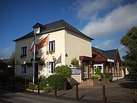 The town hall in Saint-Jean-du-Cardonnay | |
 Coat of arms | |
Location of Saint-Jean-du-Cardonnay .mw-parser-output .locmap .od{position:absolute}.mw-parser-output .locmap .id{position:absolute;line-height:0}.mw-parser-output .locmap .l0{font-size:0;position:absolute}.mw-parser-output .locmap .pv{line-height:110%;position:absolute;text-align:center}.mw-parser-output .locmap .pl{line-height:110%;position:absolute;top:-0.75em;text-align:right}.mw-parser-output .locmap .pr{line-height:110%;position:absolute;top:-0.75em;text-align:left}.mw-parser-output .locmap .pv>div{display:inline;padding:1px}.mw-parser-output .locmap .pl>div{display:inline;padding:1px;float:right}.mw-parser-output .locmap .pr>div{display:inline;padding:1px;float:left}html.skin-theme-clientpref-night .mw-parser-output .od,html.skin-theme-clientpref-night .mw-parser-output .od .pv>div,html.skin-theme-clientpref-night .mw-parser-output .od .pl>div,html.skin-theme-clientpref-night .mw-parser-output .od .pr>div{background:#000;color:#fff}html.skin-theme-clientpref-night .mw-parser-output .locmap{filter:grayscale(0.6)}@media(prefers-color-scheme:dark){html.skin-theme-clientpref-os .mw-parser-output .locmap{filter:grayscale(0.6)}html.skin-theme-clientpref-os .mw-parser-output .od,html.skin-theme-clientpref-os .mw-parser-output .od .pv>div,html.skin-theme-clientpref-os .mw-parser-output .od .pl>div,html.skin-theme-clientpref-os .mw-parser-output .od .pr>div{background:#000;color:#fff}}  Saint-Jean-du-Cardonnay  Saint-Jean-du-Cardonnay | |
| Coordinates: 49°30′25″N 1°00′36″E / 49.5069°N 1.01°E | |
| Country | France |
| Region | Normandy |
| Department | Seine-Maritime |
| Arrondissement | Rouen |
| Canton | Notre-Dame-de-Bondeville |
| Government | |
| • Mayor (2020–2026) | Jacques Niel[1] |
| Area 1 | 7.52 km2 (2.90 sq mi) |
| Population (2021)[2] | 1,340 |
| • Density | 180/km2 (460/sq mi) |
| Time zone | UTC+01:00 (CET) |
| • Summer (DST) | UTC+02:00 (CEST) |
| INSEE/Postal code | 76594 /76150 |
| Elevation | 55–146 m (180–479 ft) (avg. 130 m or 430 ft) |
| 1 French Land Register data, which excludes lakes, ponds, glaciers > 1 km2 (0.386 sq mi or 247 acres) and river estuaries. | |
Geography edit
A village of forestry and farming situated in the Roumois, just 7 miles (11 km) northwest of the centre of Rouen at the junction of the D90, D267 with the D6015 road.
Population edit
| Year | Pop. | ±% p.a. |
|---|---|---|
| 1968 | 773 | — |
| 1975 | 1,015 | +3.97% |
| 1982 | 1,094 | +1.08% |
| 1990 | 1,270 | +1.88% |
| 1999 | 1,298 | +0.24% |
| 2007 | 1,345 | +0.45% |
| 2012 | 1,352 | +0.10% |
| 2017 | 1,377 | +0.37% |
| Source: INSEE[3] | ||
Places of interest edit
- The church of St.Jean, dating from the sixteenth century.
- A seventeenth-century chateau.
- A chapel built in 1820.
See also edit
References edit
- ^ Liste des maires du département de la Seine-Maritime, 10 August 2020
- ^ "Populations légales 2021". The National Institute of Statistics and Economic Studies. 28 December 2023.
- ^ Population en historique depuis 1968, INSEE
Wikimedia Commons has media related to Saint-Jean-du-Cardonnay.