
KNOWPIA
WELCOME TO KNOWPIA

Saint-Malo-de-Phily 
Summary
Saint-Malo-de-Phily (French pronunciation: [sɛ̃ malo də fili]; Breton: Sant-Maloù-Fili) is a commune in the Ille-et-Vilaine department in Brittany in northwestern France. It is about 25 km south of Rennes.
Saint-Malo-de-Phily
Sant-Maloù-Fili (Breton) | |
|---|---|
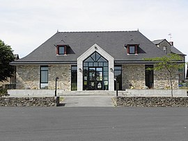 The town hall of Saint-Malo-de-Phily | |
Location of Saint-Malo-de-Phily .mw-parser-output .locmap .od{position:absolute}.mw-parser-output .locmap .id{position:absolute;line-height:0}.mw-parser-output .locmap .l0{font-size:0;position:absolute}.mw-parser-output .locmap .pv{line-height:110%;position:absolute;text-align:center}.mw-parser-output .locmap .pl{line-height:110%;position:absolute;top:-0.75em;text-align:right}.mw-parser-output .locmap .pr{line-height:110%;position:absolute;top:-0.75em;text-align:left}.mw-parser-output .locmap .pv>div{display:inline;padding:1px}.mw-parser-output .locmap .pl>div{display:inline;padding:1px;float:right}.mw-parser-output .locmap .pr>div{display:inline;padding:1px;float:left}html.skin-theme-clientpref-night .mw-parser-output .od,html.skin-theme-clientpref-night .mw-parser-output .od .pv>div,html.skin-theme-clientpref-night .mw-parser-output .od .pl>div,html.skin-theme-clientpref-night .mw-parser-output .od .pr>div{background:#000;color:#fff}html.skin-theme-clientpref-night .mw-parser-output .locmap{filter:grayscale(0.6)}@media(prefers-color-scheme:dark){html.skin-theme-clientpref-os .mw-parser-output .locmap{filter:grayscale(0.6)}html.skin-theme-clientpref-os .mw-parser-output .od,html.skin-theme-clientpref-os .mw-parser-output .od .pv>div,html.skin-theme-clientpref-os .mw-parser-output .od .pl>div,html.skin-theme-clientpref-os .mw-parser-output .od .pr>div{background:#000;color:#fff}}  Saint-Malo-de-Phily  Saint-Malo-de-Phily | |
| Coordinates: 47°52′41″N 1°47′14″W / 47.8781°N 1.7872°W | |
| Country | France |
| Region | Brittany |
| Department | Ille-et-Vilaine |
| Arrondissement | Redon |
| Canton | Redon |
| Intercommunality | Vallons de Haute-Bretagne |
| Government | |
| • Mayor (2020–2026) | Marie-Claire Brault[1] |
| Area 1 | 18.77 km2 (7.25 sq mi) |
| Population (2021)[2] | 1,069 |
| • Density | 57/km2 (150/sq mi) |
| Time zone | UTC+01:00 (CET) |
| • Summer (DST) | UTC+02:00 (CEST) |
| INSEE/Postal code | 35289 /35480 |
| Elevation | 5–114 m (16–374 ft) |
| 1 French Land Register data, which excludes lakes, ponds, glaciers > 1 km2 (0.386 sq mi or 247 acres) and river estuaries. | |
Population edit
| Year | Pop. | ±% |
|---|---|---|
| 1962 | 648 | — |
| 1968 | 659 | +1.7% |
| 1975 | 647 | −1.8% |
| 1982 | 637 | −1.5% |
| 1990 | 671 | +5.3% |
| 1999 | 657 | −2.1% |
| 2009 | 880 | +33.9% |
See also edit
References edit
- ^ "Répertoire national des élus: les maires". data.gouv.fr, Plateforme ouverte des données publiques françaises (in French). 9 August 2021.
- ^ "Populations légales 2021". The National Institute of Statistics and Economic Studies. 28 December 2023.
External links edit
Wikimedia Commons has media related to Saint-Malo-de-Phily.
- Base Mérimée: Search for heritage in the commune, Ministère français de la Culture. (in French)
- Mayors of Ille-et-Vilaine Association (in French)