


Summary
Sakai (坂井市, Sakai-shi) is a city located in Fukui Prefecture, Japan. As of 10 May 2018[update], the city had an estimated population of 92,210 in 31,509 households and a population density of 550 persons per km2.[1] The total area of the city was 209.67 square kilometres (80.95 sq mi).
Sakai
坂井市 | |
|---|---|
 Sakai City Hall | |
 Flag  Seal | |
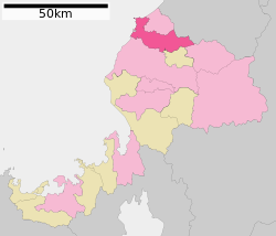 Location of Sakai in Fukui Prefecture | |
 Sakai | |
| Coordinates: 36°10′1″N 136°13′53.2″E / 36.16694°N 136.231444°E | |
| Country | Japan |
| Region | Chūbu (Hokuriku) |
| Prefecture | Fukui |
| Government | |
| • - Mayor | Norio Sakamoto |
| Area | |
| • Total | 209.67 km2 (80.95 sq mi) |
| Population (May 10, 2018) | |
| • Total | 92,210 |
| • Density | 440/km2 (1,100/sq mi) |
| Time zone | UTC+9 (Japan Standard Time) |
| Phone number | 0776-66-1500 |
| Address | 1-1 Shimoshinjō, Sakai-chō, Sakai-shi, Fukui-ken 919-0592 |
| Climate | Cfa |
| Website | www |
| Symbols | |
| Bird | Larus canus |
| Flower | Lilium |
| Tree | Cherry blossom |

Geography edit
Sakai is located in far northern Fukui Prefecture, bordered by the city of Awara and Ishikawa Prefecture to the north and the Sea of Japan to the northeast, The city of Fukui borders the city to the south. The Kuzuryū River flows through the city.
Neighbouring municipalities edit
Climate edit
Sakai has a Humid climate (Köppen Cfa) characterized by warm, wet summers and cold winters with heavy snowfall. The average annual temperature in Sakai is 14.3 °C. The average annual rainfall is 2476 mm with September as the wettest month. The temperatures are highest on average in August, at around 26.9 °C, and lowest in January, at around 2.8 °C.[2]
| Climate data for Mikuni, Sakai (1991−2020 normals, extremes 1978−present) | |||||||||||||
|---|---|---|---|---|---|---|---|---|---|---|---|---|---|
| Month | Jan | Feb | Mar | Apr | May | Jun | Jul | Aug | Sep | Oct | Nov | Dec | Year |
| Record high °C (°F) | 16.4 (61.5) |
20.0 (68.0) |
23.8 (74.8) |
28.8 (83.8) |
33.4 (92.1) |
33.8 (92.8) |
38.9 (102.0) |
39.7 (103.5) |
37.6 (99.7) |
32.3 (90.1) |
26.3 (79.3) |
21.8 (71.2) |
39.7 (103.5) |
| Mean daily maximum °C (°F) | 6.9 (44.4) |
7.4 (45.3) |
11.0 (51.8) |
16.3 (61.3) |
21.1 (70.0) |
24.3 (75.7) |
28.4 (83.1) |
30.2 (86.4) |
26.2 (79.2) |
21.0 (69.8) |
15.5 (59.9) |
9.8 (49.6) |
18.2 (64.7) |
| Daily mean °C (°F) | 3.5 (38.3) |
3.7 (38.7) |
6.7 (44.1) |
11.8 (53.2) |
16.7 (62.1) |
20.5 (68.9) |
24.7 (76.5) |
26.2 (79.2) |
22.3 (72.1) |
16.8 (62.2) |
11.2 (52.2) |
6.1 (43.0) |
14.2 (57.5) |
| Mean daily minimum °C (°F) | 0.5 (32.9) |
0.4 (32.7) |
2.7 (36.9) |
7.5 (45.5) |
12.8 (55.0) |
17.4 (63.3) |
21.9 (71.4) |
23.0 (73.4) |
18.8 (65.8) |
13.0 (55.4) |
7.3 (45.1) |
2.8 (37.0) |
10.7 (51.2) |
| Record low °C (°F) | −6.8 (19.8) |
−6.8 (19.8) |
−4.0 (24.8) |
−1.6 (29.1) |
3.4 (38.1) |
9.4 (48.9) |
14.4 (57.9) |
11.2 (52.2) |
9.0 (48.2) |
2.5 (36.5) |
−0.5 (31.1) |
−4.4 (24.1) |
−6.8 (19.8) |
| Average precipitation mm (inches) | 206.9 (8.15) |
123.6 (4.87) |
138.3 (5.44) |
125.0 (4.92) |
139.8 (5.50) |
155.4 (6.12) |
228.4 (8.99) |
147.1 (5.79) |
218.2 (8.59) |
159.8 (6.29) |
182.8 (7.20) |
253.9 (10.00) |
2,079.2 (81.86) |
| Average precipitation days (≥ 1.0 mm) | 23.4 | 18.1 | 15.5 | 11.6 | 10.6 | 10.7 | 12.0 | 8.8 | 11.6 | 12.5 | 16.6 | 23.4 | 174.8 |
| Mean monthly sunshine hours | 56.5 | 93.3 | 152.0 | 190.0 | 213.4 | 170.4 | 179.6 | 228.9 | 165.4 | 158.3 | 107.0 | 65.1 | 1,777.1 |
| Source: Japan Meteorological Agency[3][4] | |||||||||||||
| Climate data for Harue, Fukui (2003−2020 normals, extremes 2003−present) | |||||||||||||
|---|---|---|---|---|---|---|---|---|---|---|---|---|---|
| Month | Jan | Feb | Mar | Apr | May | Jun | Jul | Aug | Sep | Oct | Nov | Dec | Year |
| Record high °C (°F) | 15.7 (60.3) |
20.7 (69.3) |
24.2 (75.6) |
31.1 (88.0) |
34.3 (93.7) |
34.2 (93.6) |
39.0 (102.2) |
37.5 (99.5) |
37.2 (99.0) |
32.5 (90.5) |
26.5 (79.7) |
23.8 (74.8) |
39.0 (102.2) |
| Mean daily maximum °C (°F) | 6.6 (43.9) |
7.7 (45.9) |
11.9 (53.4) |
17.6 (63.7) |
22.9 (73.2) |
26.2 (79.2) |
29.8 (85.6) |
31.8 (89.2) |
27.7 (81.9) |
22.0 (71.6) |
16.1 (61.0) |
9.6 (49.3) |
19.2 (66.5) |
| Daily mean °C (°F) | 3.1 (37.6) |
3.8 (38.8) |
7.1 (44.8) |
12.4 (54.3) |
18.0 (64.4) |
22.0 (71.6) |
25.8 (78.4) |
27.2 (81.0) |
23.1 (73.6) |
17.1 (62.8) |
11.5 (52.7) |
5.9 (42.6) |
14.8 (58.6) |
| Mean daily minimum °C (°F) | 0.2 (32.4) |
0.3 (32.5) |
2.6 (36.7) |
7.3 (45.1) |
13.4 (56.1) |
18.3 (64.9) |
22.5 (72.5) |
23.6 (74.5) |
19.3 (66.7) |
12.9 (55.2) |
7.5 (45.5) |
2.6 (36.7) |
10.9 (51.6) |
| Record low °C (°F) | −6.9 (19.6) |
−6.8 (19.8) |
−3.4 (25.9) |
−1.9 (28.6) |
4.3 (39.7) |
9.8 (49.6) |
17.1 (62.8) |
15.1 (59.2) |
11.0 (51.8) |
3.9 (39.0) |
−0.2 (31.6) |
−5.9 (21.4) |
−6.9 (19.6) |
| Average precipitation mm (inches) | 180.7 (7.11) |
112.4 (4.43) |
129.5 (5.10) |
125.5 (4.94) |
136.3 (5.37) |
139.8 (5.50) |
241.4 (9.50) |
148.8 (5.86) |
225.3 (8.87) |
157.0 (6.18) |
167.2 (6.58) |
278.5 (10.96) |
2,029.9 (79.92) |
| Average precipitation days (≥ 1.0 mm) | 21.7 | 15.3 | 14.6 | 11.5 | 10.3 | 10.1 | 12.7 | 9.0 | 11.9 | 11.8 | 16.1 | 23.2 | 168.2 |
| Source: Japan Meteorological Agency[5][6] | |||||||||||||
Demographics edit
Per Japanese census data,[7] the population of Sakai has recently plateaued after a long period of growth. Sakai is the second most populous city in Fukui Prefecture. The Harue and Maruoka neighborhoods in the southern part of the city function as commuter towns for the city of Fukui.
| Year | Pop. | ±% |
|---|---|---|
| 1970 | 68,797 | — |
| 1980 | 75,983 | +10.4% |
| 1990 | 83,372 | +9.7% |
| 2000 | 91,173 | +9.4% |
| 2010 | 91,900 | +0.8% |
| 2020 | 88,481 | −3.7% |
History edit
Sakai is part of the ancient Echizen Province. The semi-legendary Kofun period Emperor Keitai is said to have come from the area that is now the Maruoka neighbourhood of Sakai. During the Edo period, the area was divided between the holdings of the Maruoka Domain, Fukui Domain and tenryō holdings directly under control of the Tokugawa shogunate. Following the Meiji restoration, the area was organised into part of Sakai District in Fukui Prefecture. The epicentre of the 1948 Fukui earthquake was in Maruoka.[8] The towns of Mikuni and Maruoka were created with the establishment of the modern municipalities system on April 1, 1889. The village of Harue was raised to town status on April 3, 1942. The village of Sakai was created on March 1, 1955 by the merger of the villages of Higashi-Jūgō, Hyōgo and Ōseki. It was raised to town status on April 1, 1961. The modern city of Sakai was established on March 20, 2006, from the merger of the former town of Sakai with the towns of Harue, Maruoka and Mikuni. Sakai District was dissolved as a result of this merger.
Government edit
Sakai has a mayor-council form of government with a directly elected mayor and a unicameral city legislature of 26 members.
Education edit
Sakai has 19 public elementary schools and five middle schools operated by the city government, and three public high school operated by the Fukui Prefectural Board of Education. The prefectural also operates one special education school.
High schools edit
- Maruoka Senior High School
- Mikuni Senior High School
- Sakai Senior High School
Transportation edit
Airport edit
- Fukui Airport (No scheduled flight services.)
Railway edit
As of 16 March 2024, JR West no longer operates in Sakai as its operations on the Hokuriku Main Line were transferred to third-sector company Hapi-line Fukui.[9]
- Hapi-line Fukui
 Echizen Railway Mikuni Awara Line
- Taromaru Angelland - Nishiharue Heartpia - Nishinagata Yurinosato - Shimohyogo Kofuku - Ōzeki - (Awara-shi) - Mizui - Mikuni-Jinja - Mikuni - Mikuni-Minato
Highway edit
Local attractions edit
- Echizen-Kaga Kaigan Quasi-National Park
- Tōjinbō, National Scenic Site and Natural Monument
- Maruoka Castle, one of the 100 Famous Castles of Japan
- Maruoka Domain Battery, National Historic Site
- Rokuroseyama Kofun Cluster, National Historic Site
- Technoport Fukui Stadium
- Mikuni Onsen
Notable people edit
- Shigeharu Nakano (from Maruoka) - author and Communist Party politician
- Chosei Komatsu (from Mikuni) – artistic director of the National Symphony Orchestra of Costa Rica
- Ai Takahashi (from Harue) – former leader of Japanese idol group Morning Musume.
- Kazuhiko Masada (from Mikuni) - Japanese professional wrestler and member of Tokyo Gurentai
References edit
- ^ "Sakai City Population Statistics" (in Japanese). Japan: Sakai City. Retrieved 23 May 2018.
- ^ Sakai climate data
- ^ 観測史上1~10位の値(年間を通じての値). JMA. Retrieved April 1, 2022.
- ^ 気象庁 / 平年値(年・月ごとの値). JMA. Retrieved April 1, 2022.
- ^ 観測史上1~10位の値(年間を通じての値). JMA. Retrieved April 1, 2022.
- ^ 気象庁 / 平年値(年・月ごとの値). JMA. Retrieved April 1, 2022.
- ^ Sakai population statistics
- ^ http://www.seisvol.kishou.go.jp/cgi-bin/shindo_db.cgi?from_YYYY=1948&from_MM=01&from_DD=01&from_hh=00&from_mm=00&to_YYYY=1949&to_MM=01&to_DD=01&to_hh=24&to_mm=00&ORG_PID=24403&pref=40&minimum_shindo=7&station=9999999&max_count=5&PARAM_OK_DATE=%B8%A1%BA%F [dead link]
- ^ "並行在来線「ハピラインふくい」開業 記念グッズに目輝かせるファンも" [Parallel conventional line "Hapi-Line Fukui" opens as commemorative goods go on sale]. Fukui Keizai Shimbun. 16 March 2024. Retrieved 16 March 2024.
External links edit
 Media related to Sakai, Fukui at Wikimedia Commons
 Sakai travel guide from Wikivoyage
- Official website (in Japanese)