


Summary
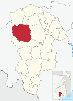
Salboni is a community development block that forms an administrative division in Medinipur Sadar subdivision of Paschim Medinipur district in the Indian state of West Bengal.
Salboni | |
|---|---|
Community development block | |
 | |
| Coordinates: 22°38′36.2″N 87°19′6.2″E / 22.643389°N 87.318389°E | |
| Country | |
| State | West Bengal |
| District | Paschim Medinipur |
| Government | |
| • Type | Federal democracy |
| Area | |
| • Total | 553.39 km2 (213.67 sq mi) |
| Elevation | 41 m (135 ft) |
| Population (2011) | |
| • Total | 188,563 |
| • Density | 340/km2 (880/sq mi) |
| Languages | |
| • Official | Bengali, Santali, English |
| Time zone | UTC+5:30 (IST) |
| PIN | 721147 (Salboni) 721129 (Godapiasal) |
| Area code | 03227 |
| Vehicle registration | WB-34 |
| Literacy | 74.87% |
| Lok Sabha constituency | Jhargram, Medinipur |
| Vidhan Sabha constituency | Salboni, Medinipur |
| Website | paschimmedinipur |
History edit
Red corridor edit
106 districts spanning 10 states across India, described as being part of the Left wing extremism activities, constitutes the Red corridor. In West Bengal the districts of Pashim Medinipur, Bankura, Purulia and Birbhum are part of the Red corridor. However, as of July 2016, there has been no reported incidents of Maoist related activities from these districts for the previous 4 years.[1] In the period 2009-2011 LWE violence resulted in more than 500 deaths and a similar number missing in Paschim Medinipur district. [2]
The Lalgarh movement, which started attracting attention after the failed assassination attempt on Buddhadeb Bhattacharjee, then chief minister of West Bengal, in the Salboni area of Paschim Medinipur district, on 2 November 2008 and the police action that followed, had also spread over to these areas.[3] The movement was not just a political struggle but an armed struggle that concurrently took the look of a social struggle. A large number of CPI (M) activists were killed. Although the epi-centre of the movement was Lalgarh, it was spread across 19 police stations in three adjoining districts – Paschim Medinipur, Bankura and Purulia, all thickly forested and near the border with Jharkhand. The deployment of CRPF and other forces started on 11 June 2009. The movement came to an end after the 2011 state assembly elections and change of government in West Bengal. The death of Kishenji, the Maoist commander, on 24 November 2011 was the last major landmark.[3][4]
From 2009 Maoist violence had rapidly spread across eleven western CD blocks of the district: Binpur I, Binpur II, Salboni, Grahbeta II, Jamboni, Jhargram, Midnapore Sadar, Gopiballavpur I, Gopiballavpur II, Sankrail and Nayagram.[5]
Geography edit
In Salboni CD block 80% of the cultivated area has infertile lateritic soil and 20% has alluvial soil. Salboni CD block is drought prone.[6]
Salboni is located at 22°38′36.2″N 87°19′6.2″E / 22.643389°N 87.318389°E.
Salbani CD block is bounded by Garhbeta II and Garhbeta III CD blocks in the north, Keshpur CD block in the east, Midnapore Sadar CD block in the south and Binpur I CD block in the west.
It is located 28 km from Midnapore, the district headquarters.
Salboni CD block has an area of 553.39 km2. It has 1 panchayat samity, 10 gram panchayats, 134 gram sansads (village councils), 528 mouzas and 411 inhabited villages. Salboni police station serves this block.[7] Headquarters of this CD block is at Salboni.[8]
Salboni CD block had a forest cover of 18,688 hectares, against a total geographical area of 52,639 hectares in 2005-06.[9]
Gram panchayats of Salboni block/ panchayat samiti are: Bankibundh, Bhimpur, Bishnupur, Debagram, Germal, Karnagarh, Kashijora, Lalgeria, Salboni and Satpathi.[10]
Demographics edit
Population edit
According to the 2011 Census of India Salbani CD block had a total population of 188,653, all of which were rural. There were 95,195 (50.46%) males and 93,458 (49.54%) females. Population in the age range 0-6 years was 23,070. Scheduled Castes numbered 35,095 (18.61%) and Scheduled Tribes numbered 32,771 (17.38%).[11]
As per the 2001 census, Salboni block had a total population of 165,193, out of which 84,247 were males and 80,946 were females. Salboni block registered a population growth of 16.71 per cent during the 1991-2001 decade. Decadal growth for the combined Midnapore district was 14.87 per cent.[12] Decadal growth in West Bengal was 17.45 per cent.[13]
Villages in Salbani CD block include (2011 census figures in brackets): Salboni (3,963), Bankibandh (1,125), Bishnupur (1,639), Kashijora (1,409), Garmal (1,324), Satpati (2,360), Lalgere (1,099), Debagram (1,402) and Karnagarh (2,812).[11]
Literacy edit
According to the 2011 census the total number of literates persons in Salbani CD block was 123,974 (74.87% of the population over 6 years) out of which males numbered 69,299 (82.89% of the male population over 6 years) and females numbered 54,675 (66.70% of the female population over 6 years). The gender gap in literacy rates was 16.19%.[11]
See also – List of West Bengal districts ranked by literacy rate
| Literacy in CD Blocks of Paschim Medinipur district |
|---|
| Jhargram subdivision |
| Binpur I – 69.74% |
| Binpur II – 70.46% |
| Gopiballavpur I – 65.44% |
| Gopiballavpur II – 71.40% |
| Jamboni – 72.63% |
| Jhargram – 72.23% |
| Nayagram – 63.70% |
| Sankrail – 73.35% |
| Medinipur Sadar subdivision |
| Garhbeta I – 72.21% |
| Garhbeta II – 75.87% |
| Garhbeta III – 73.42% |
| Keshpur – 77.88% |
| Midnapore Sadar – 70.48% |
| Salboni – 74.87% |
| Ghatal subdivision |
| Chandrakona I – 78.93% |
| Chandrakona II – 75.96% |
| Daspur I – 83.99% |
| Daspur II – 85.62% |
| Ghatal – 81.08% |
| Kharagpur subdivision |
| Dantan I – 73.53% |
| Dantan II – 82.45% |
| Debra – 82.03% |
| Keshiari – 76.78% |
| Kharagpur I – 77.06% |
| Kharagpur II – 76.08% |
| Mohanpur – 80.51% |
| Narayangarh – 78.31% |
| Pingla – 83.57% |
| Sabang – 86.84% |
| Source: 2011 Census: CD Block Wise Primary Census Abstract Data |
Language and religion edit
In the 2011 census Hindus numbered 168,863 and formed 89.51% of the population in Salboni CD block. Muslims numbered 6,000 and formed 3.18% of the population. Others numbered 13,790 and formed 7.31% of the population.[14] Others include Addi Bassi, Marang Boro, Santal, Saranath, Sari Dharma, Sarna, Alchchi, Bidin, Sant, Saevdharm, Seran, Saran, Sarin, Kheria,[15] Christians and other religious communities. Christians and other religious communities. In 2001, Hindus were 88.15%, Muslims 2.84% and tribal religions 8.47% of the population respectively.[16]
At the time of the 2011 census, 83.91% of the population spoke Bengali, 11.58% Santali and 3.60% Kurmali as their first language.[17]
BPL families edit
In Salboni CD block 36.11% families were living below poverty line in 2007.[18]
According to the District Human Development Report of Paschim Medinipur: The 29 CD blocks of the district were classified into four categories based on the poverty ratio. Nayagram, Binpur II and Jamboni CD blocks have very high poverty levels (above 60%). Kharagpur I, Kharagpur II, Sankrail, Garhbeta II, Pingla and Mohanpur CD blocks have high levels of poverty (50-60%), Jhargram, Midnapore Sadar, Dantan I, Gopiballavpur II, Binpur I, Dantan II, Keshiari, Chandrakona I, Gopiballavpur I, Chandrakona II, Narayangarh, Keshpur, Ghatal, Sabang, Garhbeta I, Salboni, Debra and Garhbeta III CD blocks have moderate levels of poverty (25-50%) and Daspur II and Daspur I CD blocks have low levels of poverty (below 25%).[18]
Economy edit
Infrastructure edit
409 or 77% of mouzas in Salboni CD block were electrified by 31 March 2014.[19]
409 mouzas in Salboni CD block had drinking water facilities in 2013-14. There were 95 fertiliser depots, 37 seed stores and 48 fair price shops in the CD block.[19]
Jindal Steel Plant edit
JSW Steel Ltd signed a memorandum of agreement with the Government of West Bengal, on 11 January 2007 for setting up a steel plant at Salboni. The first phase of the proposed 10 million tonnes per annum steel plant was to have a capacity of 3 million tonnes per annuum and was scheduled to be completed in the succeeding four years. The state government agreed to provide 4,300 acres of land on lease.[20][21] The project was delayed for various reasons and issues like land and water were sorted out. On 28 April 2013, the company made it clear that it was not going to move any further without sorting out the issue of supply of iron ore for the steel plant. The company does not have any captive iron ore mines. Additionally there are some problems with coal supplies and a global over production of steel. The steel plant was officially put on hold in December 2014.[22][23][24]
Industry edit
Bharatiya Reserve Bank Note Mudran Private Limited, a wholly owned subsidiary of the Reserve Bank of India, has note printing presses at Salboni and Mysore with a capacity of 16 billion note pieces per year.[25]
OCL India Ltd. (Dalmia Group) commissioned its cement grinding unit at Salboni in 2014.[26] The plant is at Kilapachuria village near Godapiasal.[27]
JSW Cement, had proposed construction of a 2.5 million tonnes slag based cement plant at Salboni. It was initially a part of the now stalled steel project. It proposes to utilise only 135 acres of land for the cement plant and is only a small portion of the land it has been holding since 2008. The land is near Godapiasal Forest.[24]
A Rs. 800 crore project, 2.4 million tonnes per year cement plant of JSW was inaugurated by Mamata Banerjee, Chief Minister of West Bengal, in January 2018.[28][29]
Agriculture edit
Persons engaged in agriculture
in Salboni CD block
Although the Bargadari Act of 1950 recognised the rights of bargadars to a higher share of crops from the land that they tilled, it was not implemented fully. Large tracts, beyond the prescribed limit of land ceiling, remained with the rich landlords. From 1977 onwards major land reforms took place in West Bengal. Land in excess of land ceiling was acquired and distributed amongst the peasants.[30] Following land reforms land ownership pattern has undergone transformation. In 2013-14, persons engaged in agriculture in Salboni CD block could be classified as follows: bargadars 10.54%, patta (document) holders 30.72%, small farmers (possessing land between 1 and 2 hectares) 2.91%, marginal farmers (possessing land up to 1 hectare) 19.61% and agricultural labourers 36.22%.[19]
In 2005-06 the nett cropped area in Salboni CD block was 17,572 hectares and the area in which more than one crop was grown was 12,427 hectares.[31]
The extension of irrigation has played a role in growth of the predominantly agricultural economy.[32] In 2013-14, the total area irrigated in Salboni CD block was 11,910 hectares, out of which 1,450 hectares were irrigated by canal water, 2,325 hectares by tank water, 960 hectares by deep tubewells, 2,600 hectares by shallow tube wells, 300 hectares by river lift irrigation, 1,375 hectares by open dug wells and 2,900 hectares by other methods.[19]
In 2013-14, Salboni CD block produced 37,047 tonnes of Aman paddy, the main winter crop, from 21,161 hectares, 10,185 tonnes of Aus paddy (summer crop) from 4,000 hectares, 3,139 tonnes of Boro paddy (spring crop) from 929 hectares, 2,019 tonnes of wheat from 667 hectares and 33,776 tonnes of potatoes from 2,471 hectares. It also produced oilseeds.[19]
Banking edit
In 2013-14, Salboni CD block had offices of 15 commercial banks and 1 gramin bank.[19]
Transport edit
Salboni CD block has 4 originating/ terminating bus routes.[19]
The Kharagpur-Bankura-Adra line of South Eastern Railway passes through this CD block and there are stations at Salboni and Godapiasal.[33]
National Highway 14, (old numbering NH 60), running from Morgram (in Murshidabad district) to Kharagpur (in Paschim Medinipur district), passes through this CD block.[34]
Education edit
Lt. Biswanath Pande was the first graduate and masters Degree holder of shalboni in British India. He did his Graduation as well as masters from University of Calcutta.
In 2013-14, Salboni CD block had 168 primary schools with 10,576 students, 19 middle schools with 1,353 students, 4 high schools with 2,103 students and 22 higher secondary schools with 19,138 students. Salboni CD block had 515 institutions for special and non-formal education with 15,195 students.[19]
The United Nations Development Programme considers the combined primary and secondary enrolment ratio as the simple indicator of educational achievement of the children in the school going age. The infrastructure available is important. In Salboni CD block out of the total 168 primary schools in 2008-2009, 82 had pucca buildings, 11 partially pucca, 1 kucha and 74 multiple type.[35]
Salboni Government College, established in 2011, is a degree college affiliated to Vidyasagar University.[36]
Culture edit

The kings of Karnagarh ruled over a zamindari that included Midnapore and the surrounding areas. While the fort is in ruins, the temples are still standing.
Healthcare edit
In 2014, Salboni CD block had one rural hospital, three primary health centres, one central government/ PSU medical institution and one private nursing home with total 115 beds and 16 doctors. It had 35 family welfare sub centres and one family welfare centre. 6,100 patients were treated indoors and 147,811 patients were treated outdoors in the hospitals, health centres and subcentres of the CD block.[19]
Salboni Rural Hospital, with 35 beds at Salboni, is the major government medical facility in the Salboni CD block. There are primary health centres at Godapiasal (with 10 beds), Bhimpur (with 6 beds) and Pirakata (with 4 beds).[37][38]
References edit
- ^ Singh, Vijayita. "Red Corridor to be redrawn". The Hindu, 25 July 2016. Retrieved 1 August 2016.
- ^ "District Human Development Report: Paschim Medinipur" (PDF). May 2011. Page 271. Development & Planning Department, Government of West Bengal. Retrieved 31 July 2016.
- ^ a b "Lalgarh Battle". Frontline. 17 July 2009. Retrieved 23 July 2016.
- ^ "Kishenji's death a serious blow to Maoist movement". The Hindu. 25 November 2011. Retrieved 23 July 2016.
- ^ "District Human Development Report: Paschim Medinipur" (PDF). May 2011. Page 271. Development & Planning Department, Government of West Bengal. Retrieved 8 January 2017.
- ^ "District Human Development Report: Paschim Medinipur" (PDF). page 26 (Predominant Soil), pages 265- 268 (Identification of Flood prone areas, Names of drought prone blocks). Development and Planning Department, Government of West Bengal, 2011. Retrieved 2 January 2017.
- ^ "District Statistical Handbook 2014 Paschim Medinipur". Tables 2.1, 2.2. Department of Planning and Statistics, Government of West Bengal. Retrieved 7 September 2020.
- ^ "District Census Handbook: Paschim Medinipur" (PDF). Map of Paschim Medinipur with CD block HQs and police stations (on the fifth page). Directorate of Census Operations, West Bengal, 2011. Retrieved 20 November 2016.
- ^ "District Human Development Report, Paschim Medinipur" (PDF). Table 2.4, Page 28. Development and Planning Department, Government of West Bengal, May 2011. Retrieved 2 January 2017.
- ^ "Directory of District, Subdivision, Panchayat Samiti/ Block and Gram Panchayats in West Bengal". Paschim Medinipur - Revised in March 2008. Panchayats and Rural Development Department, Government of West Bengal. Retrieved 1 August 2016.
- ^ a b c "C.D. Block Wise Primary Census Abstract Data(PCA)". 2011 census: West Bengal – District-wise CD blocks. Registrar General and Census Commissioner, India. Retrieved 3 May 2016.
- ^ "Provisional population totals, West Bengal, Table 4, (erstwhile) Medinipur District". Census of India 2001. Census Commission of India. Archived from the original on September 28, 2011. Retrieved 22 July 2016.
- ^ "Provisional Population Totals, West Bengal. Table 4". Census of India 2001. Census Commission of India. Archived from the original on 27 September 2007. Retrieved 17 July 2016.
- ^ a b "Table C-01 Population by Religion: West Bengal". censusindia.gov.in. Registrar General and Census Commissioner of India. 2011.
- ^ "ST-14 A Details Of Religions Shown Under 'Other Religions And Persuasions' In Main Table". West Bengal. Registrar General and Census Commissioner, India. Retrieved 29 July 2016.
- ^ "Table C01 Population by Religious Community: West Bengal". Registrar General and Census Commissioner of India. 2001.
- ^ a b "Table C-16 Population by Mother Tongue: West Bengal". www.censusindia.gov.in. Registrar General and Census Commissioner of India.
- ^ a b "District Human Development Report: Paschim Medinipur" (PDF). May 2011. Page 177. Development & Planning Department, Government of West Bengal. Retrieved 8 January 2017.
- ^ a b c d e f g h i "District Statistical Handbook 2014 Paschim Medinipur". Tables 2.1, 8.2, 16.1, 17.2, 18.2, 18.1, 20.1, 21.2, 4.4, 3.1, 3.3 – arranged as per use. Department of Planning and Statistics, Government of West Bengal. Retrieved 14 September 2020.
- ^ "JSW Steel inks pact with West Bengal Govt". The Hindu Business Line. 12 January 2007. Retrieved 24 July 2016.
- ^ "Shot at direct shopping - Jindal to buy 500 acres on its own for big-bang Bengal project". The Telegraph. 11 January 2007. Archived from the original on September 30, 2007. Retrieved 24 July 2016.
- ^ "Salboni project on hold till ore fix". Calcutta, India: The Telegraph. 20 April 2013. Archived from the original on May 2, 2013. Retrieved 24 July 2016.
- ^ "Hope for Jindal Salboni plant". The Times of India. Kolkata. 14 April 2013. Retrieved 24 July 2016.
- ^ a b "Salboni start drill with cement". Kolkata: The Telegraph. 17 August 2015. Archived from the original on August 17, 2015. Retrieved 24 July 2016.
- ^ "Bharatiya Reserve Bank Note Mudran (P) Ltd". Bharatiya Reserve Bank Note Mudran (P) Ltd. Retrieved 24 July 2016.
- ^ "OCL commissions grinding unit". cement.com. Retrieved 24 July 2016.
- ^ "Dalmia Bharat Limited". Wikimapia. Retrieved 24 July 2016.
- ^ "JSW launches Rs. 800 crore project in West Bengal". JSW Cement. Retrieved 11 September 2020.
- ^ "JSW Cement inaugurates 2.4 mtpa manufacturing unit at Salboni". Kolkata: The Economic Times. 15 January 2018. Retrieved 11 September 2020.
- ^ "District Human Development Report: South 24 Parganas". (1) Chapter 1.2, South 24 Parganas in Historical Perspective, pages 7-9 (2) Chapter 3.4, Land reforms, pages 32-33. Development & Planning Department, Government of West Bengal, 2009. Retrieved 7 August 2016.
- ^ "District Human Development Report, Paschim Medinipur" (PDF). Table 2.4, Page 28. Development and Planning Department, Government of West Bengal, May 2011. Retrieved 2 January 2017.
- ^ "District Human Development Report: Paschim Medinipur" (PDF). Chapter V: Economic Livelihoods, pages 129-131. Development and Planning Department, Government of West Bengal, 2011. Retrieved 2 January 2017.
- ^ "58601 Kharagpur-Adra Passenger". Time Table. indiarailinfo. Retrieved 25 July 2016.
- ^ "Rationalisation of Numbering Systems of National Highways" (PDF). New Delhi: Department of Road Transport and Highways. Retrieved 5 August 2016.
- ^ "District Human Development Report: Paschim Medinipur" (PDF). May 2011. Page: 60. Development & Planning Department, Government of West Bengal. Retrieved 31 July 2016.
- ^ "Affiliated College of Vidyasagar University". Retrieved 5 July 2016.
- ^ "Health & Family Welfare Department" (PDF). Health Statistics – Rural Hospitals. Government of West Bengal. Retrieved 1 September 2020.
- ^ "Health & Family Welfare Department" (PDF). Health Statistics – Primary Health Centres. Government of West Bengal. Retrieved 1 September 2020.