


Summary
The Saluda Dam[1] or Saluda River Dam,[2] officially the Dreher Shoals Dam,[1][3] commonly referred to as the Lake Murray Dam,[4][5] is an earthen embankment dam located approximately 10 miles (15 km) west of Columbia, South Carolina on the Saluda River. Construction on the dam began in 1927 and was completed in 1930. The purpose of the dam is flood control, hydroelectricity, recreation and water supply. At the time of its completion, the Saluda Dam was the world's largest earthen dam, creating the world's largest man-made lake, Lake Murray. In 2005, construction on a 213 ft (65 m). tall roller-compacted concrete (RCC) dam was completed at the toe of the original dam in order to mitigate an earthquake-caused dam failure.
| Lake Murray Dam | |
|---|---|
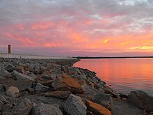 Looking down the dam from the Irmo side. | |
| Official name | Dreher Shoals Dam |
| Location | Lexington County, near Lexington, South Carolina |
| Coordinates | 34°03′12″N 81°13′04″W / 34.0533°N 81.2178°W |
| Construction began | 1927 |
| Opening date | 1930 |
| Operator(s) | Dominion Energy |
| Dam and spillways | |
| Type of dam | Embankment, earth-fill with RCC gravity toe |
| Impounds | Saluda River |
| Height | 200 ft (61 m) |
| Length | 7,800 ft (2,400 m) |
| Reservoir | |
| Creates | Lake Murray |
| Total capacity | 2,200,000 acre⋅ft (2.7 km3) |
| Catchment area | 2,420 sq mi (6,300 km2) |
| Surface area | 50,000 acres (200 km2) |
| Power Station | |
| Turbines | 5 x vertical Francis turbines (3 @ 32.5 MW, 1 @ 42.3 MW, 1 @ 67.5 MW) |
| Installed capacity | 207 MW |
| Annual generation | 245,000,000 kWh |
South Carolina Highway 6 crosses over the dam and is used as a fast connection between the towns of Lexington and Irmo. The yearly football game between rival Lexington High School and Irmo High School is often called "The Battle of the Dam".
Characteristics edit
The original Saluda Dam is a 7,800 ft (2,400 m) long, 213-foot (65 m)-high earthen-embankment dam.[6] The dam contains a 2,900 ft (880 m) long emergency spillway controlled by six steel tainter gates. The back-up dam located at the original dam's toe and is a 2,300 ft (700 m) long, 213-foot (65 m) high roller-compacted concrete dam. Rock-fill embankment sections also exist on the south and north ends of the back up dam, making a total length of 5,700 ft (1,700 m).
The hydroelectricity power station consists of concrete five vertical Francis turbines; three at 32.5 MW, one at 42.3 MW and another at 67.5 MW. The power station receives water by means of five 223 ft (68 m). high intake towers and then into penstocks. Water released from the power station moves down a 150 ft (46 m) long tailrace tunnel before being discharged back in the Saluda River.[7]
On the dam, South Carolina Highway 6 splits into two lanes, the northward one going in between the main and backup dams, and the southward road staying on the main dam. There is also a walkway across the dam.
History edit
Saluda Dam Remediation Project edit
Construction of a backup dam immediately next to the Saluda Dam was completed in 2005 by the SCANA corporation. The construction was first proposed in 1989 but did not begin until 2002. The roller-compacted concrete backup dam was required by the federal government as a mechanism for preventing flooding if an earthquake of similar magnitude to the 1886 Charleston earthquake was to occur again in South Carolina. It was projected that large parts of the Columbia, SC metropolitan region (encompassing around 135,000 people) would have been in the flood region if the original dam was damaged.
During construction, workers laid 18,590 cubic yards (14,210 m3) of roller-compacted concrete in one day, setting a North American record. The total fill for the back up dam is 1,300,000 cubic yards (990,000 m3). Because of this and the worker's "...proactive approach to protecting the surrounding communities, and the innovative methods they implemented to achieve that goal...", it received the 2006 American Society of Civil Engineers Outstanding Civil Engineering Achievement Award.[8]
See also edit
External links edit
- Scana Insight Article on Dam Archived 2006-10-16 at the Wayback Machine
- DESCRIPTION OF THE SALUDA HYDROELECTRIC PROJECT
- "Mile Long Earthen Dam Is Impervious To Water", May 1931, Popular Mechanics
References edit
- ^ a b Federal Writers Project. South Carolina: A Guide To The Palmetto State. Volume 5 of American Guide. Somerset Publishers, Inc., 1941. p. 377. ISBN 9780403021895
- ^ "Lexington County." The South Carolina Encyclopedia Guide to the Counties of South Carolina. Walter Edgar, ed. University of South Carolina Press, 2012. ISBN 9781611171518
- ^ Cathy Dreher. "Lake Murray Dam becomes Dreher Shoals Dam." Columbia Star. 11 February 2005. Retrieved 20 July 2016.
- ^ "Lake Facts and Conditions"[permanent dead link] at Capital City Lake Murray Country tourism website. Retrieved 20 July 2016.
- ^ Sherman Carmichael. Strange South Carolina. Arcadia Publishing, 2015. ISBN 9781625856043
- ^ Engineering News-record. McGraw-Hill. 1946.
- ^ "Federal Register /Vol. 74, No. 55 /Tuesday, March 24, 2009 /Notices" (PDF).
- ^ "SOUTH CAROLINA'S SALUDA DAM NAMED 2006 OUTSTANDING CIVIL ENGINEERING ACHIEVEMENT April 26, 2006". Archived from the original on January 9, 2010.