
KNOWPIA
WELCOME TO KNOWPIA

San Bartolo District 
Summary
San Bartolo is a district in southern Lima Province in Peru. It is bordered by the Pacific Ocean on the west, the district of Punta Negra on the north, the Huarochirí Province on the east, and the Santa María del Mar District on the south.
Saint Bartolo District
Distrito de San Bartolo (Spanish) | |
|---|---|
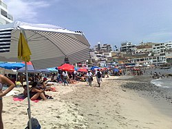 A beach in San Bartolo | |
 Flag  Coat of arms | |
 Location of San Bartolo in the Lima province | |
| Coordinates: 12°25′S 76°47′W / 12.417°S 76.783°W | |
| Country | |
| Province | Lima |
| Founded | May 5, 1946 |
| Capital | San Bartolo |
| Subdivisions | 18 populated centers |
| Government | |
| • Mayor | Augusto Carbajal (2023-2026) |
| Area | |
| • Total | 45.01 km2 (17.38 sq mi) |
| Elevation | 30 m (100 ft) |
| Population (2023)[1] | |
| • Total | 9,424 |
| Time zone | UTC-5 (PET) |
| UBIGEO | 150129 |
| Website | munisanbartolo.gob.pe |
It is well known for its beaches and attracts many beachgoers every summer. Many of them also rent apartments during this season, making the district's population increase considerably. San Bartolo has some restaurants and a club with a large seawater swimming pool.

See also edit
References edit
- ^ "Estadística Poblacional - Ministerio de Salud del Perú".
External links edit
Wikimedia Commons has media related to San Bartolo District.
- (in Spanish) Municipalidad Distrital de San Bartolo
- (in Spanish) http://www.olasperu.com/ Peru's prime surfing website
- (in Spanish) http://www.peruazul.com/ Limas's suring website